(WCS – R08/2025)
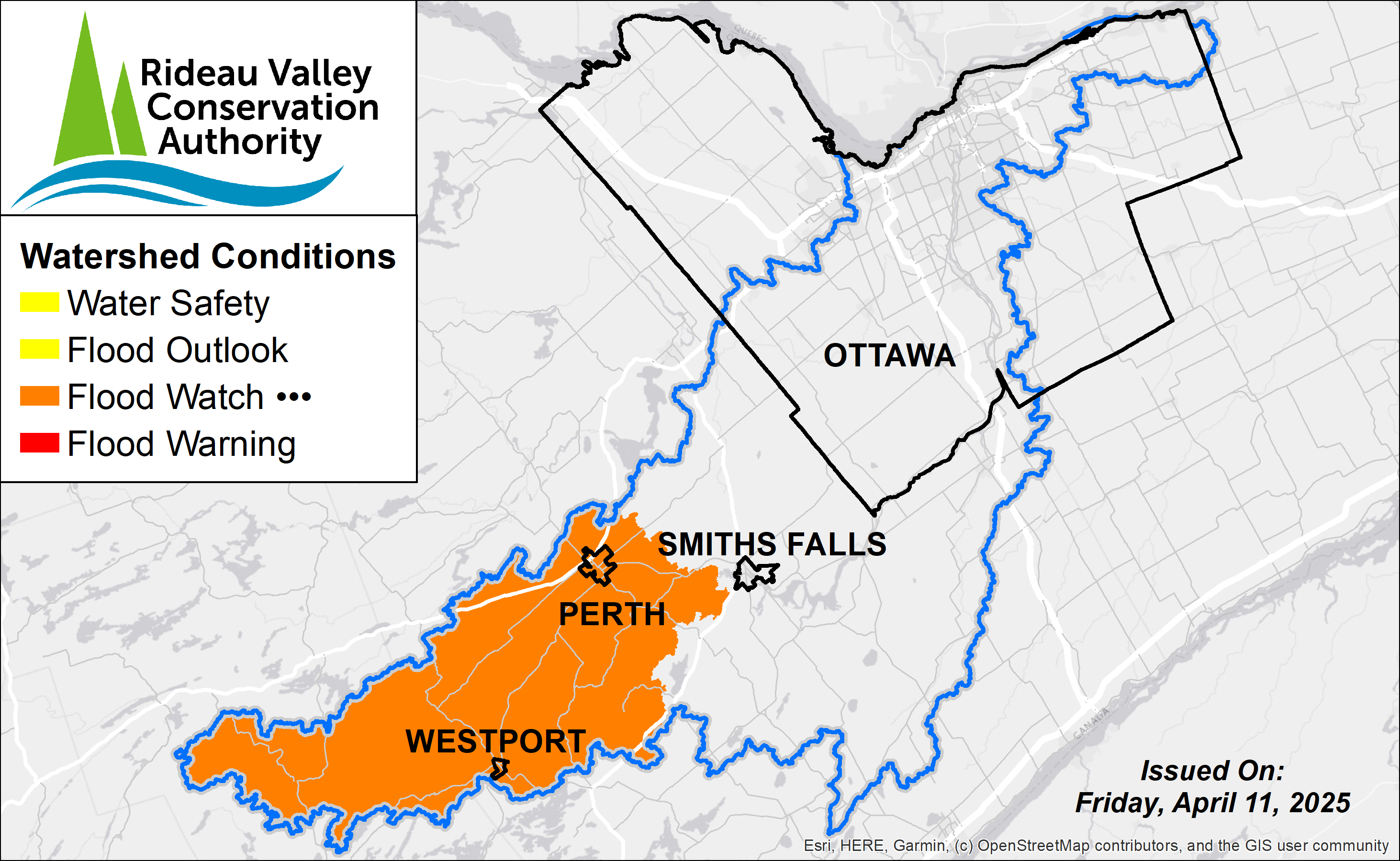
April 11, 2025 – Water levels and flows remain high in the Upper Watershed lakes area, while reservoirs in the area have limited remaining capacity. This increases the risk of localized flooding in low-lying regions. As such, a Flood Watch continues to be in effect for this area. The Flood Watch for the Long Reach portion of the Rideau River between Smiths Falls and Manotick has ended as water levels and flows have stabilized.
Residents are strongly encouraged to remain vigilant, monitor local conditions, and take necessary steps to protect their properties. Please refer to the recommended actions and safety measures provided below.
This Flood Watch is in effect until April 18, 2025 at 11:59 pm or until an update has been issued.
MORE DETAILS:
Weather Forecast: Environment and Climate Change Canada is forecasting a mix of spring conditions for the Rideau Valley over the following days, with varying precipitation and temperatures. Daytime temperatures are expected to remain above freezing through the weekend, with a brief cool-down anticipated by mid-next week. Rainfall totals of 5 mm are expected by the end of Friday, with additional mixed precipitation possible into and over the next week.
Environmental Conditions: Water levels and flows across the Upper Rideau Valley watershed remain elevated at the end of the freshet season. Reservoirs in the upper watershed now have limited capacity to absorb further precipitation and have yet to stabilize and start receding. Water levels are expected to continue rising as lasting melt and minor rainfall move through the system.
Risks: The Upper Watershed lakes are under a flood watch, based on the following factors:
- With limited capacity remaining within the upper reservoirs, increasing water levels may exceed full supply levels and result in flooding within low-lying areas.
Location-Specific Considerations: Due to the recent weather event, water levels in the Upper Watershed, especially at Bobs Lake and Christie Lake, are still at risk of rising, which could lead to or exacerbate flooding in low-lying areas. Parks Canada staff are closely monitoring conditions and adjusting operations as needed to manage water levels between the lakes. Residents in low-lying areas near Bobs Lake and Christie Lake, which have historically been prone to flooding, should continue to take necessary precautions to protect their property.
Action & Safety Recommendations: Residents in flood-prone areas are advised to closely monitor water levels and flows and take the necessary precautions to protect their property, such as:
- Ensuring sump pumps are clear, in good working condition, and have a backwater valve.
- Keeping a portable backup generator and pump easily accessible.
- Ensuring downspouts are clear and directing water at least 3 m away from the dwelling.
- Securing items that might float away as flows increase.
- Removing valuable items from basements or lower floors that could be subject to flooding.
- Keeping emergency phone numbers handy.
- Familiarizing yourself with your municipality’s Emergency Preparedness Plan.
Residents are reminded that a Water Safety Statement is in effect until April 15th and advised to exercise caution when near rivers, streams, and other waterbodies due to the risks described above. Parents should inform their children of these dangers and provide appropriate supervision.
Duration: This Flood Watch is in effect until April 18, 2025 at 11:59 pm or until an update has been issued.
RVCA monitors water levels and weather forecasts as part of its Flood Forecasting and Warning Program. Updates will be provided as conditions change.
For more information, contact:
Isabelle Maltais
Director, Watershed Science & Engineering
1-800-267-3504 ext. 1165
RVCA Watershed Conditions Statements:
Water Safety – High flows, unstable banks, melting ice or other factors that could be dangerous for recreational users such as anglers, canoeists, hikers, children, pets, etc. Flooding is not expected.
Flood Outlook – Early notice of the potential for flooding based on weather forecasts, calling for heavy rain, snow melt, high winds or other conditions that could lead to high runoff, cause ice jams and/or lakeshore flooding or erosion.
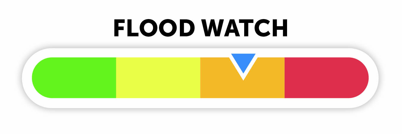
Flood Watch – Flooding is possible in specific watercourses or municipalities. Municipalities, emergency services and individuals in flood prone areas should prepare.
Flood Warning – Flooding is imminent or already occurring in specific watercourses or municipalities.