RVCA (1140)
Children categories
Department (68)
Main Office Phone Numbers : 613-692-3571 / 1-800-267-3504
Staff Directory
To make a Section 28 application:
- Contact the RVCA while you are in the early stages of planning your project. It will save you time and keep your schedule on track. Your first step is to determine if you require Conservation Authority approval. E-mail us at or speak to an RVCA Resource Specialist at 613-692-3571 || 1-800-267-3504 (extension 1193 or 1132). They will confirm that you need a permit and provide you with the preliminary information you will require to submit an application.
- Download and complete the RVCA Application for Development (includes Minimum Application Requirements). You may also contact a Resource Specialist for a paper copy or visit our office to pick up a copy.
- Refer to the Application Fee Schedule to determine the category of works and the application type. Forward your permit application form and other required information including plans drawn to scale, a survey, elevation information, etc. Please see the RVCA's Application for Development for a complete checklist. The application fee is paid at the time of filing the application with the RVCA.
Click here for a full list of forms, fees and resources.
If your application has been refused or approved with conditions, you can appeal through a the RVCA's Hearing Board.
For guidance, downoad the RVCA Hearing Procedures.
If you are planning to do any work near a lake, river, stream, floodplain, steep slope or wetland, you may require approval from the RVCA.
The following projects require RVCA review and approval:
- the construction, reconstruction, erection or placing of a building or structure of any kind,
- changes that would alter the use or potential use of a building or structure
- increasing the size of the building or structure or increasing the number of dwelling units in the building or structure,
- site grading,
- the temporary or permanent placing, dumping or removal of any material, originating in the site or elsewhere,
- the straightening, changing or diverting or interfering with an existing channel of a river, creek, stream or watercourse, or changing or interfering with a wetland.
- All shorelines and watercourses, regardless of whether or not they appear on mapping, are subject to the alteration to waterways component of Ontario Regulation 174/06.
Note: As of April 1, 2024, Ontario Regulation 41/24: Prohibited Activities, Exemptions and Permits will replace the RVCA's existing Ontario Regulation 174/06 under Section 28 of the Conservation Authorities Act. Moving forward, O. Reg. 41/24 will be used by all Conservation Authorities.
If you are not within an identified floodplain, wetland, adjacent to a steep slope or working on the waterfront, then a permit may not be required from the RVCA. You should still contact your municipality to ensure your project meets municipal requirements. Please contact us for information.
Our work in regulating lands has several major components.
1. Regulation Permits
We ensure that development proposals have regard for natural hazard features and the natural environment while conforming with our watershed development policies. We are authorized under Section 28 of the Conservation Authorities Act. Learn more >>
2. Municipal Plan Review
We are responsible for representing the provincial interests with respect to natural hazards (examples include flooding, erosion and unstable ground) and natural features on applications circulated under the Planning Act. We are responsible for providing advice on the interpretation of the Provincial Policy Statement. We also have agreements with the City of Ottawa and Counties in the watershed to provide comments on natural heritage features, which include significant woodlands, wetlands, environmentally sensitive areas, fish habitat, as well as rare, threatened and endangered species and their habitats. Learn more >>
3. Board Approved Development Policies
The goal is to foster and consistently apply the development policies and guidelines that protect the environmental integrity of our watershed. Recognizing that development and changes occur within some limits and is ultimately limited by the capacity of the watershed environment is key.
4. Septic System Approvals and Re-inspections
We provide septic system approvals and re-inspection program in interested municipalities. Our role is to ensure septic systems are built property for the benefit of the homeowner and the environment. We enforce the rules and regulations defined by the Ontario Building Code. Learn more >> Ottawa Septic System Office
Learn more >> Mississippi Valley Septic System Office
5. Technical Assistance
RVCA engineering and technical staff may also provide comments on water management and natural hazard aspects of planning and regulatory applications depending on the complexity of the application.
They are also involved in preparing subwatershed reports, remedial strategies and stormwater management strategies and the design of capital work projects and major floodplain engineering studies.
Key areas of expertise include: hydraulics and hydrology, plan input and review, environmental regulations, data collection and computer modeling, remediation and restoration techniques for the natural environment, project design, tendering and supervision.
6. Stewardship
Our stewardship programs provide technical and financial assistance to support private landowners who undertake environmental projects that are designed to improve surface and groundwater quality, reduce soil erosion, enhance wildlife and more. Learn more >>
7. Flood Forecasting and Flood Control
RVCA is responsible for issuing flood warnings to help reduce flood damages. We do this by monitoring weather conditions and river flows issuing flood messages (advisories and warnings) to a variety of public service agencies through the media and this website controlling development in flood-prone areas to reduce potential property damages. Learn more >>
The RVCA collects, monitors and analyses watershed information.
Monitoring environmental conditions helps us see trends over time, focus our actions where they can do the most good, and evaluate the effectiveness of our watershed policies and programs.
Reporting information ensures the right information is available to municipal and watershed decision makers (including watershed residents).
Use the menu to the right to visit our monitoring and reporting information. You can also access information through our interactive mapping. See below for details on what is currently available.
Interactive Mapping Tool
Access information through our interactive mapping tool. Choose from these mapping options:
RVCA |
Access our robust interactive mapping with multiple tools to help you find regulation limits, flood event depths, flood & low water status, landcover, conservation areas and more. Note: as of April 1, 2024, Ontario Regulation 41/24: Prohibited Activities, Exemptions and Permits will replace the RVCA's existing Ontario Regulation 174/06 under Section 28 of the Conservation Authorities Act. Our online map tooling tool is being updated to reflect Ontario Regulation 41/24. Our online mapping tool has been updated to reflect our Interim Policy for the Administration and Implementation of Ontario Regulation 41/24. |
Streamflow, Water Levels & Weather Stations |
See real-time and periodic information from a network of sources from across the watershed. |
Water Quality - |
View water quality data collected across the watershed. See where we test and the results. |
Subwatersheds and |
Explore our subwatershed reports that highlight four indicators of watershed health: water quality, forest cover, wetland cover and riparian cover. |
Map A Property |
Search properties to see if it may be subject to RVCA Regulation - Section 28. Note: as of April 1, 2024, Ontario Regulation 41/24: Prohibited Activities, Exemptions and Permits will replace the RVCA's existing Ontario Regulation 174/06 under Section 28 of the Conservation Authorities Act. Our online map tooling tool is being updated to reflect Ontario Regulation 41/24. Watch for updates to our mapping tool as we modify our maps to reflect new wetland boundaries. Please contact us for information.
|


The RVCA collects, monitors and analyses watershed information.
Monitoring environmental conditions helps us see trends over time, focus our actions where they can do the most good, and evaluate the effectiveness of our watershed policies and programs.
Reporting information ensures the right information is available to municipal and watershed decision makers (including watershed residents).
Use the menu to the right to visit our monitoring and reporting information. You can also access information through our interactive mapping. See below for details on what is currently available.
Interactive Mapping Tool
Access information through our interactive mapping tool. Choose from these mapping options:
|
|
|
|
||
| Access our robust interactive mapping with multiple tools to help you find regulation limits, flood event depths, flood & low water status, landcover, conservation areas and more. |
See real-time and periodic information from a network of sources from across the watershed. |
View water quality data collected across the watershed. See where we test and the results. | Explore our subwatershed reports that highlight four indicators of watershed health: water quality, forest cover, wetland cover and riparian cover. | Search properties to see if it may be subject to Section 28 — Ontario Regulation 174/06 (Development, Interference with Wetlands and Alternations to Shorelines and Watercourses Regulation. |
More...
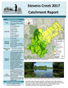
Ottawa West Tributaries - 2017 Catchment Report
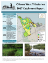
Marika Livingston
The streams and rivers in the Rideau Valley watershed are home to a variety of plants and animals.
RVCA staff collect information on the physical conditions of the watershed — vegetation, wetlands, shorelines, land uses. We also look at fish communities and benthic invertebrates. We look see how aquatic and terrestrial creatures interact with their environment. All this information is used to create a picture of the conditions of our streams, lakes, rivers and overall watershed. In turn, this information will set the management direction for the future.
Information is compiled and summarized in RVCA catchment reports and subwatershed reports.