


RVCA (1140)
Children categories
Department (68)
Main Office Phone Numbers : 613-692-3571 / 1-800-267-3504
Staff Directory
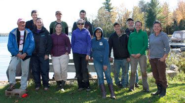
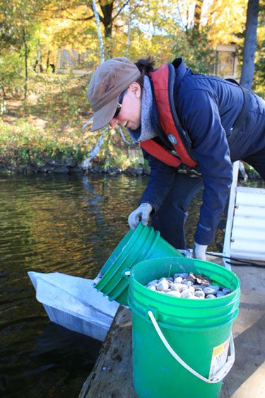
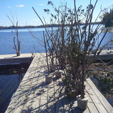
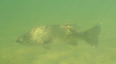
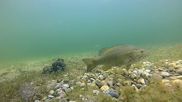
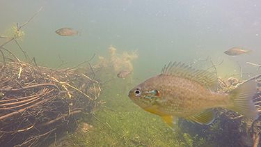
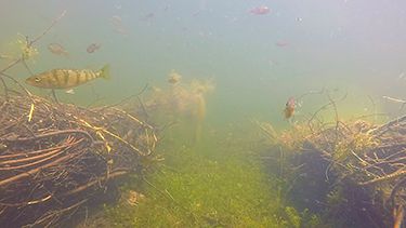
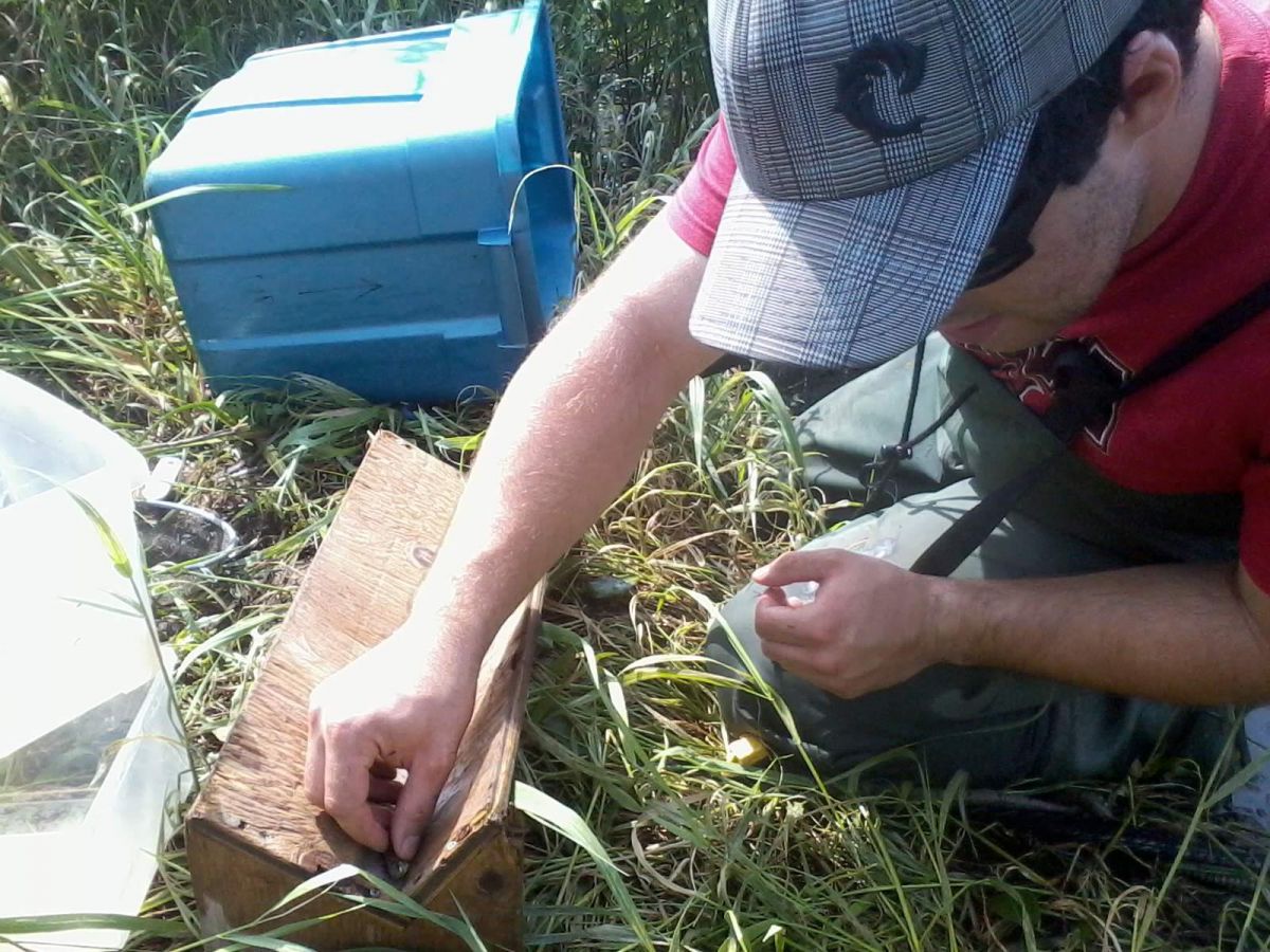
The Rideau Valley Conservation Authority in partnership with the Otty Lake Association collaborated to enhance fish habitat in Otty Lake — specifically spawning, nursery and feeding habitat for smallmouth and largemouth.
What was done?
Phase 1 (2013)
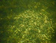
- Installed 75 gravel spawning beds a using round river wash stone
- Deposited wood branches and small trees anchored in cement as well as brush bundles — this wooded debris created habitat for many food sources such as crayfish and aquatic insects as well as places where fish can rest, find shelter and feed
Phase 2 (2014)
- Installed 83 spawning beds and sank 185 wooden clusters as shelter and feeding habitat
- Placed 58 large rocks (cornerstones) various nests providing additional cover for dedicated smallmouth bass fathers as they brood their young
Phase 3 (2015)
- 49 spawning beds, nine brush piles were placed in shallow weedy bays to provide more shelter and feeding habitat
- 75 cornerstone were placed at various nests which provides cover and shelter for the guarding male and fry
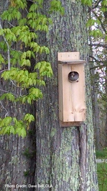
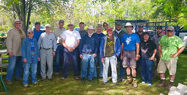
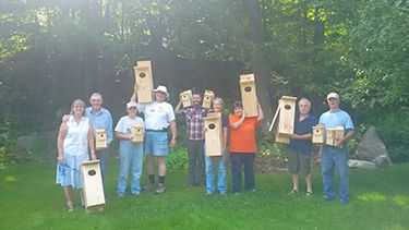
Through all three phases 228 bass nests were installed, 133 cornerstones added, 335 trees/branches and nine brush bundles placed in shallow areas. A total of 840 volunteer hours were accrued. In addition, 20 wood duck nesting boxes were installed.
Monitoring:
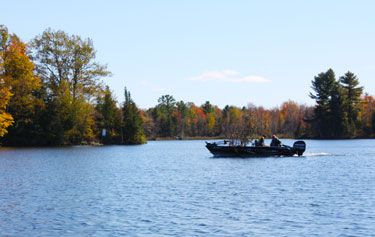
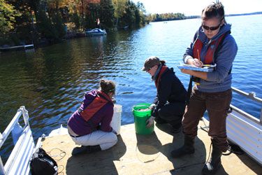
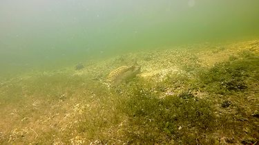
RVCA staff and volunteers monitored the success of the project with site visits in spring and summer. This entailed counting active nests, making observations on the integrity of the gravel and observing the wood structures using an underwater camera.
The Results:
successful/confirmed spawning on nests
2014 — 41%
2015 — 43%
2016 — 55%
2017 — 36%
2018 — 56%
2019 — 58.5%
Project Partners:


Information:
Jennifer Lamoureux
Aquatic and Fish Habitat Biologist,
Rideau Valley Conservation Authority
613-692-3571 ext. 1108
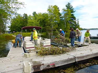
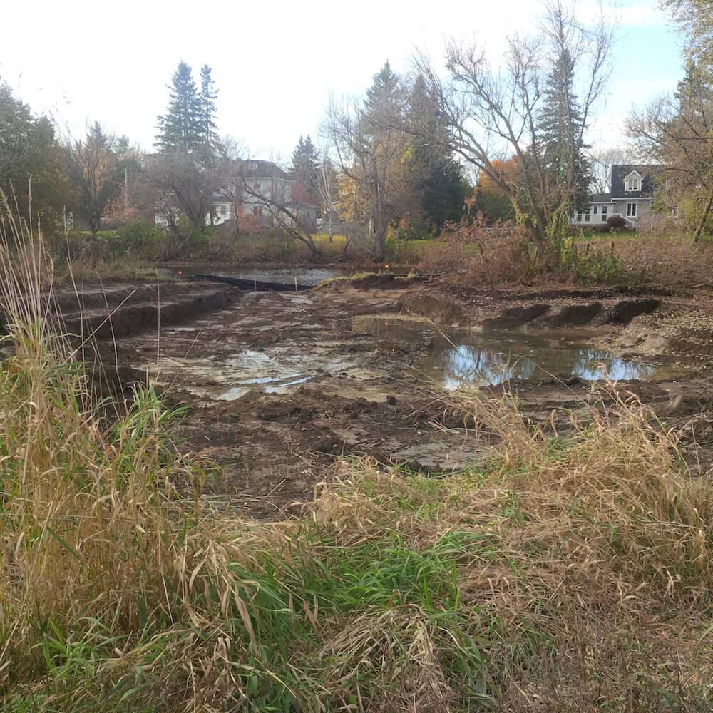
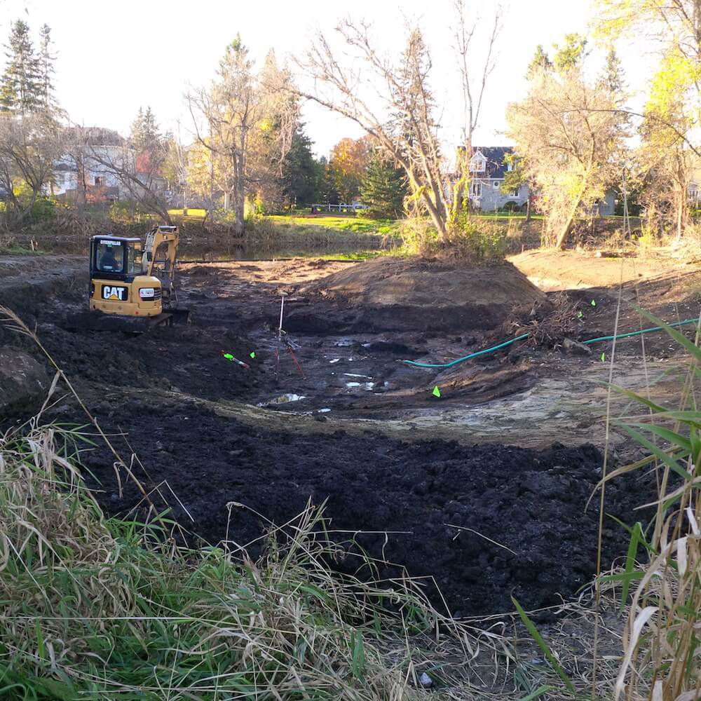
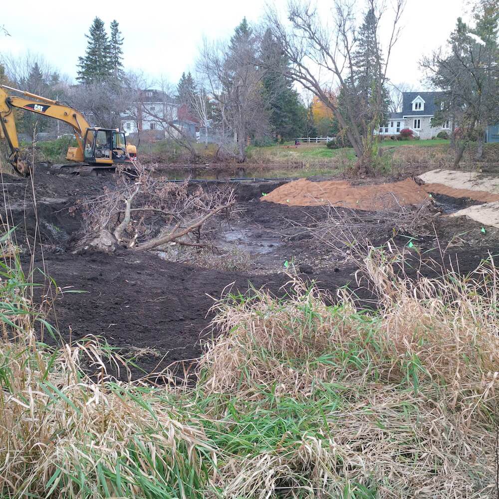
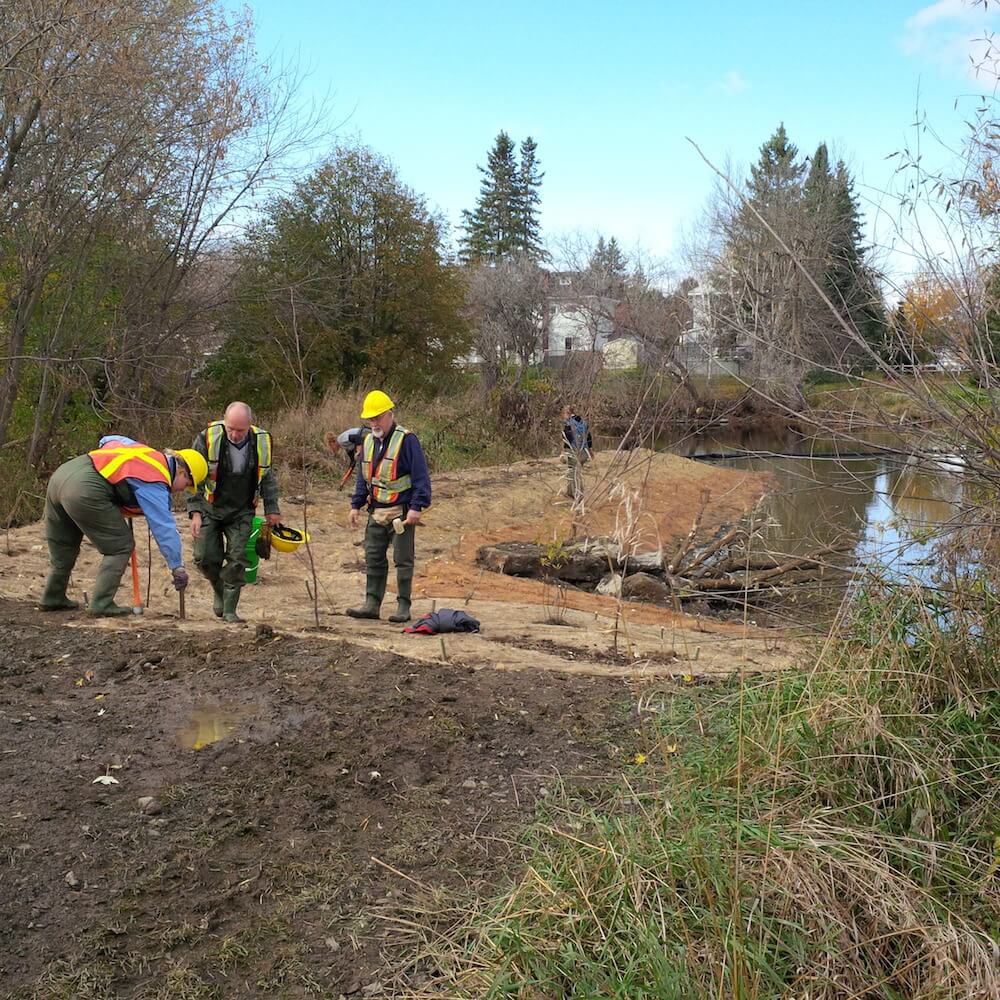
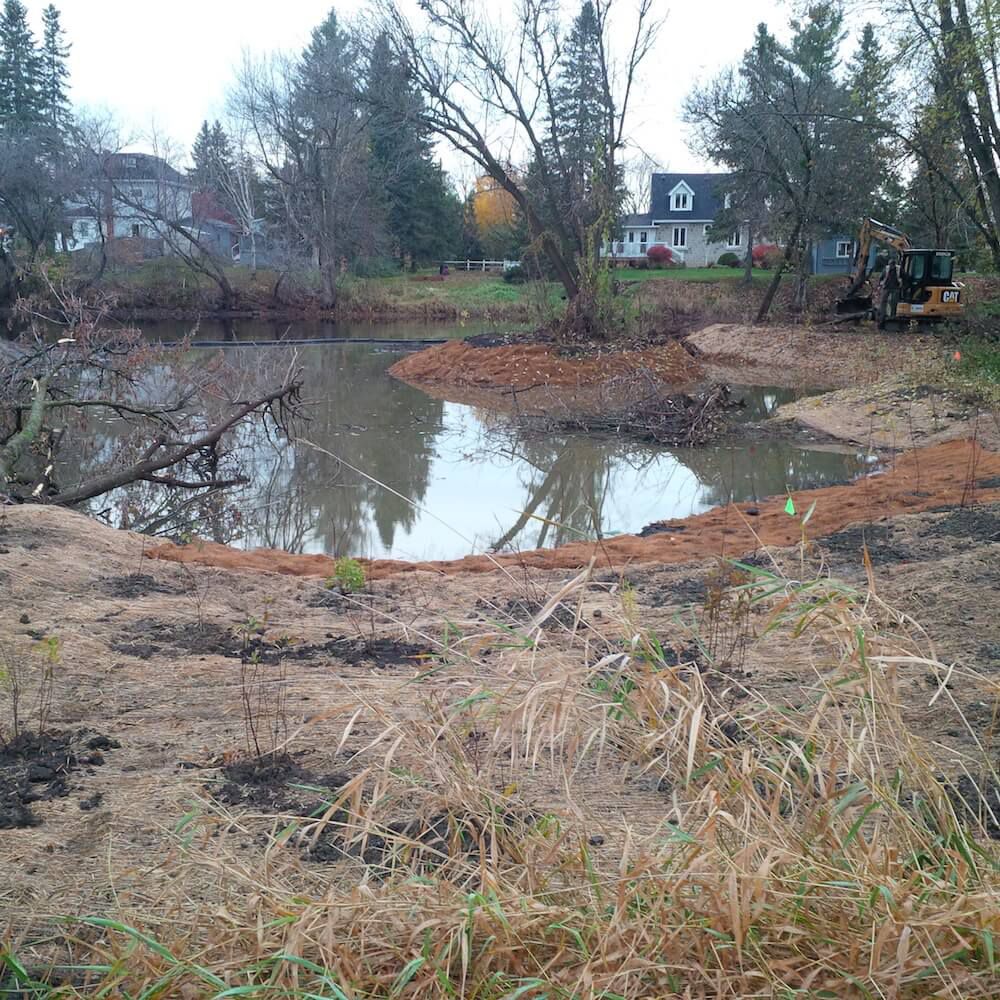
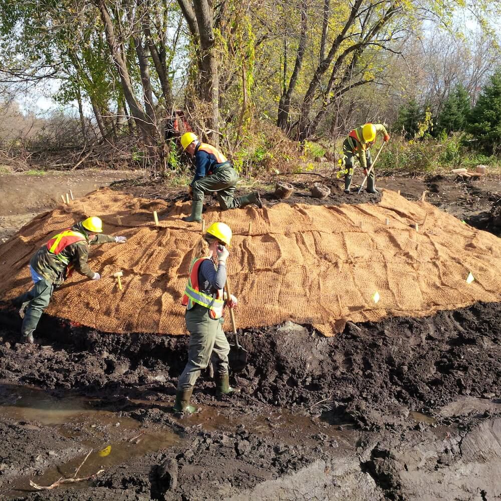
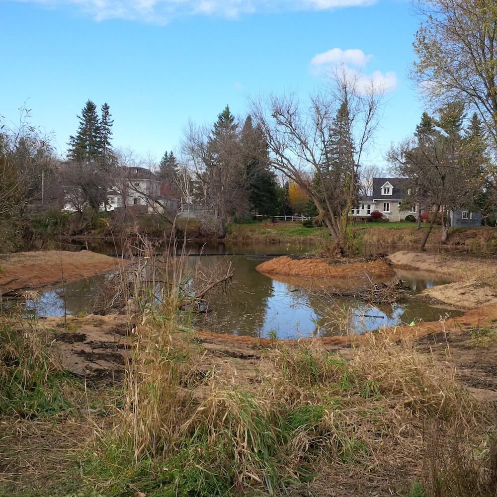
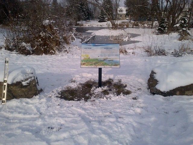
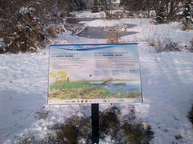
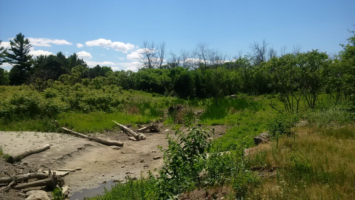
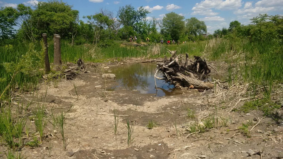
The Rideau Valley Conservation Authority, with their partners, has built a fish habitat embayment at the Richmond Conservation Area, located in Ottawa, Ontario. The project involved converting an existing grassed park area into a small wetland embayment along the shore of the Jock River. Raab Construction helped construct the wetland with the assistance of many dedicated volunteers.
Construction Highlights
- 1,000 square metres of new spawning, nursery, rearing and feeding habitat created to support the 40 species of fish that reside in the Jock River
- 9 days of construction took place in October 2014
- 108 truckloads of fill were removed from the Jock River floodplain
- 100 metres of new shoreline created by re-grading the existing slope and planting a shoreline buffer around the perimeter of the new embayment
In 2014, the Jock River Embayment Creation Project won the Top Canadian Fishing Industry Conservation Project Award.
Project Partners
- Rideau Valley Conservation Authority
- Fisheries and Oceans Canada — Recreational Fisheries Conservation Partnerships Program
- Muskies Canada Ottawa Chapter
- National Defence Fish and Game Club
- Community Foundation of Ottawa
- Ottawa Fly Fishers Society
- Shell Fueling Change
- Fendock
Information
Jennifer Lamoureux
Aquatic and Fish Habitat Biologist,
Rideau Valley Conservation Authority
613-692-3571 ext. 1108
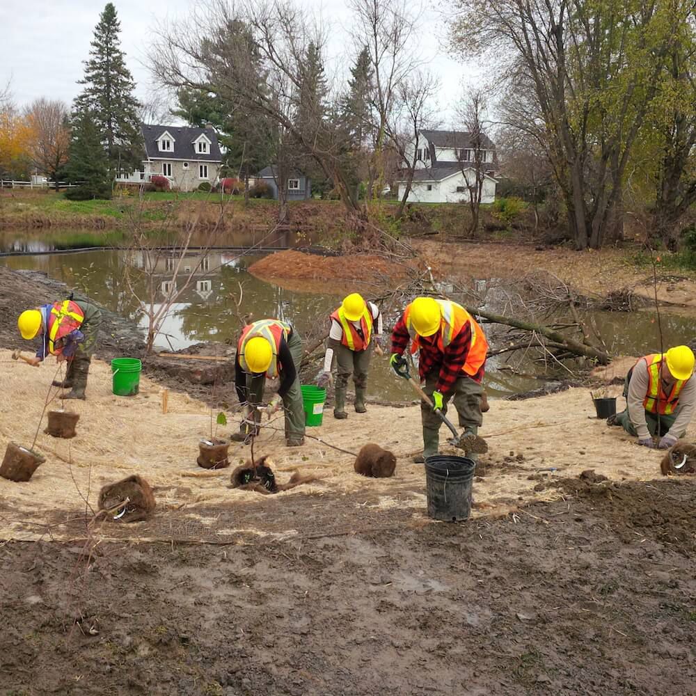
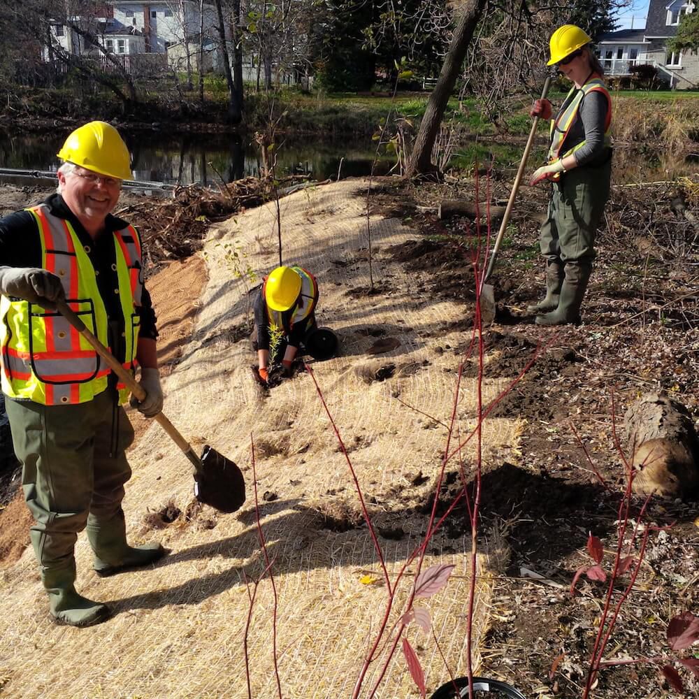
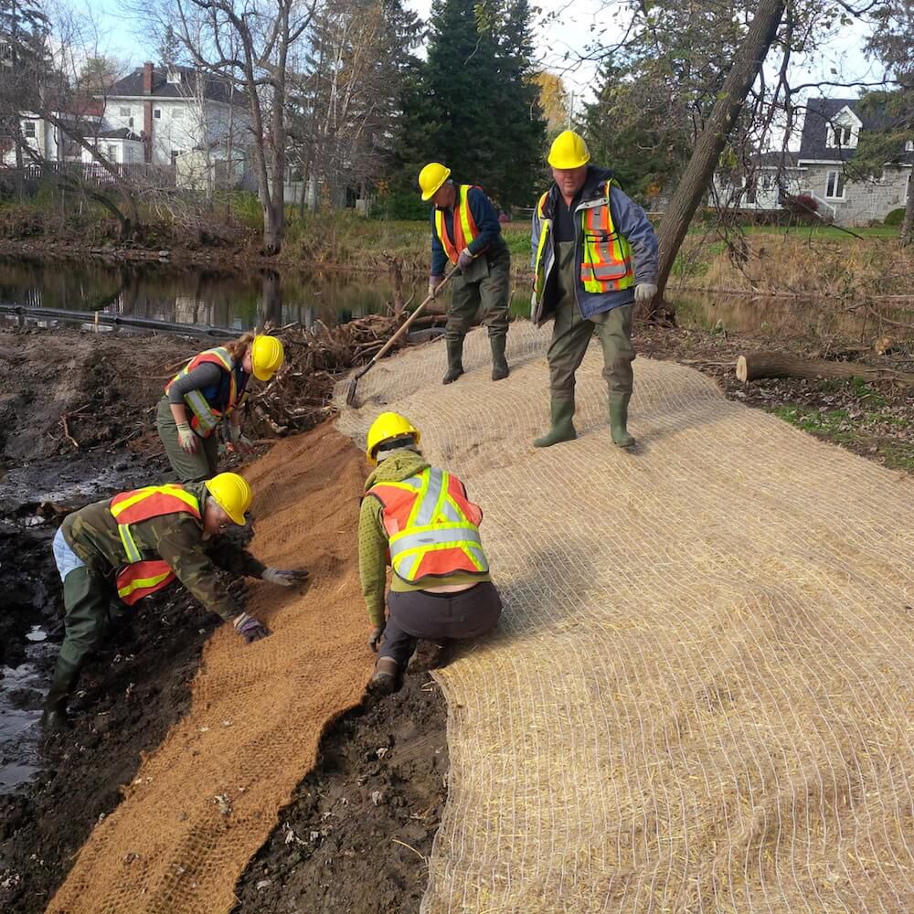
The Rideau Valley Conservation Authority (RVCA) partnered with the National Capital Commission (NCC) to design and construct a small wetland adjacent to the Ottawa River. This new wetland is located close to Remic Rapids along the Sir John A. Macdonald Parkway. The feature is 0.15 hectares and consists of a shallow basin that is a water supply for wildlife as well as amphibian breeding and bird foraging area. Volunteers and NGO community groups provided clean up and planting assistance. The wetland provides a unique and highly visible habitat feature along the National Capital Commission Ottawa River Pathway.
Benefits of the Project
- Altered elevations creates areas for more diverse aquatic and terrestrial plant life
- Provides new and enhanced habitat for wetland wildlife
- Provides quiet area for water fowl and shorebird nesting, rearing and feeding
- Installed woody structures creates more diverse habitat
- Installed sand and pea stone creates turtle nesting and basking areas
- Common buckthorn (invasive species) removal allowed for more native plant growth
Project Partners
![]()

Information
Jennifer Lamoureux
Aquatic and Fish Habitat Biologist,
Rideau Valley Conservation Authority
613-692-3571 ext. 1108
Project Status: Complete
Hogs Back to Kars & Kars to Burritts Rapids
The Rideau Valley Conservation Authority (RVCA) has completed two hazard mapping studies for the Rideau River: Hogs Back to Kars and Kars to Burritts Rapids. These studies update existing mapping in some areas and new mapping in others.
These maps are typically known as “floodplain mapping” and they show areas that are prone to natural hazards such as flooding, erosion and natural environment features such as wetlands. Both Rideau River studies look at identifying two main types of hazards along these stretches of the watercourse: flooding and slope stability.
When completed, the mapping will be used by the City of Ottawa and the Municipality of North Grenville when updating their Official Plan and Zoning Schedules and in the review of development applications under the Planning Act. RVCA will also use the mapping to guide the review of development applications submitted under the Province’s Development, Interference with Wetlands and Alterations to Shorelines and Watercourses Regulation.
Members of the public are encouraged to attend our open house and/or provide comments on the mapping below. Conservation Authority staff welcome historical records of past flood events, news clippings, photographs and even anecdotal stories to help confirm the reasonableness of calculations and resulting hazard mapping. For those unable to attend the open house, comments can be sent to Ferdous Ahmed, RVCA Senior Water Resources Engineer at .
These mapping studies are being completed as part of the City of Ottawa Hazard Mapping Project.
These studies are being done through a collaboration — known as the City of Ottawa Hazard Mapping Project — involving the City of Ottawa and the Mississippi Valley, Rideau Valley and South Nation Conservation Authorities. The City recognized a need to update its zoning schedules based on up-to-date flood risk mapping and has provided contributions enabling the Conservation Authorities to move ahead with these studies sooner than would otherwise be possible. The RVCA is currently working on several studies in the Ottawa area.
Project Status: Complete
The Rideau Valley Conservation Authority (RVCA) has completed a hazard mapping study for Kings Creek — a tributary of the Jock River — from the Brunton Side Road to the Jock River.
These maps are typically known as “floodplain mapping” and they show areas that are prone to natural hazards such as flooding, erosion and natural environment features such as wetlands.
When completed, the mapping will be used by the City of Ottawa and the Townships of Beckwith and Montague when updating their Official Plan and Zoning Schedules and in the review of development applications under the Planning Act. RVCA will also use the mapping to guide the review of development applications submitted under the Province’s Development, Interference with Wetlands and Alterations to Shorelines and Watercourses Regulation.
Members of the public are encouraged to attend our open house (date to be announced) and/or provide comments on the mapping below. Conservation Authority staff welcome historical records of past flood events, news clippings, photographs and even anecdotal stories to help confirm the reasonableness of calculations and resulting hazard mapping. For those unable to attend the open house, comments can be sent to Ferdous Ahmed, RVCA Senior Water Resources Engineer at .
These mapping studies are being completed as part of the City of Ottawa Hazard Mapping Project.
These studies are being done through a collaboration — known as the City of Ottawa Hazard Mapping Project — involving the City of Ottawa and the Mississippi Valley, Rideau Valley and South Nation Conservation Authorities. The City recognized a need to update its zoning schedules based on up-to-date flood risk mapping and has provided contributions enabling the Conservation Authorities to move ahead with these studies sooner than would otherwise be possible. The RVCA is currently working on several studies in the Ottawa area.
Project Status: Complete
The Rideau Valley Conservation Authority (RVCA) has completed a hazard mapping study for Becketts Creek from Sarsfield Road to the Ottawa River.
These maps have been traditionally known as “floodplain mapping” or “regulation mapping” and they show areas that are prone to natural hazards such as flooding, erosion and natural environment features such as wetlands.
When completed, the mapping will be used by the City of Ottawa when updating their Official Plan and Zoning Schedules and in the review of development applications under the Planning Act. RVCA will also use the mapping to guide the review of development applications submitted under the Development, Interference with Wetlands and Alterations to Shorelines and Watercourses Regulation.
Members of the public are encouraged to attend the open house (details below) and/or provide comments on the mapping below. Conservation Authority staff welcome historical records of past flood events, slope failure, erosion, news clippings, photographs and even anecdotal stories to help confirm the reasonableness of calculations and resulting hazard mapping For those unable to attend the open house, comments can be sent to Ferdous Ahmed, RVCA Senior Water Resources Engineer at .
These mapping studies are being completed as part of the City of Ottawa Hazard Mapping Project.
These studies are being done through a collaboration — known as the City of Ottawa Hazard Mapping Project — involving the City of Ottawa and the Mississippi Valley, Rideau Valley and South Nation Conservation Authorities. The City recognized a need to update its zoning schedules based on up-to-date flood risk mapping and has provided contributions enabling the Conservation Authorities to move ahead with these studies sooner than would otherwise be possible. The RVCA is currently working on several studies in the Ottawa area.
Project Status: Complete
The Rideau Valley Conservation Authority (RVCA) has completed a hazard mapping study for Mud Creek from 3rd Line Road North to the Rideau River.
These maps have been traditionally known as “floodplain mapping” or “regulation mapping” and they show areas that are prone to natural hazards such as flooding, erosion and natural environment features such as wetlands.
When completed, the mapping will be used by the City of Ottawa when updating their Official Plan and Zoning Schedules and in the review of development applications under the Planning Act. RVCA will also use the mapping to guide the review of development applications submitted under the Development, Interference with Wetlands and Alterations to Shorelines and Watercourses Regulation.
Members of the public are encouraged to attend the upcoming open house (details below) and/or provide comments on the draft mapping (see below). Conservation Authority staff welcome historical records of past flood events, slope failure, erosion, news clippings, photographs and even anecdotal stories to help confirm the reasonableness of calculations and resulting hazard mapping For those unable to attend the open house, comments can be sent to Ferdous Ahmed, RVCA Senior Water Resources Engineer at .
These mapping studies are being completed as part of the City of Ottawa Hazard Mapping Project.
Mud Creek Report
Report: Mud Creek Flood Risk Mapping from Prince of Wales Drive to Rideau River, July 9, 2019
These studies are being done through a collaboration — known as the City of Ottawa Hazard Mapping Project — involving the City of Ottawa and the Mississippi Valley, Rideau Valley and South Nation Conservation Authorities. The City recognized a need to update its zoning schedules based on up-to-date flood risk mapping and has provided contributions enabling the Conservation Authorities to move ahead with these studies sooner than would otherwise be possible. The RVCA is currently working on several studies in the Ottawa area.
Project Status: Complete
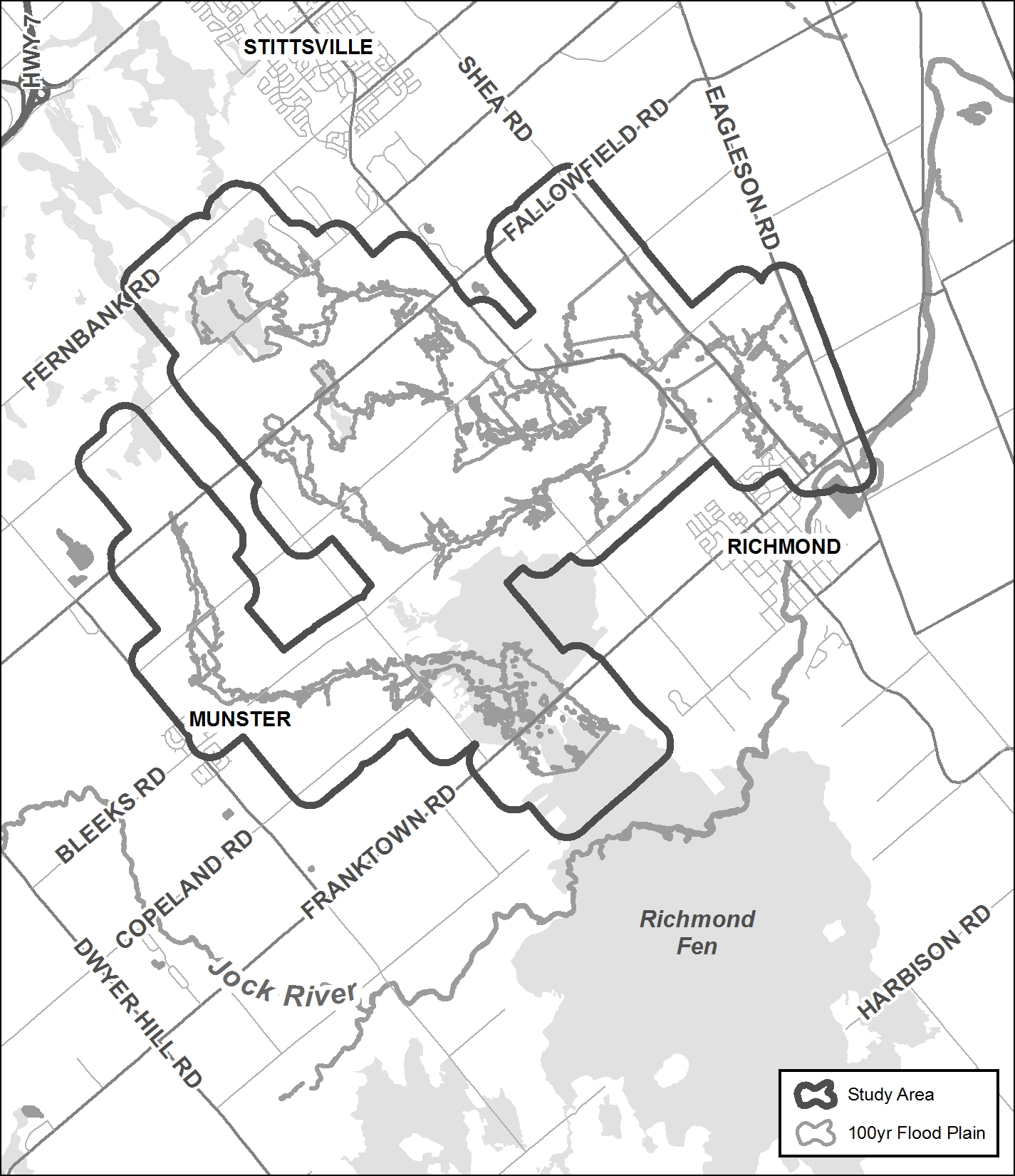
The Rideau Valley Conservation Authority (RVCA) has completed a hazard mapping study for the Jock River between Ashton Station Road and approximately the south limit of the community of Franktown. This section of the Jock River is being hazard mapped for the first time; however, both the Goodwood Marsh and Franktown Swamp (both Provincially Significant Wetlands and both within the study limits) have been regulated since 2006.
These maps have been traditionally known as “floodplain mapping” or “regulation mapping” and they show areas that are prone to natural hazards such as flooding, erosion and natural environment features such as wetlands.
When completed, the mapping will be used by Beckwith Township when updating their Official Plan and Zoning Schedules and in the review of development applications under the Planning Act. RVCA will also use the mapping to guide the review of development applications submitted under the Development, Interference with Wetlands and Alterations to Shorelines and Watercourses Regulation.
Due to Covid 19, we are not holding an in-person public open house. Instead, we invite you to contact an RVCA Resource Specialists at 613-692-3571 (toll-free 1-800-267-3504) extension 1193 or 1132 or . If you prefer, we can book individual or small group meetings on-line or in person to discuss local impacts and concerns. This is also an opportunity to learn how flood risks and slope stability hazards may affect shoreline management and/or development in Beckwith Township. Authority staff welcome historical records of past flood events, slope failure, erosion, news clippings, photographs and even anecdotal stories to help confirm the reasonableness of calculations and resulting hazard mapping.
This study is just one of several ongoing hazard mapping studies taking place in the watershed. For a complete list on ongoing work, click here.
Upper Jock Report
Report: Jock River Flood Risk Mapping from Richmond Road to Ashton Station Road, July 16, 2021
2021 Draft Maps
2021 Draft Maps
OPTION 1: Interactive Map - Click here to view the interactive map full screen
The interactive map allows you to zoom in to a specific property and get very specific digital informaiton. Need help? Have questions? Call a Resource Specialist at 613-692-3571 or 1-800-267-3504 ext. 1132 or 1193 or email us at .
OPTION 2: PDF Maps
If you prefer more traditional mapping, try our PDF maps. Need help? Have questions? Call a Resource Specialist at 613-692-3571 or 1-800-267-3504 ext. 1132 or 1193 or email us at .
|
Index Map:
|

Public Consultation
Members of the public are invited to review the draft regulation and hazard maps during the public consultation period between November 15 and December 22, 2021.
Questions? Comments? Please contact an RVCA Resource Specialist:
Phone: 613-692-3571 or 1-800-267-3504 ext. 1132 or 1193
Email: or complete an online property inquiry form
For those unable to participate in the consultation process, comments can be sent to Ferdous Ahmed, RVCA Senior Water Resources Engineer at .
Resources
- Upper Jock River Hazard Mapping Factsheet
- Video: Hazard Mapping for Floods: What it is and why we do it
Project Status: Active
Web update: May 5, 2022
The Rideau Valley Conservation Authority (RVCA) has completed a hazard mapping study for Stevens Creek from Malakoff Road to the Rideau River in the City of Ottawa.
These maps have been traditionally known as “floodplain mapping” or “regulation mapping” and they show areas that are prone to natural hazards such as flooding, erosion and natural environment features such as wetlands.
When completed, the mapping will be used by the City of Ottawa when updating their Official Plan and Zoning Schedules and in the review of development applications under the Planning Act. RVCA will also use the mapping to guide the review of development applications submitted under the Development, Interference with Wetlands and Alterations to Shorelines and Watercourses Regulation.
Public consultation on the draft hazard mapping study for Stevens Creek from Malakoff Road to the Rideau River will continue until April 29, 2022. Virtual public consultation began late November 2021. Affected landowners were notified by mail and staff have been responding to inquiries by telephone calls, e-mail, virtual meetings, small group in-person meetings and site visits. In some cases the draft mapping has been refined based on site-specific information.
With the recent easing of provincial COVID-19 restrictions, the RVCA is now able to host an in-person presentation and question and answer session to provide an additional opportunity for public consultation.
Thursday, April 21, 2022
Alfred Taylor Recreation Centre
2300 Community Way, North Gower
Doors Open at 6:00 p.m.
Presentation begins at 6:15 p.m.
Question & Answer Period to follow
Anyone unable to attend can contact an RVCA Resource at 613-692-3571, toll-free at 1-800-267-3504 or by email at .
This study is just one of several ongoing hazard mapping studies taking place in the watershed. For a complete list on ongoing work, click here.
Draft Maps
Draft Maps - Updated: April 2022
OPTION 1: Interactive Map - Click here to view the interactive map full screen
The interactive map allows you to zoom in to a specific property and get very specific digital informaiton. Need help? Have questions? Call a Resource Specialist at 613-692-3571 or 1-800-267-3504 ext. 1132 or 1193 or email us at .
OPTION 2: PDF Maps
If you prefer more traditional mapping, try our PDF maps. Need help? Have questions? Call a Resource Specialist at 613-692-3571 or 1-800-267-3504 ext. 1132 or 1193 or email us at .
|
Index Map:
|

Public Consultation
Public consultation on the draft hazard mapping study for Stevens Creek from Malakoff Road to the Rideau River will continue until April 29, 2022. With the recent easing of provincial COVID-19 restrictions, the RVCA is now able to host an in-person presentation and question and answer session to provide an additional opportunity for public consultation.
Thursday, April 21, 2022
Alfred Taylor Recreation Centre
2300 Community Way, North Gower
Doors Open at 6:00 p.m.
Presentation begins at 6:15 p.m.
Question & Answer Period to follow
Anyone unable to attend can contact an RVCA Resource at 613-692-3571, toll-free at 1-800-267-3504 or by email at .
Questions? Comments? Please contact an RVCA Resource Specialist:
Phone: 613-692-3571 or 1-800-267-3504 ext. 1132 or 1193
Email: or complete an online property inquiry form
For those unable to participate in the consultation process, comments can be sent to Tyler Bauman, RVCA Water Resources Engineer (Flood Management) at .
Resources
- November 2021 Landowner Factsheet: Stevens Creek Hazard Mapping
- March 2022 Landowner Factshee: Stevens Creek Hazard Mapping
- Fiche descriptive, Nov. 2021: Étude cartographique des risques liés au ruisseau Steven
- Fiche descriptive, Mars 2022 : Étude cartographique des risques liés au ruisseau Steven
- Video: Hazard Mapping for Floods: What it is and why we do it
Project Status: Complete
 The Rideau Valley Conservation Authority (RVCA) has completed a hazard mapping study for Mosquito Creek from Mitch Owens Road to the Rideau River in the City of Ottawa.
Much of the area has been regulated since 2017 with the completion of the report entitled: Rideau River Flood Risk Mapping from Hogs Back to Kars, July 2017. This 2017 mapping captured Mosquito Creek from the Rideau River to Limebank Road. This new study extends to Mitch Owens and will update previous mapping.
These maps have been traditionally known as “floodplain mapping” or “regulation mapping” and they show areas that are prone to natural hazards such as flooding, erosion and natural environment features such as wetlands.
When completed, the mapping will be used by the City of Ottawa when updating their Official Plan and Zoning Schedules and in the review of development applications under the Planning Act. RVCA will also use the mapping to guide the review of development applications submitted under the Development, Interference with Wetlands and Alterations to Shorelines and Watercourses Regulation.
Members of the public are invited to share information and review the draft regulation and hazard maps (available below) during the public consultation period which will run until July 29, 2022. We also welcome you to see the draft hazard and regulations maps at the public open house.
Mosquito Creek Hazard Land and Regulations Mapping Open House
Rideauview Community Centre
4310 Shoreline Drive, Ottawa
Tuesday, June 28, 2022
4:30 to 8:00 p.m.
You can also book individual or small group meetings on-line or in person to review mapping and discuss potential impacts and concerns by contacting an RVCA Resource at 613-692-3571, toll-free at 1-800-267-3504 or by email at or complete an online property inquiry form.
This study is just one of several ongoing hazard mapping studies taking place in the watershed. For a complete list on ongoing work, click here.
Draft Maps
OPTION 1: Interactive Map - Click here to view the interactive map full screen
The interactive map allows you to zoom in to a specific property and get very specific digital informaiton. Need help? Have questions? Call a Resource Specialist at 613-692-3571 or 1-800-267-3504 ext. 1132 or 1193 or email us at .
OPTION 2: PDF Maps
If you prefer more traditional mapping, try our PDF maps accessible below. Need help? Have questions? Call a Resource Specialist at 613-692-3571 or 1-800-267-3504 ext. 1132 or 1193 or email us at .
|
Index Map:
|

Resources
- Landowner Factsheet: Moquito Creek Hazard Mapping
- Fiche descriptive : Étude cartographique des risques liés au ruisseau Mosquito
- Video: Hazard Mapping for Floods: What it is and why we do it
More...
Project Status: Active
Posted: September 12, 2022 The Rideau Valley Conservation Authority, in collaboration with the City of Ottawa, has recently embarked on a hazard mapping update for the realigned Van Gaal Drain in the Village of Richmond. This mapping identifies changes to flood prone areas and where new development is to be allowed, restricted or prohibited in accordance with provincial and municipal planning policies.
These maps have been traditionally known as “floodplain mapping” or “regulation mapping” and they show areas that are prone to natural hazards such as flooding, erosion and natural environment features such as wetlands.
Mapping and regulating natural hazard areas ensure safe and sustainable development. Development projects within these areas must obtain permission from the Conservation Authority before proceeding (Ontario Regulation 174/06, Development, Interference with Wetlands and Alteration to Shorelines and Watercourses). When completed, the mapping will also be used by the City of Ottawa when updating their Official Plan and Zoning Schedules and in the review of development applications under the Planning Act.
The Rideau Valley Conservation Authority (RVCA) invites you to participate in the public consultation process regarding this mapping update from September 12 to October 14, 2022.
You can participate by viewing draft maps online (see links below) and by contacting an RVCA Resource Specialist (phone 613-692-3571, toll-free at 1-800-267-3504 ext. 1132 or 1193, email . You can also join us at our public open house.
Van Gaal Drain Hazard Land and Regulations Mapping Open House
Richmond Memorial Community Centre (Seniors’ Room)
6095 Perth Street, Richmond
Wednesday, October 5, 2022
4:30 to 8 p.m.
This consultation period and open house offer the opportunity for RVCA staff to respond to any questions that you may have regarding the mapping and collect your input about local conditions.
Draft Map
Interactive Map - Click here to view the interactive map full screen
The interactive map allows you to zoom in to a specific property and get very specific digital informaiton. Need help? Have questions? Call a Resource Specialist at 613-692-3571 or 1-800-267-3504 ext. 1132 or 1193 or email us at .
Need help? Have questions? Call a Resource Specialist at 613-692-3571 or 1-800-267-3504 ext. 1132 or 1193 or email us at .
Technical Report
Download J.F. Sabourin and Associates Inc. report:
Richmond Village Development / Proposed Realignment of Van Gaal Drain