RVCA (1140)
Children categories
Department (68)
Main Office Phone Numbers : 613-692-3571 / 1-800-267-3504
Staff Directory
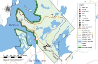
 Township of Rideau Lakes drainage manager Dan Chant joined RVCA intern Caitlin Sommer in Portland this July to paint yellow fish on several storm drains. These fish will remind residents that stormwater goes directly to the lake.The Township of Rideau Lakes has generously funded a pilot partnership with Big Rideau Lake Association, Cataraqui Region Conservation Authority and Rideau Valley Conservation Authority to work co-operatively on a sustainable drainage pilot project in the village of Portland and the surrounding rural catchment area.
As climate change contributes to more frequent and extreme rain events, excess nutrients, sediments, harmful chemicals and pollutants are increasingly washed into Big Rideau Lake through our storm drainage systems. This contributes to increased aquatic weed growth, more toxic algae blooms and an overall decline in lake health and enjoyment.
In summer 2022, staff from RVCA as well as volunteers from the Big Rideau Lake Association conducted a sampling and monitoring program, targeting an urban drain in the village as well as a rural drain (non-agricultural) outside the village. Research was conducted to find and recommend sustainable drainage practices that are best suited to protect water quality and lake health.
Read the Monitoring Report/Summary.
Read the final Recommendations Report.
Resources:
Reducing your runoff can also begin at home – and can be as easy as installing a rain barrel. To learn more about how you can reduce stormwater runoff on your own property, check out the resources below.
VIDEO: Learn how to build a low-cost, low-maintenance rain garden on your property: https://youtu.be/dvgJXlul9Bk
VIDEO: Learn how the RVCA’s Shoreline Naturalization Program offers technical and financial support for waterfront owners to naturally reduce their runoff: https://youtu.be/j2WEnMfRZTo
BLOG: Learn all the simple, cost-effective ways you can reduce runoff on your own property: https://www.rvca.ca/view-all-blog-posts/soak-up-the-summer-storms-reducing-your-runoff-in-the-big-city
BLOG: Learn more about the RVCA’s Clean Water Grants program that supports sustainable drainage and other projects for rural residents: https://www.rvca.ca/view-all-blog-posts/grant-program-makes-clean-water-projects-affordable
INTERACTIVE: Scroll over the pins to learn how you can keep contaminants out of your storm drain: https://www.rvca.ca/view-all-blog-posts/reducing-runoff-which-side-are-you-on
INTERACTIVE: Check out this interactive graphic for sustainable drainage practices on waterfront properties: https://www.rvca.ca/view-all-blog-posts/waterfront-living-which-side-are-you-on
WEBPAGE: Learn more about how to naturalize your shoreline (whether it’s a ditch, stream, river or lake!): https://www.rvca.ca/stewardship-grants/shoreline-naturalization/how-to-naturalize-your-shoreline
Benefits of sustainable drainage:
- Reduced algae blooms and excessive weed growth in our lakes and rivers
- Improved water quality for local ecosystems
- Better water quality for local tourist industries including recreational fishing and seasonal rentals
- Safer drinking water for residents with surface water intakes
- Improved knowledge of sustainable drainage best practices can be applied across the watershed
More Information:

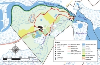
The Jebbs Creek Wetland Embayment Creation Project converted a small area of existing meadow habitat in the Rideau Valley Conservation Authority’s Perth Wildlife Reserve Conservation Area to a series of small riverine wetland embayments along the shoreline of Jebbs Creek within Tay Valley Township in Eastern Ontario.
Jebbs Creek is a tributary in the Tay River watershed, which supports a warm/cool water fishery. The purpose of the Jebbs Creek Wetland Embayment Creation Project was to create 1,600 m² of new spawning, nursery, rearing, and feeding habitat for the 20 species of fish that reside in Jebbs Creek.
The Kemptville District of the Ministry of Natural Resources and Forests manages the Tay River watershed for an extremely diverse fishery which includes northern pike (Esox Lucius), smallmouth bass (Micropterus dolomieu), largemouth bass (Micropterus salmoides) and walleye (Sander vitreus).
Northern pike is a local sport fish, well known for its large size and predatory nature. Despite its reputation as a top predator, northern pike are particularly sensitive during spawning and are often subject to high egg mortality; therefore, it is crucial to ensure that suitable spawning habitat exists to support this species. Through a multi-tier approach, the goal was to create and maintain a suitable spawning and nursery site for northern pike along Jebbs Creek, while helping to improve shoreline stability, riparian habitat and water quality. The feature also provides a small riverine wetland embayment along Jebbs Creek which will provide important habitat for breeding birds, amphibians, turtles nesting habitat with a goal to increase overall biodiversity.
2018 Construction highlights:
- 5 days of construction
- 1600 m² of fish habitat created
- 5.5 kg of shoreline and wetland seed mixes were installed around the wetland feature
- 5.0 kg of meadow seed mix installed in the fill deposition area for pollinator habitat
- 15 volunteers participated in the planting day for a total of 75 volunteer hours
- 125 native shrubs and trees planted around the new wetland feature
Jebb's Creek Plan View Habitat Structure (PDF)
Jebb's Creek Plan View Contours (PDF)
Post Construction Phase monitoring is scheduled for the spring/summer in 2019, 2020, 2022 and 2024.
Thank you to our Otty Lake Association volunteers!
Project Objectives
- Enhance fish habitat by creating new spawning, nursery, rearing and feeding habitat for the fish community of Jebbs Creek (target species northern pike)
- Improve food supply for aquatic and terrestrial species through increasing overhanging vegetation along the shoreline.
- Improving the function of adjacent wetland habitats for aquatic species
- Create a quiet backwater area adjacent to the main current of Jebbs Creek.
- Provide winter and summer refuge areas for fish.
- Protect water quality and enhance wildlife habitat by establishing a naturalized buffer with native species of trees and shrubs
- Altering elevations to create conditions more suitable for more diverse submergent and emergent aquatic vegetation
- Enhance recreational and educational opportunities at the site by installing educational signage
- Engage and educate community members by involving volunteers in the process and providing a demonstration site that shows a variety of cost-effective methods to protect and enhance shorelines and wildlife habitats.
- Partnership opportunities with various groups and the Conservation Authority.
Project Description
Project implementation was carried out by the RVCA and partners. A variety of techniques/applications were carried out, including:
- The removal of fill from the existing shoreline to create a series of small embayment’s with a variety of slope conditions
- In-water planting of aquatic sedges and grasses known to be favorable for northern pike spawning
- Installation of wood structure to further enhance nursery habitat
- Re-vegetation of the riparian area by planting native trees, shrubs and wetland vegetation
- Maintain the pathway system adjacent to the embayment feature to continue access for recreational use
- Deposit the excess fill in specified areas in the adjacent field outside of the regulatory area and seed these areas with a pollinator seed mix to support pollinator habitat
- The installation of an interpretive sign along the adjacent existing pathway, with partner logos, describing the project benefits from a watershed management perspective
Project Timeline
- (2015-2018) background data collection to inform the detailed design process
- December/January 2017/18 Refine and further develop the wetland embayment proposal
- February/March/April 2018 prepare Detailed Design (contour plan, cross section plan, landscape plan, structures plan)
- April 2018 site visit with RVCA/MNRF staff
- June 2018 review of plans for permits and tender package for potential contractors
- July/August 2018 Around the Rideau announcing the project and partners prior to construction
- September 2018 Construction of the wetland feature
- November/December 2018 Around the Rideau announcing completion of the project and showing construction and volunteer photos
- Post effectiveness monitoring 2019, 2021, 2023 (year 1,3,5)
Project Partners:

Information:
Walleye spawn in the spring for one to two weeks, depending on water temperatures, and return to the same spawning site each year which means they have high site fidelity to their spawning areas. This project consisted of placing round river stone on the bed of Scanlan Creek to restore an impaired walleye spawning bed. This work will further enhance the productivity of the walleye that spawn in Scanlan Creek and return to Wolfe Lake. By restoring this spawning bed site to a functional riffle habitat we will improve the recruitment success of spawning walleye from Wolfe Lake.
Construction Phase
Two locations measuring five metres by 10 metres were determined to be in need of augmentation with appropriately-sized river stone. Staff and volunteers installed 100 tonnes of six-inch round river stone for walleye spawning on the bed of Scanlan Creek in the fall of 2019, when water levels were lower.
What are the anticipated outcomes?
- Create a greater awareness about the threats to the local walleye population and how simple costs effective measures can improve spawning success and recruitment.
- Engage with volunteers on Wolfe Lake and in the Westport area, building enthusiasm and environmental awareness while reinforcing a strong sense of community, particularly involving youth in the hands-on element of the project, providing them a valuable learning experience and opportunity to positively impact the world around them.
- Educate lake residents on how habitat enhancement efforts can improve the local walleye fishery on the lake.
- Promote the goodwill and partnerships formed through the enhancement project.
In order to implement this project a partnership was formed between the Wolfe Lake Association (WLA), the Westport Area Outdoor Association (WAOA), the Rideau Valley Conservation Authority (RVCA), Rideau Valley Conservation Foundation (RVCF), Camp IAWAH (Youth camp located on Wolfe Lake) and TD Friends of the Environment.

Information:
Stillwater Creek Slope Stabilization Project
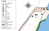
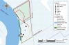
RVCA was contracted by the City of Ottawa to design and implement remediation of an eroded bank of Stillwater Creek adjacent to Nautica Private and Carling Avenue and into the Ottawa River. Erosion of the slope is being caused by fluctuating flow and velocity in the creek and this project will help prevent potential slope failure.
 |
 |
|
| East Bank Erosion | East Bank Erosion |
The headwaters of Stillwater Creek begin in the National Capital Commission’s Stoney Swamp. Stoney Swamp is almost 2000 hectares in size, and is a mix of woodland, wetland and regenerating fields. From Stoney Swamp, Stillwater Creek runs through a heavily channelized and impacted area adjacent to Robertson Road. The creek turns into its natural morphology downstream of Robertson Road until the Highway 417 crossing. It then becomes channelized again, as it runs through Wesley Clover Park on Corkstown Road. The creek flows through another large wetland before Moodie Drive crossing, and from there runs parallel between Highway 417 and Corkstown Road until it turns north flowing through residential neighborhoods before emptying into the Ottawa River between the Nepean Sailing Club and Andrew Haydon Park.
The first phase to be completed is on the west bank of the creek in the treed area. The highlighted blue area is the East bank portion of the work to be completed as the second phase.
 |
| Map of the Work Area |
Further erosion of the bank of Stillwater Creek at Nautica Private could be detrimental to the properties on Nautica Private and to the safety of the residents.
Rock Toe Berm Construction
RVCA looked into multiple alternatives for the slope stabilization of the banks of Stillwater Creek. RVCA decided on the construction of a rock toe berm to stabilize the east bank of the creek. Once the design was complete, RVCA had it checked by a third-party local geotechnical engineering firm.
The rock toe berm has been designed to make a “key” at the base of the slope to be filled with large “rock protection” sized stones. The slope will then be backfilled at a 1.5:1 (h:v) slope and the large stones will extend above the creeks assumed 100-year flood elevation. The work is expected to protect the properties on Nautica Private from further property damage due to erosion.
Timing
The project took place from approximately December 2, 2019 – February 28, 2020.
Project Partners
City of Ottawa
Rideau Valley Conservation Authority
Information
Terry K. Davidson, P.Eng.
Director of Engineering & Regulations
More...
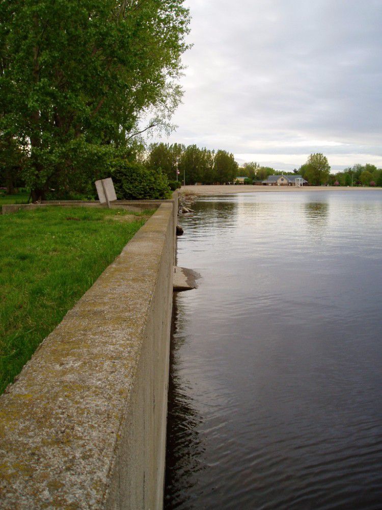
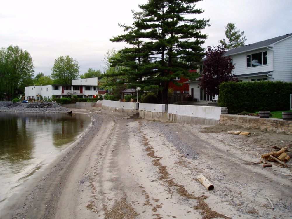
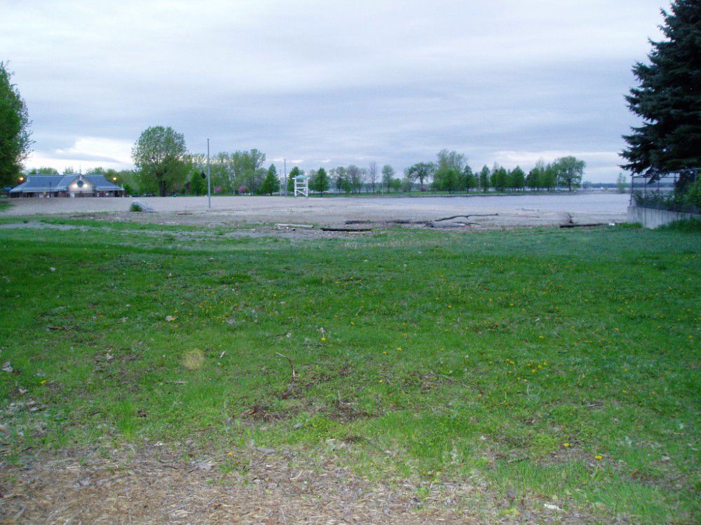
In September 2007, City of Ottawa Council approved a funding arrangement for a remedial flood control project in Britannia Village. The Britannia Village Flood Control Project looks to reduce expected property damages, public safety risks and inconvenience in this existing community during Ottawa River flood events up to and including the 1:100 year flood. The Rideau Valley Conservation Authority has agreed to undertake the design, construction and long-term management of the flood control system.
Construction began in the fall of 2015 and a Notice of Completion was circulated in February 2018.
Project Partners:

Information:
Terry K. Davidson, P. Eng.
Director Regulations,
Rideau Valley Conservation Authority
613-692-3571 ext. 1107