RVCA (1136)
Children categories
Department (67)
Main Office Phone Numbers : 613-692-3571 / 1-800-267-3504
Staff Directory


November 17, 2016
Otter-Hutton Hazard Mapping Public Open Houses
Rideau Lakes, November 14, 2016 — Members of the public are invited to an upcoming open house to review hazard maps. The RVCA has completed draft hazard mapping for Otter Creek (from Otter Lake outlet to the Rideau River) and Hutton Creek (from the Motts Mills Dam to its confluence with Otter Creek). These maps are typically known as “floodplain mapping,” but they also show areas that are prone to natural hazards such as flooding, erosion and natural environment features such as wetlands. The mapping will be used by the Township of Elizabethtown-Kitley, the Township of Rideau Lakes and the…
Published in
Media Release
More...
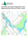
Otter and Hutton Creeks - Flood Risk and Generic Regulation Limits Mapping Along Otter and Hutton Creeks, 2016
Download attachments:
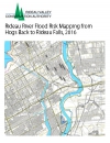
Rideau River Flood Risk Mapping from Hogs Back to Rideau Falls, 2016
Download attachments:
Upper Rideau Lake Regulatory Flood Risk Mapping Report, 2012
Download attachments:
Tay River Flood Risk Mapping Report, Glen Tay Road to Lower Rideau Lake, 2013
Download attachments: