outdoor-ed-8.jpeg
outdoor-ed-3.jpeg
outdoor-ed-1.jpeg
IMG_70291
IMG_7308
2018-Baxter-Day-Camps
Slide
images/Unknown-2.jpeg

ATR - July-August 2017

Money is available to landowners interested in planting trees. The Rideau Valley Conservation Authority offers private landowners tree planting programs that help them get technical advice, planting plans and funding for trees.  “We have numerous community-minded partners providing funding to projects to help reduce landowner costs,” says Scott Danford, RVCA Forestry Program Manager. “We offer planting programs that make it easy and affordable for landowners.” To be eligible, landowners need at least one acre of land and are willing to plant a minimum of 500 trees. If you have the space, RVCA can help get trees growing on your land…
On January 17, 2017 the Rideau Valley Conservation Authority downgraded the Drought status in the watershed from “Moderate,” which had been carried over from a dry year in 2016, to “Minor.” The “Minor” status was kept in place because of uncertainty about groundwater conditions that couldn’t be checked until spring. The “Minor” status was removed on April 19 after three months of above normal precipitation that went a long way to recharging groundwater aquifers. Since February, rainfall totals each month have been an average of 1.65 times normal. It is not unusual for there to be above normal amounts of…
With relatively minor rain forecast for the coming week and the flood waters in decline, the RVCA is withdrawing the Flood Watch that has been in effect for the last week. Water levels are still above normal but continuing to decline. The 3-day rainfall of 35 millimetres presently forecast for Wednesday through Friday in eastern Ontario is expected to cause a pause in the decline. Periods of heavier, localized rain may fall in thunderstorms but no significant impact is expected at this time. Waters have receded from the North Gower area where serious flooding along Stevens Creek occurred last week.…
Ottawa South residents and guests can enjoy the soothing sights and sounds of nature along the newly upgraded Chapman Mills Conservation Area trails and boardwalk. Dignitaries and special guests gathered at the site today to celebrate and help with the installation of the final pieces of wooden boardwalk. Owned by the Rideau Valley Conservation Authority (RVCA), Chapman Mills is an exceptional example of conservation parkland with river shoreline, wetland and flood plain areas that are unique and vital to our local community. “Chapman Mills is one of Ottawa’s most ecologically significant natural areas,” said Rideau Valley Conservation Authority (RVCA) Chair…
As Stevens Creek levels slowly decline, residents of North Gower continue to deal with water in basements and on streets as a result of record setting rainfall. On the Rideau, minor flooding of low-lying areas on the Long Reach have access issues similar to what often occurs in the spring. Parks Canada staff are doing strategic dam operations to get water levels down throughout the Canal system with as little impact as possible. With high flows passing through the dams, boaters are advised to stay well away. Also with high waters, boat wake becomes a problem causing damage to shorelines.…

The Rideau Valley Conservation Authority (RVCA) is conducting several hazard mapping studies on watercourses within the City of Ottawa and the RVCA area of jurisdiction. For some watercourses, old mapping will be updated; and for others, hazards maps will be created for the first time. 

July 25, 2017

Rideau River Hazard Mapping Studies

Super User

Project Status: Complete

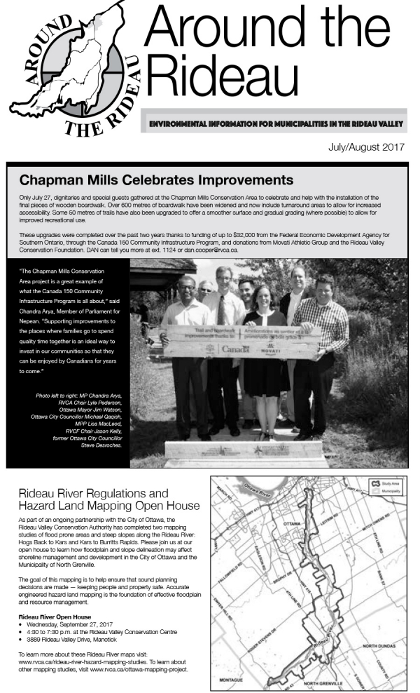
Hogs Back to Kars & Kars to Burritts Rapids

The Rideau Valley Conservation Authority (RVCA) has completed two hazard mapping studies for the Rideau River: Hogs Back to Kars and Kars to Burritts Rapids. These studies update existing mapping in some areas and new mapping in others.

These maps are typically known as “floodplain mapping” and they show areas that are prone to natural hazards such as flooding, erosion and natural environment features such as wetlands. Both Rideau River studies look at identifying two main types of hazards along these stretches of the watercourse: flooding and slope stability. 

When completed, the mapping will be used by the City of Ottawa and the Municipality of North Grenville when updating their Official Plan and Zoning Schedules and in the review of development applications under the Planning Act. RVCA will also use the mapping to guide the review of development applications submitted under the Province’s Development, Interference with Wetlands and Alterations to Shorelines and Watercourses Regulation.

Members of the public are encouraged to attend our open house and/or provide comments on the mapping below. Conservation Authority staff welcome historical records of past flood events, news clippings, photographs and even anecdotal stories to help confirm the reasonableness of calculations and resulting hazard mapping. For those unable to attend the open house, comments can be sent to Ferdous Ahmed, RVCA Senior Water Resources Engineer at .

These mapping studies are being completed as part of the City of Ottawa Hazard Mapping Project.

These studies are being done through a collaboration — known as the City of Ottawa Hazard Mapping Project — involving the City of Ottawa and the Mississippi Valley, Rideau Valley and South Nation Conservation Authorities. The City recognized a need to update its zoning schedules based on up-to-date flood risk mapping and has provided contributions enabling the Conservation Authorities to move ahead with these studies sooner than would otherwise be possible. The RVCA is currently working on several studies in the Ottawa area.


Flooding has occurred in areas of the Rideau Watershed as a result of rains that were closer to monthly totals than daily amounts. The community of North Gower has had floodwaters in some homes and in the streets near Stevens Creek. Low-lying areas along the Rideau and its tributaries have also been flooded but no residential flooding has been reported or is expected in those areas at this time. A weather system moving into eastern Ontario Wednesday night may bring more rain in thunder storms. What impact these storms will have will depend on timing, intensity and size. The decline…
Heavy rains forecast for Monday into Tuesday could cause rapid increases in water levels in small streams and raise rivers and lakes to above normal levels. The Meteorological Service of Canada (MSC) has issued a Rainfall Warning that says “A slow moving upper disturbance over Lake Huron is expected to generate significant rainfall amounts over much of Eastern Ontario”. As much as 100 millimetres (mm) of rain is possible over a wide area. A few days without rain provided some capacity for infiltration of the rain into the soil but that storage has been filled with water levels already on…
Page 50 of 82

Contact Us

Address:
Rideau Valley Conservation Authority
3889 Rideau Valley Drive
Manotick, Ontario K4M 1A5

Phone:
613-692-3571, 1-800-267-3504

Email:

Hours:

Regular Hours: Monday to Friday, 8:30 a.m. to 4:30 p.m.

Member of: conservation ontario