monitoring_1.jpeg
rvca-slide_01.jpg
rvca-slide_02.jpg
rvca-slide_03.jpg
rvca-slide_04.jpg
rvca-slide_05.jpg
rvca-slide_06.jpg
rvca-slide_07.jpg
rvca-slide_08.jpg
rvca-slide_09.jpg
rvca-slide_10.jpg
rvca-slide_11.jpg
rvca-slide_12.jpg
OTTAWA, April 29, 2022 – Ready to make a splash as you help your local environment? You’re in luck: after a two-year pause, the City Stream Watch program is finally back – with a lot of catching up to do.  The RVCA-led program has monitored Ottawa’s 25 urban and rural creeks and streams since 2003, relying on enthusiastic volunteers to help with annual garbage clean-ups, invasive species removals, fish and water sampling, habitat assessments and shoreline naturalization projects.  But all of that came to a grinding halt in the spring of 2020, when the COVID-19 pandemic limited RVCA’s ability to welcome…
Water Conditions Statement: Flood Outlook — Lower Ottawa River April 27, 2022 —   The Flood Outlook Statement issued on April 14th is still in effect for areas along the Lower Ottawa River (Arnprior to Hawkesbury).   Water levels and flows on the main stem of the Ottawa River are expected to increase in most locations over the next few days in response to combined snowmelt from the northern part of the basin and recent rainfall. Levels are expected to be similar to those experienced about one week ago in most locations before starting to decline. Reservoirs throughout the basin are being…
Water Conditions Statement: Flood Outlook — Lower Ottawa River April 14, 2022 —  A Flood Outlook Statement is being issued for areas along the Lower Ottawa River (Arnprior to Hawkesbury). Based on forecasted precipitation and anticipated snow melt, levels and flows along the Ottawa River are expected to increase over the next few days as a result of the onset of the spring freshet in the Ottawa River basin. Snow cover varies significantly across the 146,300 km2 Ottawa River basin, with most southern areas having no snow cover at all. A large portion of snow cover in the northern regions…

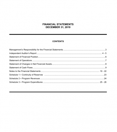
2021 RVCA Financial Statement

(WCS – R08/2022) April 6, 2022 – The Rideau Valley Conservation Authority is continuing with a HIGH WATER SAFETY message for all areas. Although water levels and flows are now declining for most areas of the Rideau Valley Watershed, except for the lakes which are discussed below, the forecasted rain will cause water levels and flows to increase in the coming days. The short-term forecast indicates as much as 40 mm of rain may fall between Thursday, April 7 and Saturday, April 9. The snow has melted across the entire watershed. Although no significant flooding is anticipated, water levels and flows are expected…
(WCS – R06/2022) April 1, 2022 – The Rideau Valley Conservation Authority is issuing a HIGH WATER SAFETY message for all areas. Water levels and flows are declining for most areas of the Rideau Valley Watershed, except for the reservoir lakes which are discussed below. The short-term forecast indicates mostly above zero temperatures and limited precipitation, although there is a possible rain event coming later next week. The snow has melted across the lower watershed, but some snow remains in the upper watershed, near Perth. Parks Canada staff who manage the water levels for the Rideau Canal are carefully watching the water levels…
OTTAWA, March 30, 2022 – Public consultation on the draft hazard mapping study for Stevens Creek from Malakoff Road to the Rideau River will continue until April 29, 2022.  The Rideau Valley Conservation Authority (RVCA), in collaboration with the City of Ottawa, has completed a hazard mapping study for Stevens Creek from Malakoff Road to the Rideau River. Virtual public consultation began late November 2021. Affected landowners were notified by mail and staff have been responding to inquiries by telephone calls, e-mail, virtual meetings, small group in-person meetings and site visits. In some cases the draft mapping has been refined based on…
MANOTICK, April 5, 2022 – With another challenging year behind us, it’s clear the Rideau Valley Conservation Authority not only survived 2021, but thrived.  The RVCA’s 2021 Annual Report is now available online. Despite continued disruption from the global pandemic, staff embarked on many special projects in 2021 that will continue into the coming year. This included:  installing 11 new climate stations across the watershed to improve our flood and drought forecasting, particularly in the face of a changing climate completing draft hazard mapping studies for the Upper Jock River and Stevens Creek kicking off an ambitious Watershed Report process to…
(WCS – R06/2022) March 25, 2022 – The Rideau Valley Conservation Authority is terminating the FLOOD WATCH for the Village of North Gower but a FLOOD OUTLOOK continues for all the low-lying areas around the smaller creeks and streams in the Rideau Valley Watershed, including any connected creeks or ditches. The current short-term weather forecast indicates cooler, mostly below zero temperatures, for the next five days with limited precipitation. Although much of the snow has already melted, some snow remains in the watershed, especially in the upper watershed areas. Parks Canada staff who manage the water levels for the Rideau Canal have indicated that the water…

2021 Annual Report

Page 14 of 82

Contact Us

Address:
Rideau Valley Conservation Authority
3889 Rideau Valley Drive
Manotick, Ontario K4M 1A5

Phone:
613-692-3571, 1-800-267-3504

Email:

Hours:

Regular Hours: Monday to Friday, 8:30 a.m. to 4:30 p.m.

Member of: conservation ontario