RVCA (1138)
Children categories
Department (67)
Main Office Phone Numbers : 613-692-3571 / 1-800-267-3504
Staff Directory
Otter Lake Regulatory Flood Risk Mapping Report, 2011
Download attachments:
Ottawa RIver Flood Risk Mapping Report, Shirley's Bay to Cumberland 2014
Download attachments:
Kemptville Creek Flood Risk Mapping Report - 2009
Download attachments:
Jock River Flood Risk Mapping Report, within City of Ottawa, 2005 - Summary
Download attachments:
Cardinal Creek Flood Risk Mapping Report, Ottawa River to O'Toole Road, 2014
Download attachments:
Bob's Lake Regulatory Flood Risk Mapping Report, 2012
Download attachments:
Blueberry Creek Flood Risk Mapping Report, 2010
Download attachments:
Big Rideau Lake Regulatory Flood Risk Mapping Report, 2012
Download attachments:

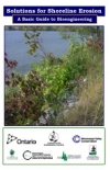
Shoreline Naturalization Program Species Availability List

A list of plants, shrubs and trees available through the Shoreline Naturalization Program.
Download attachments:
More...
Septic Smart - Booklet 2

Advanced Treatment Systems — Alternatives to Conventional Septic Systems
This twelve page booklet will help you become familiar with advanced treatment units as well as the type of final distribution and soil treatment that could be used with them in Ontario (aerobic treatment units and filtration units).