


RVCA (1140)
Children categories
Department (68)
Main Office Phone Numbers : 613-692-3571 / 1-800-267-3504
Staff Directory
Rideau River Floodline Mapping: Regional Road 6 to Burritts Rapids: General Report, prepared by Robinson Consultants Inc., 2003
MANOTICK, June 15, 2021 – Accessibility and conservation advocates are teaming up to transform Baxter Conservation Area into the most accessible nature destination in Eastern Ontario – but they need your help. The Nature For All committee is working to upgrade Baxter’s bridges, boardwalks, trails and facilities to the gold standard of accessibility to make the park as inclusive as possible to all ages and abilities. Truly accessible natural areas are few and far between, which leaves people with disabilities or mobility concerns stuck on the sidelines. Nature For All believes every person should be able to enjoy the many physical and…
Published in
Media Release
Rideau River Flood Risk Mapping Report, Poonamalie Dam to Smith Falls Report, 2010
Download attachments:
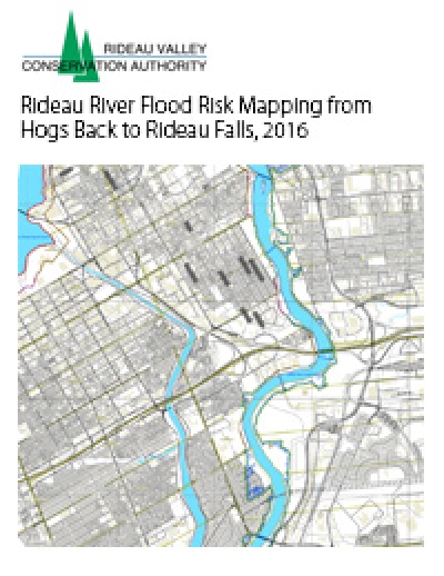
Rideau River Flood Risk Mapping from Hogs Back to Rideau Falls, 2016
Download attachments:
April 30, 2021
Plant a tree for Mom - and Mother Earth - this Mother's Day
RIDEAU VALLEY, May 4, 2021 – Your mother gave you the gift of life, and now you can return the favour. Thanks to the Rideau Valley Conservation Foundation’s special occasions tree planting program, you can skip the grocery store bouquet and plant an environmental legacy in your mom’s honour, instead. The native tree species are planted across the Rideau Valley watershed, from Frontenac to Smiths Falls to downtown Ottawa, helping to fight erosion, manage floods and keep contaminants out of our rivers and lakes. Staff tend to the new trees, helping them grow into maturity so they can thrive for decades…
Published in
Media Release
Steven Creek Floodplain Mapping, prepared by Robinson Consultants, 1995
Download attachments:
RIDEAU VALLEY, March 19, 2021 – Even the goodest of good pups can accidentally harass or kill wildlife while off exploring, which is why we’re reminding visitors to keep their dogs on-leash and on conservation area trails at all times. Spring is a particularly sensitive time, as some birds and animals build their nests on or very close to the ground. These nests can easily be trampled, eaten or otherwise destroyed by curious canines. While we welcome on-leash dogs to most of our conservation areas, RVCA's Conservation Lands manager Chelsey Ellis says her department’s top priority is protecting the natural spaces…
Published in
Media Release
Tay River Flood Plain Mapping, prepared by FENCO Consultants Limited, 1981
Download attachments:
March 15, 2021
Team of super sleuths help RVCA investigate Adrains Creek
RIDEAU LAKES, March 15, 2021 – Holmes and Watson would surely approve of the watershed’s latest investigative team: the Township of Rideau Lakes, Upper Rideau Lake Association (URLA) and the Rideau Valley Conservation Authority (RVCA). This spring, staff and volunteers from all three organizations will embark on their second season of a unique collaboration to examine why water quality in Adrains Creek is consistently rated “poor” in RVCA reports – and whether the creek is contributing to the same poor rating in Upper Rideau Lake. RVCA regularly monitors sites throughout Upper Rideau Lake and one site on Adrains Creek. The…
Published in
Media Release
Tay River Flood Risk Mapping Report, Christie Lake to Glen Tay, 2010
Download attachments:
More...
RIDEAU VALLEY, April 22, 2021 – Just in time for Earth Day, Rideau Valley residents can count on cleaner water, healthier shorelines and more climate-resilient communities thanks to a groundbreaking agreement between the Rideau Valley Conservation Foundation (RVCF) and Modern Niagara. The national mechanical, electrical, integrated technology and building services corporation will provide $300,000 to the Foundation over five years to help acquire 375 more acres of local wetlands, shorelines and forests for perpetual protection. This is the first deal of its kind for the RVCF and will provide it with much more flexibility to acquire sensitive natural areas across…
Published in
Media Release
Tay River Flood Risk Mapping Report, Glen Tay Road to Lower Rideau Lake, 2013
Download attachments:
WESTPORT, April 26, 2021 – Every day can be Earth Day with the help of a spring Outdoor Adventure Kit from Foley Mountain and its community partners. Back by popular demand, families can pick up one of 200 free kits from any Rideau Lakes or Westport library branch, as well as the Lyndhurst and Seeley’s Bay branches of the Leeds and Thousand Islands Public Library beginning May 1. The spring kits include materials and instructions to help families of all ages get outside and explore. Families can expect seed packets for starting a pollinator garden, a magnifying glass and nature journal…
Published in
Media Release
Upper Rideau Lake Regulatory Flood Risk Mapping Report, 2012
Download attachments: