Monitoring & Reporting (91)
Children categories

Flood Risk/Hazard Mapping Reports (61)
Learn More:
- Contact Tyler Bauman, Water Resources Engineer (Flood Management)
In cooperation with local municipalities and the province, the RVCA identifies, studies and maps natural hazard areas along local rivers, lakes, streams and wetlands. Natural hazard areas include floodplains, unstable slopes. Natural features such as wetlands are also mapped. In the past, these maps were called flood risk maps.
If not understood or dealt with effectively, these hazards can pose risks and problems to society, especially when considering development activities.
Hazard mapping is used by watershed municipalities when updating Official Plan and Zoning Schedules and in the review of development applications under the Planning Act. The RVCA uses the mapping for the administration and enforcement of regulations made under the Conservation Authorities Act (Section 28).
Ottawa River Flood Plain Mapping Report, MacLaren Plansearch - Appendix C - December 1984 - Superseded
Ottawa RIver Flood Risk Mapping Report, Shirley's Bay to Cumberland 2014
Otter Lake Regulatory Flood Risk Mapping Report, 2011
Otter and Hutton Creeks - Flood Risk and Generic Regulation Limits Mapping Along Otter and Hutton Creeks, 2016

Otty Lake Regulatory Flood Risk Mapping Report, 2011
Richmond (Village of) Flood Risk Mapping Report, Van Gaal and Arbuckle Municipal Drains, 2009
Rideau River Flood Risk Mapping Report, Smiths Falls to Kars, 1976
Rideau River Floodline Mapping, Smiths Falls to Poonamalie, prepared by J.F. MacLaren, 1979
Rideau River Floodline Mapping, Tributaries - Smiths Falls to Kars, prepared by J.F. MacLaren, February 1983
Rideau River Flood Risk Mapping Report, Mooney's Bay to Rideau Falls, 1984
More...
Rideau River Flood Risk Mapping Study: Mooneys Bay to Regional Road 6, prepared by M. M. Dillon Limited, 1989
Rideau River Floodline Mapping: Regional Road 6 to Burritts Rapids: General Report, prepared by Robinson Consultants Inc., 2003
Rideau River Flood Risk Mapping Report, Poonamalie Dam to Smith Falls Report, 2010
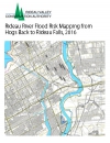
Rideau River Flood Risk Mapping from Hogs Back to Rideau Falls, 2016