Super User
100,000 Shoreline Plants!
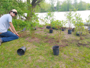
OTTAWA, May 29, 2020 — RVCA’s Shoreline Naturalization Program has reached a milestone — this spring they planted their 100,000th shoreline plant.
The Shoreline Naturalization Program was established in 2009 to help shoreline landowners and groups create natural, resilient shoreline buffers that protect property from erosion, provide critical wildlife habitat and, improve water quality. The program is geared to waterfront landowners who have wetlands, streams, rivers, and lakes within the Rideau Valley watershed. Lake associations, not-for-profits, and stream/creek/river groups are eligible as well.
‘It's been great seeing the program grow over the years. More and more people realize the importance of maintaining natural shoreline buffers. It shows every year with the number of calls we get,” says Meaghan McDonald, RVCA’s Lake Planning/Shoreline Stewardship Coordinator.
There are a lot of benefits to naturalizing your shoreline. Shoreline plants filter runoff that contains pollutants such as fertilizers, soil, road salt, vehicle fluids, pet waste and septic leachate. They improve wildlife habitat by providing food, safe travel areas and places to live. They provide shade over the water, which creates habitat and resting areas for fish. Shade cools water temperatures, which is good for many fish species. These plants are key to erosion protection. They slow erosion processes down by trapping soil in place. They control runoff. Too many soil particles in the water can be problematic for aquatic wildlife by reducing clarity, burying fish spawning grounds, clogging fish gills and limiting aquatic plant growth. A buffer of shoreline plants means less work maintaining your waterfront. All you need to do is prune to maintain your wonderful, water views. Shoreline vegetation also helps with flood abatement. The plants slow down surface water runoff and absorb it into the ground.
You can learn more about the program or sign up for a free site visit at https://www.rvca.ca/stewardship-grants/shoreline-naturalization/shoreline-naturalization-program. You will get a free site visit to discuss your individual needs. And, the program will provide you with a custom planting plan tailored to your property's specifications. And, the cost of shoreline plants is subsidized.
It’s a win-win situation — you get beautiful shoreline plantings that enhance your property and the environment benefits too.
-end-
For more information, please contact:
Meaghan McDonald
Lake Planning / Shoreline Stewardship Coordinator
Rideau Valley Conservation Authority
613-692-3571 ext. 1192
Remembering Walkerton

Today’s local partnerships continue to protect drinking water
Ken Graham, Chair, Mississippi-Rideau Source Protection Committee
As we deal with COVID-19, we are reminded of the value and importance of our public health system. Twenty years ago, this May, Ontarians were reeling with the news of different public health event: the Walkerton Water Tragedy. The community of Walkerton, Ontario, located north-west of Toronto with a population of less than 5,000 at the time, saw seven deaths, and 2,300 people fall ill, after breakdowns in the local water system. The drinking supply in Walkerton became contaminated by Escherichia coli and Campylobacter jejuni bacteria.
After a powerful public inquiry, it was time to respond to a tainted-water catastrophe with decisive changes in how our health system was functioning. The O’Connor Commission’s call to action resulted in changes to how drinking water was managed, including the introduction of Ontario’s Clean Water Act, 2006.
In 2007, under the Clean Water Act, Mississippi and Rideau Valley Conservation Authorities formed a local Source Protection Authority which formed a committee of multiple stakeholders — Municipalities, industry, small business, environmental interests, First Nations, agriculture and the general public — who would oversee research and the development of important source protection plans. In effect since 2015, these plans include policies that respond to local threats and help protect our municipal drinking water sources. Since day one, we have been fortunate to have municipalities, residents and businesses support the work of this local Source Protection Authority and do their part to keep our drinking water safe and clean. This work continues today.
And while May is a somber time for Walkerton and Canadians as a whole, we hope that locally we can take comfort that we have made advances through legislation and local teamwork which together are ensuring that our municipal drinking water sources are safe and abundant — now and into the future.
We remember those who lost their lives in Walkerton twenty years ago this month and we think of all the people whose health continues to be affected from that tragedy
Thank you to those in public health, environmental protection and local citizens who continue to work and advocate for safe drinking water. Together we are all part of this work to protect public health in Ontario. Let’s all do our part to keep ourselves, our families and each other safe.
----
Ken Graham is Chair of the Mississippi-Rideau Source Protection Committee. Ken served 20 years as an elected Smiths Falls Town Councillor and 11 years on the Rideau Valley Conservation Authority Board of Directors including three as Chair. Mr. Graham has also held Board of Directors positions at numerous other organizations such as the Leeds, Grenville and Lanark District Health Unit, the Smiths Falls Airport Commission, the Perth and Smiths Falls District Hospital, Smiths Falls Child Development Center and the Smiths Falls Heritage House Museum. In his professional career, Mr. Graham was a civilian employee of the Ontario Provincial Police, a Police Officer with the Smiths Falls Police Service and an Investigator with the Ontario Ministry of the Environment.

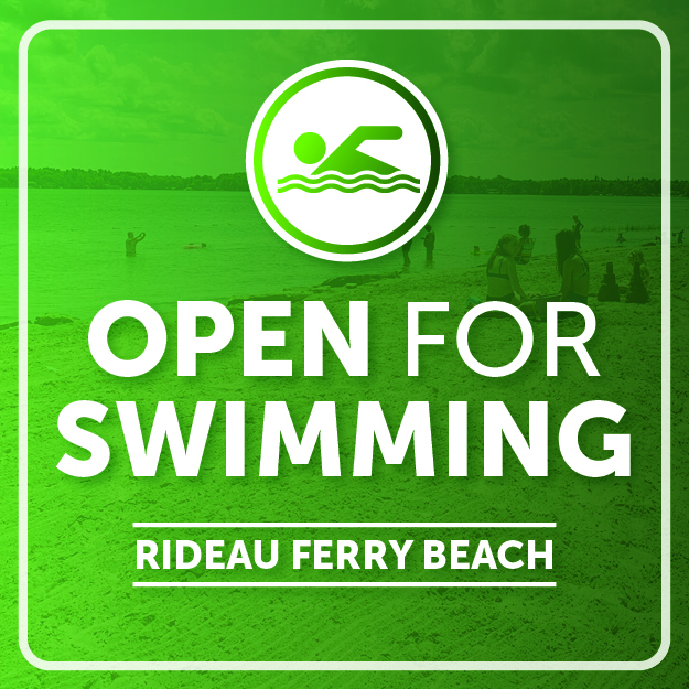
Flood Watch Termination — Lower Ottawa River / Fin de la veille de crue — Cours inférieur de la rivière des Outaouais
Water Safety Statement Remains in Effect
April 20, 2020 — The Flood Watch issued on April 9, 2020 is being TERMINATED. A Water Safety Statement is in effect as all areas are experiencing high spring flows which are typical for this time of year.
The Ottawa River Regulation Committee has indicated that levels are decreasing along the main stem of the Ottawa River from Pembroke down to the Montreal region as runoff from melting snow in tributaries decreases. It is expected that levels will continue decreasing to normal spring freshet levels as no major precipitation is forecasted over the next few days.
Residents are advised to stay away from watercourses where flows are high and where banks might be unstable. Parents are encouraged to explain dangers to children.
The Mississippi Valley, Rideau Valley, and South Nation Conservation Authorities monitor
water levels and weather forecasts with the Ministry of Natural Resources and Forestry as part
of the Flood Forecasting and Warning Program. Updates are provided as conditions change.
The Ottawa River Regulating Committee will be reassessing forecast conditions and providing hydrological condition updates on its website daily at ottawariver.ca/forecasts/.
To view current flood warnings across Ontario, visit:
www.ontario.ca/law-and-safety/flood-forecasting-and-warning-program.
This WATER SAFETY STATEMENT is in effect until May 4, 2020 at 5:00 PM. No further updates will be issued unless forecasted levels or conditions change.
- end -
Definitions:
- Water Conditions Statement - Water Safety: indicates that high flows, melting ice or other factors could be dangerous for such users as boaters, anglers and swimmers but flooding is
not expected. - Water Conditions Statement - Flood Outlook: gives early notice of the potential for flooding based on weather forecasts calling for heavy rain, snow melt, high winds or other conditions.
- Flood Watch: potential for flooding exists within specific watercourses and municipalities.
- Flood Warning: flooding is imminent or occurring within specific watercourses and municipalities.
Une déclaration sur la sécurité aquatique est en vigueur
20 avril 2020 - La déclaration de veille de crue publié le 9 avril 2020 EST LEVÉE. Une déclaration sur la sécurité aquatique est en vigueur car toutes les régions connaissent des débits de printemps élevés qui sont typiques pour cette période de l'année.
Le Comité de régularisation de la rivière des Outaouais a indiqué que les niveaux sont à la baisse dans le tronçon principal de la rivière des Outaouais, de Pembroke à la région de Montréal, en raison des eaux de fonte des affluents de la rivière qui diminuent. On s'attend à ce que les niveaux continuent à baisser pour atteindre les niveaux normaux de la crue printanière, car aucune précipitation majeure n'est prévue au cours des prochains jours.
Il est conseillé aux résidents de se tenir à l'écart des cours d'eau dont le débit est élevé et dont les berges pourraient être instables. On recommande aux parents d’expliquer ces dangers aux enfants.
Les offices de protection de la nature des rivières Mississippi, Rideau et Nation Sud surveillent les niveaux d'eau et les prévisions météorologiques avec le ministère des Richesses naturelles et des Forêts dans le cadre du Programme de prévision et d'alerte des crues. Des mises à jour sont émises en fonction de l'évolution des conditions.
Le Comité de régularisation de la rivière des Outaouais réévaluera les prévisions et publiera quotidiennement des mises à jour des conditions hydrologiques sur son site Web à ottawariver.ca/forecasts/.
Pour consulter les alertes de crue actuelles en Ontario, visitez le site : www.ontario.ca/law-and-safety/flood-forecasting-and-warning-program.
Ce message sur la SÉCURITÉ AQUATIQUE est en vigueur jusqu'au 4 mai 2020 à 17h00. Aucune autre mise à jour ne sera émise à moins que les niveaux ou les conditions prévus ne changent.
- fin -
Définitions :
- Communiqué sur les conditions des bassins versants – Sécurité aquatique : indique que des débits forts, de la glace fondante ou d’autres facteurs peuvent être dangereux pour des utilisateurs comme les plaisanciers, les pêcheurs à la ligne et les baigneurs, mais qu’une crue n’est pas prévue.
- Communiqué sur les conditions des bassins versants – Perspective de crue :préavis de crue possible basé sur des prévisions de pluies abondantes, de fonte des neiges, de forts vents ou autre.
- Veille de crue :possibilité de crue pour des cours d’eau et municipalités spécifiques.
- Avertissement de crue : crue immimente ou en cours pour des cours d’eau et
municipalités spécifiques.
Flood Watch — Lower Ottawa River / Veille de crue — Cours inférieur de la rivière des Outaouais
April 9, 2020 — A Flood Watch is being issued for areas along the Lower Ottawa River. Water levels and flows from Arnprior to Hawkesbury continue to rise gradually due to on-going snowmelt in the central and northern portions of the Ottawa River basin.
On Monday a spring storm is expected to bring above average temperatures and a significant amount of rainfall. Minor flood levels may be exceeded in low-lying, flood prone areas depending on the temperatures and precipitation received.
Levels and flows are expected to stabilize into the weekend and will continue to rise beginning on Monday.
Levels are currently expected to remain below major flood thresholds in all locations and are expected to be similar to levels reached in May 2018.
AREAS OF CONCERN ALONG LOWER OTTAWA RIVER:
Water levels are expected to be similar or below the peak levels reached in May 2018 for:
- Constance Bay and Britannia (Grandview Road, Britannia Village, Belltown Community)
Water levels are expected to be similar or slightly above the peak levels reached in May 2018 for:
- East of Cumberland Village (Boisé Village, Morin Road, Leo Lane)
- Clarence-Rockland (Voisine, Onesime Guilbord Roads)
- Alfred-Plantagenet (Presqu’ile (Miller Island), Presquile Road)
- L’Orignal (Montpetit and Dufour Streets)
Residents in flood-prone areas are encouraged to closely follow evolving conditions and to take necessary measures to protect their property. Residents are advised to stay away from watercourses where flows are high and where banks might be unstable. Parents are encouraged to explain dangers to children.
The Mississippi Valley, Rideau Valley, and South Nation Conservation Authorities monitor water levels and weather forecasts with the Ministry of Natural Resources and Forestry as part of the Flood Forecasting and Warning Program. Updates are provided as conditions change.
The Ottawa River Regulating Committee will be reassessing forecast conditions and providing hydrological condition updates on its website daily at ottawariver.ca/forecasts/.
To view current flood warnings across Ontario, visit: www.ontario.ca/law-and-safety/flood-forecasting-and-warning-program.
This FLOOD WATCH is in effect until April 23, 2020 at 5:00 PM.
- end -
Definitions:
- Water Conditions Statement: Water Safety: indicates that high flows, melting ice or other factors could be dangerous for such users as boaters, anglers and swimmers but flooding is
not expected. - Water Conditions Statement: Flood Outlook: gives early notice of the potential for flooding based on weather forecasts calling for heavy rain, snow melt, high winds or other conditions.
- Flood Watch: potential for flooding exists within specific watercourses and municipalities.
- Flood Warning: flooding is imminent or occurring within specific watercourses and municipalities.
9 avril 2020 - Une veille de crue est émise pour les secteurs situés le long du cours inférieur de la rivière des Outaouais. Les niveaux d'eau et les débits d'Arnprior à Hawkesbury continuent d'augmenter progressivement en raison de la fonte des neiges en cours dans les parties centrale et nord du bassin de la rivière des Outaouais.
Lundi, une tempête printanière devrait entraîner des températures supérieures à la moyenne et une quantité importante de précipitations. Les seuils d'inondation mineurs pourraient être dépassés dans les zones basses sujettes aux inondations, en fonction des températures et des précipitations reçues.
Les niveaux et les débits d'eau devraient se stabiliser au cours de la fin de semaine et continuer à augmenter à partir de lundi.
Les niveaux d'eau devraient se maintenir en dessous des seuils d'inondation majeurs dans tous les secteurs et devraient être similaires aux niveaux atteints en mai 2018.
ZONES PRÉOCCUPANTES LE LONG DU COURS INFÉRIEUR DE LA RIVIÈRE DES OUTAOUAIS :
Les niveaux d'eau devraient être similaires ou inférieurs aux niveaux maximums atteints en mai 2018 pour :
- Constance Bay et Britannia (Chemin Grandview, Village de Britannia, Collectivité de Belltown)
Les niveaux d'eau devraient être similaires ou légèrement supérieurs aux niveaux maximums atteints en mai 2018 pour les secteurs suivants :
- À l'est du village de Cumberland (Village de Boisé, Chemin Morin, Allée Leo)
- Clarence-Rockland (Chemins Voisine, Onesime Guilbord, Boileau, Lalonde et Ettyville)
- Alfred-Plantagenet (Presqu'ile (Île Miller), chemin Presqu'ile)
- L'Orignal (rues Montpetit et Dufour)
On encourage les résidents des zones inondables à suivre de près l'évolution des conditions et à prendre les mesures nécessaires pour protéger leurs biens. Il est conseillé aux résidents de se tenir à l'écart des cours d'eau où les débits sont élevés et où les berges pourraient être instables. On recommande aux parents d'expliquer les dangers aux enfants.
Les offices de protection de la nature des rivières Mississippi, Rideau et Nation Sud surveillent les niveaux d'eau et les prévisions météorologiques avec le ministère des Richesses naturelles et des Forêts dans le cadre du Programme de prévision et d'alerte des crues. Des mises à jour sont émises en fonction de l'évolution des conditions.
Le Comité de régularisation de la rivière des Outaouais réévaluera les prévisions et publiera quotidiennement des mises à jour des conditions hydrologiques sur son site Web à ottawariver.ca/forecasts/.
Pour consulter les alertes de crue actuelles en Ontario, visitez le site : www.ontario.ca/law-and-safety/flood-forecasting-and-warning-program.
Cette VEILLE DE CRUE est en vigueur jusqu'au 23 avril 2020 à 17 h.
- fin -
Définitions :
- Communiqué sur les conditions des bassins versants – Sécurité aquatique : indique que des débits forts, de la glace fondante ou d’autres facteurs peuvent être dangereux pour des utilisateurs comme les plaisanciers, les pêcheurs à la ligne et les baigneurs, mais qu’une crue n’est pas prévue.
- Communiqué sur les conditions des bassins versants – Perspective de crue :préavis de crue possible basé sur des prévisions de pluies abondantes, de fonte des neiges, de forts vents ou autre.
- Veille de crue :possibilité de crue pour des cours d’eau et municipalités spécifiques.
- Avertissement de crue : crue immimente ou en cours pour des cours d’eau et
municipalités spécifiques.
Announcement: Goulbourn Wetland Complex Regulated to 2017 MNRF Designated Boundary and 120 metre Adjacent Lands
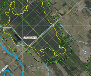
Effective February 18, 2020, the Rideau Valley Conservation Authority (RVCA) is regulating the entire Goulbourn Provincially Significant Wetland (PSW) boundary as approved by the Ministry of Natural Resources and Forestry (MNRF) in 2017. The RVCA will also be regulating 120 metres from the defined 2017 boundary, per Ontario Regulation 174/06.
Since 2006, the Province of Ontario has required Conservation Authorities to regulate development in wetlands and adjacent lands. The RVCA’s responsibilities in this regard are outlined in Ontario Regulation 174/06. Although the RVCA regulates all PSWs, the wetlands within the Flewellyn Special Study Area, which includes the Goulbourn Wetland Complex, were exempt while the City of Ottawa undertook various studies to better understand the hydrology of the area and a wetland boundary re-evaluation. However, in order to address the matter of ongoing interference with these wetlands, the RVCA Board of Directors, at their meeting on January 25, 2018, passed a motion to apply Ontario Regulation 174/06 to the Goulbourn Wetland Complex based on boundaries that were identified by MNRF in 2008.This was an interim approach until such time as:
- The City of Ottawa had concluded a re-evaluation of the boundaries for those wetlands within the Flewellyn Special Study Area
- The wetland boundaries identified through the re-evaluation were approved by MNRF
- Notification was provided to landowners
- The City of Ottawa adopted an official plan amendment to recognize the re-evaluated wetlands as Provincially Significant
These steps have been completed. The City of Ottawa adopted Official Plan Amendment 240 on February 12, 2020 to designate the re-evaluated wetlands within the Flewellyn Special Study Area as Provincially Significant. The RVCA now regulates the entire Goulbourn Wetland Complex PSW in accordance the MNRF approved boundaries, and the 120 adjacent lands. This includes PSWs that were identified through this process that extend beyond the Flewellyn Special Study Area boundary.
What Affect Does Ontario Regulation 174/06 Have?
Ontario Regulation 174/06 (Development, Interference with Wetlands and Alterations to Shorelines and Watercourses Regulation) under Section 28 of the Conservation Authorities Act, requires property owners to obtain the written permission of the RVCA prior to interfering in any way with the existing channel of a river, creek, stream or watercourse or for changing or interfering in any way (including hydrologic function) with a wetland. Therefore, property owners must receive approval from the RVCA prior to undertaking any development or site alteration within a Provincially Significant Wetland or within 120 metres of a Provincially Significant Wetland boundary. Development is defined as:
- The construction, reconstruction, erection or placing of a building or structure of any kind or changes to a building or structure that would result in an increase in size or the number of dwelling units,
- Site grading, and
- Temporary or permanent placing, dumping or removal of any material, originating on the site or elsewhere.
For More Information Please Contact Us
We encourage you to contact our office if you have any questions or would like additional information, including a site-specific map of your property showing regulated areas.
You can contact one of our Resource Specialists at:
You can also view maps, Ontario Regulation 174/06 and RVCA’s development policies at Regulations & Planning