Foley Mountain Educational Programming
The outdoor environmental education program at Foley Mountain provides students with interactive, experiential, curriculum-based experiences that will help them to understand our natural world and their relationship with it. The Program can accommodate up to 60 students per day and all equipment is provided. All programs are approximately 1.5 hours in duration. Descriptions are offered as general guidelines — if there are specific objectives that you would like to accomplish, please let us know. Although grade levels are recommended for each program, these are only guidelines. Please select any desired fields to narrow your search.
| Half Day Program | $200 / group * | maximum 30 students, 90 minutes with an RVCA instructor |
| Full Day Program | $275 / group * | maximum 30 students, two 90 minutes with an RVCA instructor |
| Self-directed | $2.50/person * | Interested in just visiting the conservation area with your class but not booking a program? The cost is $2.50/person. This does not include the use of buildings other than access to public washrooms. To reserve facilities, contact staff. Staff must still be contacted to book a self-directed visit. |
| Overnight Tent Camping (accommodations only) | 1-15 people - $90/night * 16-30 people - $180/night * 30+ people - $7 for each additional person * Additional buildings also available for rent (link to facility rentals) |
Take you class on an overnight adventure to our group camping area! Plan your own activities or book our education staff to provide programming during your stay (see above for pricing). |
| Virtual Outdoor Education Program | $100 for a 45 minute program for up to 30 students * | Our outdoor education staff will guide you and your students through an adventure that focuses on bringing the outdoors to you. Our virtual programs are live, adapted for each grade level listed, curriculum connected, and include opportunities to interact directly with our outdoor educators! |
* plus applicable taxes
For information and to book a VIRTUAL program, click here.
Super User
Survey seeks feedback ahead of new Resource Management Strategy
RIDEAU VALLEY, Oct. 25, 2024 – The Rideau Valley Conservation Authority is seeking feedback from the public on its mandatory hazard management programs, as part of the development of a Watershed-Based Resource Management Strategy required under Ontario Regulation 686/21.
All residents, landowners, municipal partners, agencies and businesses in the Rideau Valley are invited to complete a survey on the delivery and improvement of mandatory programs and services including Flood Forecasting and Warning, Drought or Low Water Response, Land Use Planning advisory services and application of development regulations in natural hazard areas.
Natural hazard areas include river or stream valleys, unstable soils or bedrock, areas affected by flooding, erosion or dynamic beaches, and wetlands.
The survey is open until November 18, 2024. Survey results will be used to prepare an interim Watershed Management Strategy, which will be followed by more extensive stakeholder and public consultation in 2025 to inform a more detailed and comprehensive Watershed Management Strategy. Next year’s Strategy will dive deeper into RVCA’s work and will encompass all programs and services as the RVCA prepares a new Strategic Plan.
For more information contact or visit www.rvca.ca to learn more about our programs.
-30-
ALUS Lanark expands, becomes ALUS Mississippi-Rideau
RIDEAU AND MISSISSIPPI WATERSHEDS, October 16, 2024 – After three successful seasons as ALUS Lanark, the environmental stewardship program for farmers will now be available to all agricultural properties within the Rideau Valley and Mississippi Valley watersheds.
The expanded ALUS Mississippi-Rideau program will help farmers complete ecosystem projects such as reforestation, windbreaks, riparian buffers, wetland projects, grassland and pollinator habitat, delayed cut/grazing, and clean water projects. Farmers are eligible to have project costs covered in part or in full, and they may be eligible to receive annual payments for the ecosystem services they’ve added to their property.
The program is jointly administered by the Rideau Valley Conservation Authority (RVCA) and the Mississippi Valley Conservation Authority (MVCA) as part of their broader complement of stewardship programs and grants. Under ALUS Lanark, a total of 44 projects created 320 acres of habitat enhancements on 19 properties. By expanding the reach of the program, it will accelerate those successes and spread them across the region for the benefit of all.
The new ALUS Mississippi-Rideau program will cover 8,500km2 which encompasses 31 municipalities and is home to approximately 986,000 people. In this region, agriculture is the backbone of many local communities and farmers have been stewards of the land for generations. ALUS recognizes the value of their stewardship efforts and provides financial support to enable farmers to continue producing food and commercial goods while protecting and enhancing habitat, biodiversity and clean water.
“We’re thrilled to expand this partnership with ALUS to reach even more farmers across the watershed,” said Sommer Casgrain-Robertson, General Manager of the RVCA. “We’ve seen a steady uptake from Lanark farmers, and there is a growing interest across the watershed. We’re grateful to local farmers for all they do, so we’re excited to provide additional incentives so they can complete more conservation projects that improve the health of our watershed, our communities and local farmland.”
MVCA’s general manager said partnerships like this help farmers to pursue Environmental Farm Plans (EFP) and related projects during tough economic times.
“The farmers know these projects can enhance their operations including their water management, and ALUS makes it possible to take the leap,” said Sally McIntyre, MVCA’s General Manager.
ALUS Mississippi-Rideau will continue to be guided in its decision making by a Partnership Advisory Committee (PAC) to ensure local priorities are addressed by approved projects. Fifty per cent of the committee are local farmers who, in partnership with the other committee members (local elected officials, environmental experts, etc.), will determine which projects are prioritized for ALUS funding.
About ALUS
ALUS (originally an acronym for Alternative Land Use Services) is a charitable organization that sustains agriculture and biodiversity for the benefit of communities and future generations. ALUS provides direct financial and technical support to a network of more than a thousand farmers and ranchers who deliver ecosystem services in more than 30 communities across Canada, such as cleaner air, cleaner water, carbon sequestration, erosion control, flood mitigation, pollinator support and wildlife habitat. Learn more at ALUS.ca.
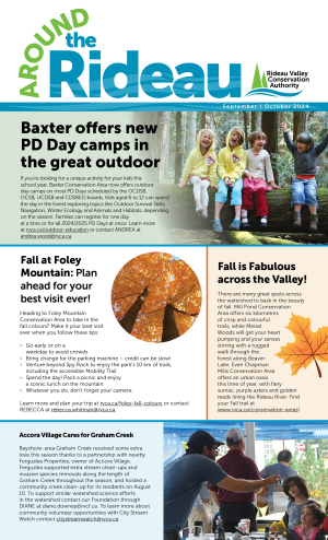
ATR-September-October 2024
Baxter Forest School DRAFT
Baxter Forest School offers an alternative education in which children spend most of their time outside, playing and learning through experiential, hands-on activities that promote curiosity in an active and authentic learning environment. Students will receive the benefits of repeated and regular visits to a natural area, in a play and inquiry-based education setting.
PLEASE READ our Forest School Frequently Asked Questions for more information.
Location: 7498 Carter Road, Kars, ON, South of Ottawa — Google map
Winter Forest School Registration NOW OPEN:
Complete this Registration Request Form to be added to our registration list. PLEASE NOTE that filling out this form does not necessarily guarantee a space in the program but begins the registration process. We will send registration packages out on a first-come, first-served basis, including the program handbook and other necessary documents, to complete registration and payment.
Program Details
- Program sessions offered for ages 4-6, 6-8, 6-10 and 8-13. Children must be the minimum age for the group by December 31, 2024.
- Cost per child is $55/full day or $30/half day
- We will do our best to accommodate your requests but reserve the right to alter the schedule based on demand.
- 2025 Spring Forest School dates are listed below, and registration will take place in early 2025.
Tuition subsidies for the forest school program may be available for those who qualify. Please contact for more details.
Winter Forest School
| Program Session | Date/Time |
|
Half Day — Mondays |
January 6 – March 3, 2025 |
|
Full Day |
January 7– March 4, 2025 (9 sessions) 9 a.m. to 12 p.m. or 3 p.m. |
|
Full Day — Wednesdays |
January 8– March 5, 2025 |
|
Full Day — Thursdays |
January 9– March 6, 2025 (9 sessions) 9 a.m. to 3 p.m. |
| Half Day — Fridays (Ages 6-10) |
January 10 – March 7, 2025 (9 sessions) 9 a.m. to 12 p.m. |
Fall Forest School Sessions (Registration now open)
| Program Session | Date/Time | Cost |
|
Half Day — Mondays |
September 9 – December 9, 2024 |
$360 |
|
Full Day (with half day option) — Tuesdays |
September 10 – December 11, 2024 (14 sessions) 9 a.m. to 12 pm or 3 p.m. |
$770 (full day) $420 (half day) |
|
Full Day — Wednesdays |
September 10 – December 11, 2024 (14 sessions) 9 a.m. to 3 p.m. |
$770 (full day) |
|
Full Day — Thursdays |
September 12 – December 12, 2024 |
$770 |
|
Half Day — Fridays |
September 13 – December 13, 2024 (14 sessions) 9 a.m. to 12 p.m. |
$420 (half day) |
*plus any applicable taxes
Spring Forest School (Registration Coming in Winter 2024-25)
| Program Session | Date/Time |
|
Half Day — Mondays |
March 17 – June 16, 2025 |
|
Full Day (with half day option) — Tuesdays |
March 18 – June 17, 2025 (14 sessions) 9 a.m. to 12 p.m. or 3 p.m. |
|
Full Day — Wednesdays |
March 19 – June 18, 2025 |
|
Full Day — Thursdays |
March 20 – June 19, 2025 (14 sessions) 9 a.m. to 3 p.m. |
|
Half Day — Fridays |
March 21 – June 20, 2025 (13 sessions- no program on Friday, April 18, 2025) 9 a.m. to 12 p.m. |
| Our Community Partners | ||||||
 |
||||||
Consultation open for proposed updates to Mississippi-Rideau Source Protection Plan
RIDEAU AND MISSISSIPPI WATERSHEDS, October 8, 2024 – Public consultation is now open for several policy amendments to the Mississippi-Rideau Source Protection Plan. Proposed policy changes apply to the management of road salt, fuel tanks, agriculture, pesticides, fertilizers, chemical storage, snow storage and other potential drinking water threats near municipal wells or intakes.
The Mississippi-Rideau Source Protection Plan is a locally developed plan to keep our municipal drinking water safe and clean. It is required under the Clean Water Act, 2006.
This Plan is overseen by the Mississippi-Rideau Source Protection Region, and has been in effect since 2015. This plan contains policies for activities that have been determined to be significant drinking water threats (as determined by the Technical Rules under the Clean Water Act, 2006) in areas near municipal groundwater wells and surface water intakes. It is currently undergoing an update to align with recent legislative changes from the Ministry of Environment, Conservation and Parks. The updates will only apply to a select number of properties located within designated drinking water protection zones.
Drinking water sources in the Mississippi-Rideau Source Protection Region include groundwater drawn from aquifers underground, and water drawn from the Ottawa River, Rideau River, Tay River and Mississippi River. The Source Protection Plan sets out policies that use a variety of tools to protect municipal drinking water sources from contamination. These tools include education, risk management planning, prohibition and land use planning. Visit the Source Protection Region’s local website at www.mrsourcewater.ca to find out more.
The Source Protection Region is required to consult with the public on the proposed changes. Digital copies of the proposed updates can be found at www.mrsourcewater.ca/en/consultation, or hard copies can be viewed by appointment at the Rideau Valley Conservation Authority headquarters in Manotick. Members of the public can provide feedback on the proposed changes until November 22, 2024.
If you have questions or wish to provide comments about the proposed changes, please contact Marika Livingston at 613-692-3571 ext. 1148 or .
- 30 -
Mississippi Valley and Rideau Valley Source Protection Authorities
Marika Livingston
3889 Rideau Valley Drive, PO Box 599
Manotick, ON K4M 1A5
613-692-3571 or 1-800-267-3504 ext. 1148
Baxter PD Day Program
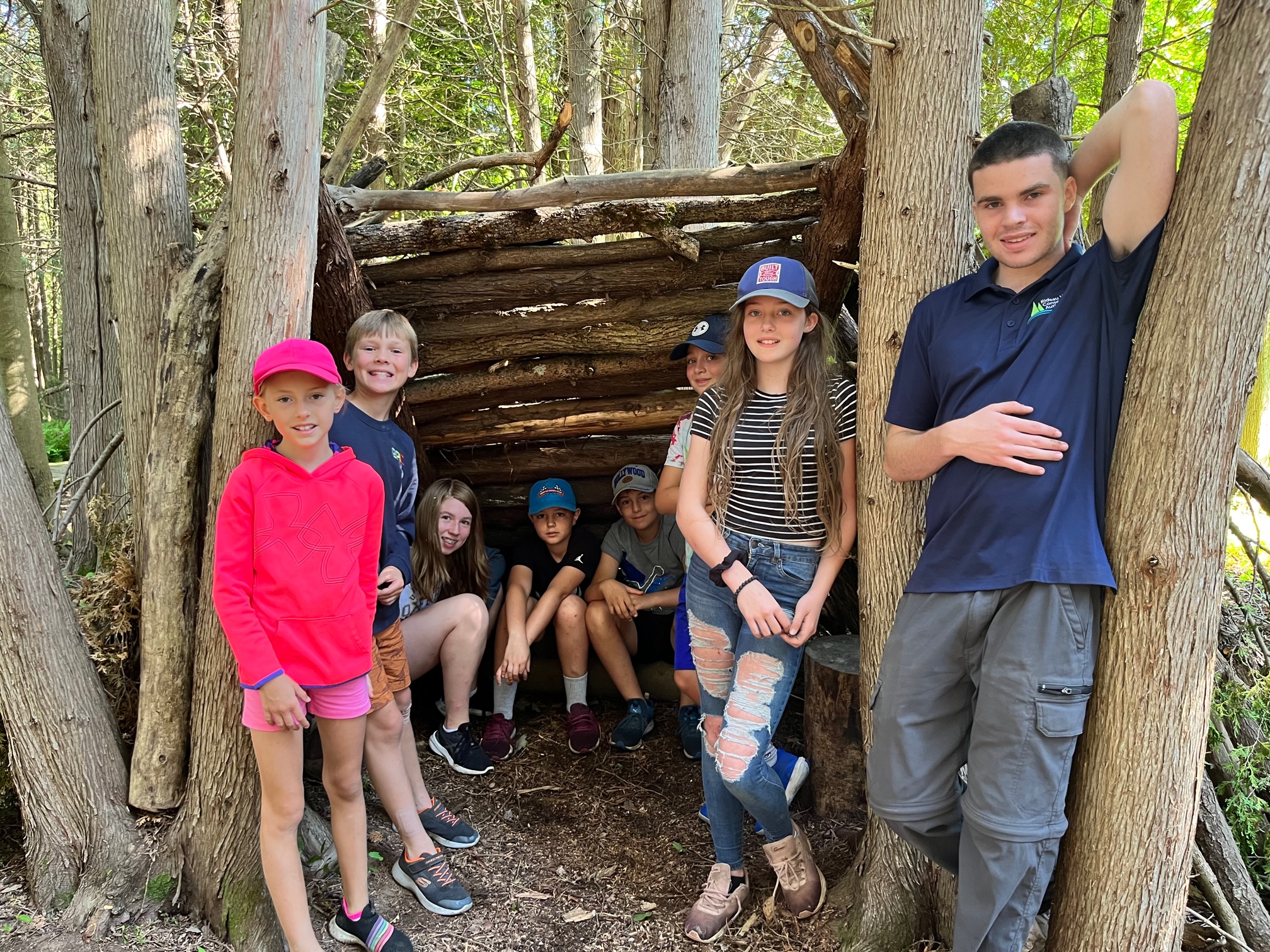
Baxter will be offering PD Day programs this school year! The days will be themed by our outdoor education staff depending on the season and time of year such as Outdoor Survival Skills, Navigation, Winter Wonderland, Animals and Habitats.
Come join us for a day in the Forest!
Please submit your request for Baxter PD Day Programs using our Registration Request Form. We are looking forward to welcoming your child(ren) to Baxter for days of exploration, outdoor learning, and play.
PLEASE NOTE that filling out this form does not necessarily guarantee a space in the program but begins the registration process. We will send registration packages out on a first-come, first-served basis, including the program handbook and other necessary documents, to complete registration and payment.
PD Day Program Details:
- We are excited to offer programming for the following age groups: 6-12.
- Children are eligible for a session if they are six years old by December 31, 2024.
- Cost per child is $55/full day.
- The program will run from 9 AM to 4 PM each day.
- You can register for all sessions for your school board or one at a time.
- Our PD Program days will be run out of Baxter’s Interpretive Centre.
- There are no before or after care options for our PD Day Program.
Watershed Conditions Statement: Forecasted Precipitation to Increase Water Levels Across Rideau Valley Watershed
(WCS – R08/2024)
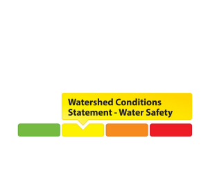
August 08, 2024 – The Rideau Valley Conservation Authority is issuing a WATER SAFETY message for the entire Rideau Valley Watershed.
A low-pressure system associated with remnants of Tropical Storm Debby is expected to produce heavy rainfall throughout the region. Local estimates of 50 to 100 mm of rainfall are possible beginning Thursday evening and continuing into Friday. Despite above normal precipitation over the last month, stream flows have generally stabilized at normal seasonal levels.
Although riverine flooding is not anticipated at this time, all water levels and flows across the Rideau Valley Watershed are expected to increase. Depending on the location and rainfall intensity, localized flooding in low-lying areas, including ditches and stormwater features, may be possible. Flows on the Rideau River are not expected to increase significantly.
It is advised that residents adjacent to smaller tributaries and streams take precautionary measures to protect their property, including:
- Ensuring sump pumps are clear, in good working condition and have a backwater valve
- Ensuring easy access to a portable backup generator and pump
- Ensuring downspouts are clear and the outlet is at least 3 metres from the dwelling
- Securing items that might float away as flows increase
Until the water levels and flows recede, the RVCA advises the public to exercise extreme caution around ALL WATERBODIES and remind children about the dangers of playing near open water.
This watershed conditions statement is in effect until Friday, August 16, 2024 at 5 PM or until an update has been issued.
-end-
Contact: Brian Stratton, RVCA Manager Engineering Services
Rideau Valley Conservation Authority
613-692-6804, 1-800-267-3504 ext. 1141
www.rvca.ca/watershed-conditions
"Rideau Valley Conservation Authority is a partnership of municipalities within the Rideau Valley watershed
created under the Conservation Authorities Act to deliver a range of programs in watershed management and
natural resource conservation."
RVCA Watershed Conditions Statements:
- Water Safety – High flows, unstable banks, melting ice or other factors that could be dangerous for recreational users such as anglers, canoeists, hikers, children, pets, etc. Flooding is not expected.
- Flood Outlook – Early notice of the potential for flooding based on weather forecasts, calling for heavy rain, snow melt, high winds or other conditions that could lead to high runoff, cause ice jams and/or lakeshore flooding or erosion.
- Flood Watch – Flooding is possible in specific watercourses or municipalities. Municipalities, emergency services and individuals in flood prone areas should prepare.
- Flood Warning – Flooding is imminent or already occurring in specific watercourses or municipalities.


