Super User
Flood Watch - Ottawa River – Arnprior To Hawkesbury
APRIL 17, 2019: OTTAWA RIVER FROM ARNPRIOR TO HAWKESBURY — Rideau Valley Conservation Authority (RVCA) in conjunction with the Mississippi Valley Conservation Authority (MVCA), South Nation Conservation Authorities (SNC) and Ministry of Natural Resources & Forestry (MNRF) Kemptville District, cautions residents along the Ottawa River that water levels are expected to increase significantly over the weekend and into next week. Levels are not expected to reach those observed at the height of the flood in 2017 at this time.
The Ottawa River Regulation Planning Board has stated, “With significant rainfall forecasted later this week, levels will exceed minor flood levels over the Easter weekend in flood prone areas along the Ottawa River at Lake Coulonge, Chats Lake, Britannia / Lac Deschênes, Pointe-Gatineau, Ottawa / Cumberland, Rockland, Thurso and other vulnerable areas down to the Montreal Archipelago.”
River Conditions Forecast / Flooding Risk: The current snowpack throughout much of the Ottawa River basin remains at twice its normal depth for this time of the year. Meteorological forecasts indicate that two low pressure systems will be combining to produce significant rainfall (40 to 50 mm) throughout the Ottawa River watershed beginning on Thursday. Combined with spring runoff from the central and southern portions of the watershed, this precipitation is expected to cause a rapid and sustained increase in water levels and flows on the main stem of the Ottawa River. The Regulating Committee will be reassessing forecast conditions and providing hydrological condition updates on its website daily at http://www.ottawariver.ca/forecast.php.
Residents are advised to stay away from watercourses where flows are high and where banks might be unstable. Parents are encouraged to explain these dangers to their children.
This FLOOD WATCH statement is valid through April 23, 2019. Additional statements will be issued when or if conditions are expected to change significantly from this outlook.
For more information regarding the Ottawa River, visit www.ottawariver.ca.
-end-
"Rideau Valley Conservation Authority is a partnership of municipalities within the Rideau Valley watershed created under the Conservation Authorities Act to deliver a range of programs in watershed management and natural resource conservation."
RVCA Watershed Conditions Statements:
- Water Safety – High flows, unstable banks, melting ice or other factors that could be dangerous for recreational users such as anglers, canoeists, hikers, children, pets, etc. Flooding is not expected.
- Flood Outlook – Early notice of the potential for flooding based on weather forecasts, calling for heavy rain, snow melt, high winds or other conditions that could lead to high runoff, cause ice jams and/or lakeshore flooding or erosion.
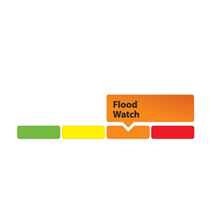
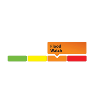
- Flood Watch – Flooding is possible in specific watercourses or municipalities. Municipalities, emergency services and individuals in flood-prone areas should prepare.
- Flood Warning – Flooding is imminent or already occurring in area watercourses.
Flood Watch - Ottawa River – Arnprior To Hawkesbury
APRIL 17, 2019: OTTAWA RIVER FROM ARNPRIOR TO HAWKESBURY — Rideau Valley Conservation Authority (RVCA) in conjunction with the Mississippi Valley Conservation Authority (MVCA), South Nation Conservation Authorities (SNC) and Ministry of Natural Resources & Forestry (MNRF) Kemptville District, cautions residents along the Ottawa River that water levels are expected to increase significantly over the weekend and into next week. Levels are not expected to reach those observed at the height of the flood in 2017 at this time.
The Ottawa River Regulation Planning Board has stated, “With significant rainfall forecasted
later this week, levels will exceed minor flood levels over the Easter weekend in flood prone areas along the Ottawa River at Lake Coulonge, Chats Lake, Britannia / Lac Deschênes, Pointe-Gatineau, Ottawa / Cumberland, Rockland, Thurso and other vulnerable areas down to the Montreal Archipelago.”
River Conditions Forecast / Flooding Risk: The current snowpack throughout much of the Ottawa River basin remains at twice its normal depth for this time of the year. Meteorological forecasts indicate that two low pressure systems will be combining to produce significant rainfall (40 to 50 mm) throughout the Ottawa River watershed beginning on Thursday. Combined with spring runoff from the central and southern portions of the watershed, this precipitation is expected to cause a rapid and sustained increase in water levels and flows on the main stem of the Ottawa River. The Regulating Committee will be reassessing forecast conditions and providing hydrological condition updates on its website daily at http://www.ottawariver.ca/forecast.php.
Residents are advised to stay away from watercourses where flows are high and where banks might be unstable. Parents are encouraged to explain these dangers to their children.
This FLOOD WATCH statement is valid through April 23, 2019. Additional statements will be issued when or if conditions are expected to change significantly from this outlook.
For more information regarding the Ottawa River, visit www.ottawariver.ca.
-end-
"Rideau Valley Conservation Authority is a partnership of municipalities within the Rideau Valley watershed created under the Conservation Authorities Act to deliver a range of programs in watershed management and natural resource conservation."
RVCA Watershed Conditions Statements:
- Water Safety – High flows, unstable banks, melting ice or other factors that could be dangerous for recreational users such as anglers, canoeists, hikers, children, pets, etc. Flooding is not expected.
- Flood Outlook – Early notice of the potential for flooding based on weather forecasts, calling for heavy rain, snow melt, high winds or other conditions that could lead to high runoff, cause ice jams and/or lakeshore flooding or erosion.
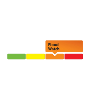
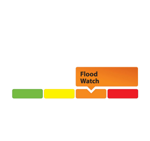
- Flood Watch – Flooding is possible in specific watercourses or municipalities. Municipalities, emergency services and individuals in flood-prone areas should prepare.
- Flood Warning – Flooding is imminent or already occurring in area watercourses.
MISSISSIPPI AND RIDEAU WATERSHEDS, April 15, 2019 — On March 11, 2019 the Ministry of Environment, Conservation and Parks (MECP) approved an amendment to the Mississippi-Rideau Source Protection Plan and the Rideau Valley Assessment Report. The approved amendment took effect on March 25, 2019.
This amendment reflects a new municipal well system, comprised of two wells, in the community of Richmond and will be owned and operated by the City of Ottawa. This new well system will serve approximately 5,800 people residing in the Western Development Lands.
The new well system also affects two existing Wellhead Protection Areas in the Source Protection Plan and Assessment Report, the King’s Park Wellhead Protection Area in Richmond and the Munster Wellhead Protection Area. An amendment to the Mississippi-Rideau Source Protection Plan (including the Rideau Valley Assessment Report) is required before the new well system is brought online.
“These amendments ensure municipal drinking water systems continue to be protected through the drinking water source protection program,” said Marika Livingston, Project Manager for the Mississippi-Rideau Source Protection Region.
Drinking water sources in the Mississippi-Rideau Source Protection Region include groundwater, drawn from aquifers underground, and water drawn from rivers. The Source Protection Plan sets out policies that use a variety of tools to protect municipal drinking water sources from contamination. These tools include education, risk management planning, prohibition and land use planning. Policies in the Mississippi-Rideau Source Protection Plan first came into effect on January 1, 2015. Visit the Region’s local website at www.mrsourcewater.ca to find out more.
The Notice of Approval of the amended Assessment Report and Source Protection Plan for the Mississippi-Rideau Source Protection Region is also posted on Ontario’s Environmental Registry at www.ebr.gov.on.ca.
If you have questions about the approved changes, please contact Marika Livingston at 613-692-3571 ext. 1148 or .
- 30 -
Mississippi Valley and Rideau Valley Source Protection Authorities
Marika Livingston
3889 Rideau Valley Drive, PO Box 599
Manotick ON K4M 1A5
613-692-3571 or 1-800-267-3504 ext. 1148
Recent Heavy Rain Causing Water Levels to Increase in Upper Watershed and Other Localized Areas
April 15, 2019 – The heavy rainfall on Sunday and Monday, with amounts up to 40 mm, is causing the water levels to increase in all waterways across the Rideau Valley Watershed. The areas most affected include:
- Properties around Bob’s Lake, Christie Lake, Tay River and Wolfe Lake in the upper Rideau Valley Watershed. In these areas, the water levels are approaching flood levels. Parks Canada staff are closely monitoring the water levels in Bobs Lake and Christie Lake, and operations at the Bolingbroke Dam will take place as required, to balance the levels in Bobs Lake and Christie Lake.
- Properties around the smaller creeks and streams in the lower Rideau Valley Watershed, including the low-lying roads and waterfront properties adjacent to the Jock River (near Richmond) and Stevens Creek (near North Gower), and any connected creeks or ditches. Some flooding may be occurring in the lowest areas.
The forecast is calling for dry conditions for the next couple of days and then more rain near the end of this week which could once again causing water levels to increase.
Extreme caution should be exercised by everyone when near local waterbodies. Parents should inform their children of the risks and provide appropriate supervision.
Residents in flood prone or low-lying areas, historically susceptible to flooding, should continue to take the necessary precautions to protect their property, such as:
- Ensuring sump pump is clear, in good working condition and has a backwater valve
- Ensuring easy access to a portable backup generator and pump
- Ensuring downspouts are clear and the outlet is at least 3 metres from the dwelling
- Securing items that might float away as flows increase
- Removing valuable items from basements or lower floors that could be subject to flooding
- Keeping emergency phone numbers handy
- Familiarizing yourself with your municipality’s Emergency Preparedness Plan
This watershed conditions statement is in effect until Thursday April 18, 2019 and will be updated at that time unless the forecast or conditions change.
-end-
"Rideau Valley Conservation Authority is a partnership of municipalities within the Rideau Valley watershed created under the Conservation Authorities Act to deliver a range of programs in watershed management and natural resource conservation."
RVCA Watershed Conditions Statements:
- Water Safety – High flows, unstable banks, melting ice or other factors that could be dangerous for recreational users such as anglers, canoeists, hikers, children, pets, etc. Flooding is not expected.
- Flood Outlook – Early notice of the potential for flooding based on weather forecasts, calling for heavy rain, snow melt, high winds or other conditions that could lead to high runoff, cause ice jams and/or lakeshore flooding or erosion.
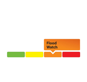
- Flood Watch – Flooding is possible in specific watercourses or municipalities. Municipalities, emergency services and individuals in flood-prone areas should prepare.
- Flood Warning – Flooding is imminent or already occurring in area watercourses.
Forecast Rain Expected to Increase Water Levels in Bobs Lake, Christie Lake, Tay River and Wolfe Lake
April 11, 2019 – The current weather forecast is calling for up to 30 mm of rain between Friday and Monday, and then more rain later next week. This anticipated rain, plus meltwater from the remaining snow pack, will increase the water levels in Bob’s Lake, Christie Lake, Tay River and Wolfe Lake. The water levels in the three lakes and the Tay River are currently above average and increasing because of snowmelt runoff. Waterfront property owners in these areas should be prepared for possible flooding in the upcoming days. Parks Canada staff are closely monitoring the water levels in Bobs Lake and Chrisite Lake, and operations at the Bolingbroke Dam will take place as required, to balance the levels in Bobs Lake and Christie Lake.
Water levels and flows in all other areas of the Rideau Valley Watershed are also expected to increase with the forecast rain, however, no significant flooding in expected.
City of Ottawa crews have now completed their annual ice removal program on the Rideau River between Rideau Falls and Bronson Avenue. However, City crews are continuing to monitor for possible ice jams due to shoreline ice that may break loose (for more information: City of Ottawa information at 311).
Extreme caution should be exercised by everyone when near local waterbodies. Parents should inform their children of the risks and provide appropriate supervision.
Residents in flood prone or low-lying areas, historically susceptible to flooding, should continue to take the necessary precautions to protect their property, such as:
- Ensuring sump pump is clear, in good working condition and has a backwater valve
- Ensuring easy access to a portable backup generator and pump
- Ensuring downspouts are clear and the outlet is at least 3 metres from the dwelling
- Securing items that might float away as flows increase
- Removing valuable items from basements or lower floors that could be subject to flooding
- Keeping emergency phone numbers handy
- Familiarizing yourself with your municipality’s Emergency Preparedness Plan
This watershed conditions statement is in effect until Thursday April 18, 2019 and will be updated at that time unless the forecast or conditions change.
-end-
"Rideau Valley Conservation Authority is a partnership of municipalities within the Rideau Valley watershed created under the Conservation Authorities Act to deliver a range of programs in watershed management and natural resource conservation."
RVCA Watershed Conditions Statements:
- Water Safety – High flows, unstable banks, melting ice or other factors that could be dangerous for recreational users such as anglers, canoeists, hikers, children, pets, etc. Flooding is not expected.
- Flood Outlook – Early notice of the potential for flooding based on weather forecasts, calling for heavy rain, snow melt, high winds or other conditions that could lead to high runoff, cause ice jams and/or lakeshore flooding or erosion.
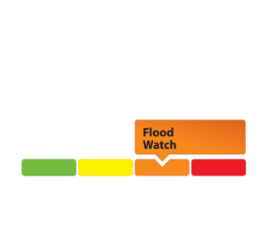
- Flood Watch – Flooding is possible in specific watercourses or municipalities. Municipalities, emergency services and individuals in flood-prone areas should prepare.
- Flood Warning – Flooding is imminent or already occurring in area watercourses.
Volunteer makes a splash with conservation authority
April 11, 2019 - As volunteers go, Larry Hum’s a real humdinger.
The retired telecoms engineer has been volunteering with the Rideau Valley Conservation Authority (RVCA) since 2015, helping staff remove invasive plants, survey streams and sample for aquatic animals.
“It’s something I always wanted to do, working in the field,” said Mr. Hum, who lives in Bells Corners. He didn’t excel in biology as a student, so he pursued engineering instead. But he still wanted to explore his childhood interest. “It’s an opportunity for me to work in bioscience without going into the heavy, heavy science.”
Since joining the volunteer crew Mr. Hum has helped with a number of City Stream Watch aquatic surveys, headwater sampling, lake and stream monitoring and benthic monitoring (assessing insect populations to indicate water pollution levels).
He’s also helped with tree planting projects, garbage clean-ups and invasive species removal.
Ripping out invasive plants is an especially satisfying job, he said.
“Sometimes the task seems insurmountable, but as we take it one season after season the results are encouraging,” Mr. Hum said. “And it always feels good when you yank out those undesirables.”
City Stream Watch co-ordinator Rosario Castanon Escobar said Mr. Hum has been an invaluable part of their team.
“He’s an enthusiastic volunteer,” said Ms. Castanon Escobar. “We love working with him.”
Growing up in urban Montreal, Mr. Hum’s family didn’t have the resources to go explore the countryside.
But he’s more than made up for that as an adult. On top of his RVCA work, he’s given considerable time to EarthWatch, an international environmental charity. With them he has spent time on the ground helping researchers study elephants in Africa and black bears in Minnesota. He also helped researchers study the effects of climate change in Trinidad.
In the spirit of National Volunteer Week (April 7 to 13), Mr. Hum encouraged watershed residents to get involved with their local conservation authority – even just one time.
“Give it a whirl. If you don’t like it, you can always stop,” he said. “I find it quite enjoyable and rewarding.”
There are many ways to volunteer with the RVCA this spring, starting with two community clean-ups on April 27 and May 4. Tree planters are also wanted for a shoreline naturalization project at Black Rapids on May 11.
To sign up to be a City Stream Watch volunteer, join the mailing list at https://www.rvca.ca/about-us/join-our-mailing-lists#city-stream-watch-mailing-list.
A volunteer orientation will take place May 25. RSVPs are required for all events.
Keep an eye on our volunteer calendar for other opportunities throughout the year, as well: https://www.rvca.ca/calendar-of-events/monthcalendar/2019/4/82
Upcoming RVCA volunteer events:
Glad Clean up the Capital Event – Pinecrest Creek
When: Sat. April 27, 9 a.m. to 12 p.m. (RSVP required)
Where: Connaught Park – baseball diamond (Located at Connaught Avenue)
In partnership with the Queensway Terrace Community Association, City Stream Watch will be conducting a clean-up in Pinecrest Creek within the Connaught Park area along the National Capital Commission’s Pinecrest Creek Pathway. Participants will pick up litter from the stream and shorelines surrounding Pinecrest Creek. We will meet in the baseball diamond for 9:00AM.
What to wear: Dress for the weather! Wear waterproof boots, long socks (if wearing chest waders), long pants and a hat
What to bring: Bring a water bottle
What we will provide: We will have drinking water to replenish empty bottles, some snacks, chest waders, garbage bags and gloves.
Glad Clean up the Capital Event – Sawmill Creek
When: Sat. May 4, 9 a.m. to 12 p.m. (RSVP required)
Where: Towngate Shopping Plaza (Located at Bank St. and Hunt Club Rd. intersection)
In collaboration with the Canadian Forces Ottawa Fish and Game Club, City Stream Watch will be conducting a clean-up in Sawmill Creek along the Towngate Shopping Plaza region. Participants will pick up litter in the stream and shorelines surrounding Sawmill Creek. There are several areas in the region that tend to accumulate garbage, and we will divide the group out across these locations. We will meet up in the south (back end) of the Towngate parking lot for 9 a.m.
What to wear: Dress for the weather! Wear waterproof boots, long pants and a hat
What to bring: Bring your own water bottle
What we will provide: We will have drinking water to replenish empty bottles, some snacks, chest waders, garbage bags and gloves.
Shoreline Naturalization Project – Black Rapids Creek
When: Sat. May 11, 9 a.m. to 12 p.m. (RSVP required)
Where: Black Rapids Creek Site (near the Woodroffe Ave. and Fallowfield Rd. intersection, north of the train tracks)
The RVCA Shoreline Naturalization Program will be planting trees and shrubs along the shoreline of Black Rapids Creek. Participants will help plant trees and shrubs; a planting demonstration will be given beforehand. The site has difficult terrain to work in and is not suitable for young children. We will be meeting at 9 a.m. on site.
Meeting location: Park at the nearby Park and Ride and walk across Woodroffe Ave to the NCC Greenbelt Pathway. Follow it north until you cross the railway tracks. RVCA staff and vehicles will be along the path.
What to wear: Dress for the weather! Wear sturdy shoes (steel toe boots recommended but not required), long pants and a hat
What to bring: Bring your own water bottle
What we will provide: We will have drinking water to replenish empty bottles, some snacks, shovels and gloves.
Spring Orientation/Training Session – Sawmill Creek (Riverside Dr)
When: Sat. May 25, 10 a.m. to 12 p.m. (RSVP required)
Where: Rideau River Eastern Pathway – Parkland beside Sawmill Creek/Riverside Dr
Our annual City Stream Watch Spring Orientation and Training Session for new volunteers will take place along the shoreline of Sawmill Creek along Riverside Dr./Rideau River Eastern Pathway. If you have joined us for stream surveys in the past or have come out to a training session before, there is no need to attend the training session again. Also, if you are can’t attend but still want to help survey, we always provide on-the-job training.
Meeting location: We will be meeting on the Rideau River Eastern Pathway along the shoreline of Sawmill Creek. Park at Billings Bridge Shopping Centre, walk north on Bank Street to the Rideau River, turn right onto the Rideau River Eastern Pathway and walk towards Sawmill Creek. RVCA staff will be at that location.
What to wear: Dress for the weather! Wear sturdy shoes, socks, long pants and a hat
What to bring: Bring your own water bottle
What we will provide: We will have drinking water to replenish empty bottles, some snacks, chest waders, and equipment for the purpose of demonstrations.
- end -
April 9, 2019 - Close your eyes. Can you picture six million trees? We can – because that’s how many we’ve planted since 1984.
The Rideau Valley Conservation Authority (RVCA) has released its 2018 annual report, and among our many accomplishments from the past year, the planting of our six millionth tree stands tall.
“Every year we partner with landowners to reforest abandoned farm fields and other unused land,” said Scott Danford, manager of the reforestation program at RVCA. “Putting this land to work promotes wildlife and biodiversity, protects soil from erosion and improves water quality, while improving the look and value of these private properties.”
And that’s just one program of many at the Rideau Valley Conservation Authority, which monitors watershed health across a vast swath of land from Central Frontenac to Merrickville-Wolford and all the way to downtown Ottawa.
Under the Conservation Authorities Act, the RVCA is responsible for furthering the “conservation, restoration, development and management of natural resources in the watershed.” Its mission is to understand, manage, protect, restore and enhance the 4,000 km2 Rideau watershed through science, stewardship, education, policy and leadership.
“We need natural features like forests, wetlands, shoreline buffers and floodplains if we want clean water and robust tourism, recreation and agriculture sectors,” said Sommer Casgrain-Robertson, RVCA General Manager. “We also need these features to help protect people and property from flooding and erosion as natural features absorb and slow the movement of water in addition to filtering out contaminants.”
Other highlights from 2018 include:
- 200,000 visitors to RVCA’s 11 conservation areas, which offer 42 kilometres of public trails
- 10,000 student visitors to the authority’s outdoor education programs at Baxter and Foley Mountain conservation areas, and the launch of a new Forest School kindergarten program at Foley Mountain
- 70 km of streams and tributaries surveyed and 39 lakes, 13 wells and 163 stream sites sampled
- 159 clean water projects funded with nearly $400,000 in grants
- Heart’s Desire Weir in the Jock River replaced with a river-friendly rocky ramp
- 11,433 native trees and shrubs planted, naturalizing 79 shorelines
- Demonstration rain garden installed at Baxter Conservation Area to reduce stormwater runoff
- 18 flood messages and 10 low water response messages issued
- 52 nest boxes monitored for ducks, a 1,600 m2 fish habitat created at the Perth Wildlife Reserve, and six new habitat features for species at risk completed across the watershed
- Tay River subwatershed report released
- 88 km of new hazard mapping completed to guide development applications
- 1,366 Planning Act applications reviewed (site plan control, minor variances, severances, subdivision reviews and other development needs)
- 1,107 septic system applications and inspections processed
- 1,636 inquiries, applications, complaints and violations processed under the Conservation Authorities Act.
In other words, we were busy!
“Investing in local watershed health today ensures a sustainable future for our local communities and economies,” said Ms. Casgrain-Robertson. “Thank you to our staff, municipalities, partners and volunteers who helped us achieve our 2018 goals, and we look forward to a successful 2019.”
For your copy of the RVCA 2018 Annual Report, visit www.rvca.ca or call 613-692-3571 or 1-800-267-3504 for a hard copy.
— end —


