Super User
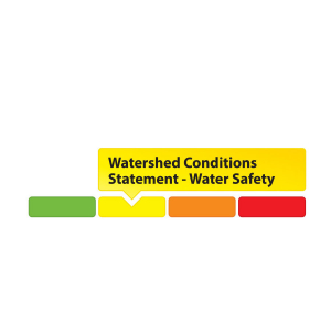
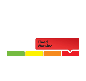
May 28, 2019 – The Rideau Valley Conservation Authority (RVCA) is terminating the Flood Watch that was previously in effect and issuing a High Water Safety message for properties around Bobs Lake and Christie Lake.
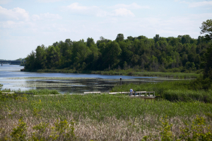
The water levels on Bobs and Christie Lakes continue to decline slowly but both lakes are still above average for this time of year. This water levels are expected to gradually drop down to seasonal levels with no significant rainfall and somewhat seasonal temperatures in the forecast for the next week. Parks Canada staff are closely monitoring the water levels in these lakes. Operations at the Bolingbroke Dam will take place as required to balance the levels in Bobs Lake and Christie Lake.
Water levels continue to be at seasonal values in the rest of the Rideau Valley Watershed.
Everyone needs to be cautious around lakes and streams with the fluctuating water levels. Children need to be educated about the hazards and kept away from all watercourses.
This watershed conditions statement is in effect until Tuesday June 4, 2019 at 5 PM and will be updated at that time unless the forecast or conditions change.
-end-
"Rideau Valley Conservation Authority is a partnership of municipalities within the Rideau Valley watershed created under the Conservation Authorities Act to deliver a range of programs in watershed management and natural resource conservation."
RVCA Watershed Conditions Statements:
- Water Safety – High flows, unstable banks, melting ice or other factors that could be dangerous for recreational users such as anglers, canoeists, hikers, children, pets, etc. Flooding is not expected.
- Flood Outlook – Early notice of the potential for flooding based on weather forecasts, calling for heavy rain, snow melt, high winds or other conditions that could lead to high runoff, cause ice jams and/or lakeshore flooding or erosion.
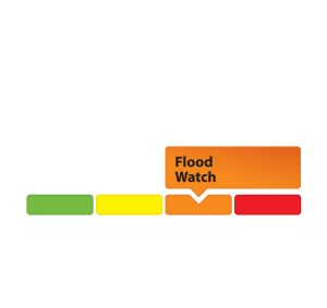
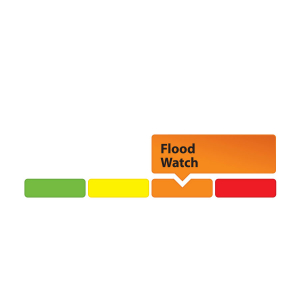
- Flood Watch – Flooding is possible in specific watercourses or municipalities. Municipalities, emergency services and individuals in flood-prone areas should prepare.
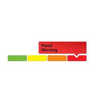
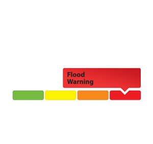
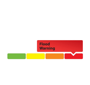
- Flood Warning – Flooding is imminent or already occurring in area watercourses.
May 23, 2019 – Looking for ways to green your backyard? Need inspiration from your most dedicated neighbours? Want the scoop on river-friendly development trends? The Rideau Valley Conservation Authority invites you to subscribe to its new blog, The River Reed.
From green waterfront living to cute critters to special features, we’ve got life in the Rideau Valley watershed covered!
The blog will focus on the people, projects and policies making our watershed a healthy, liveable place for all – people and wildlife included.
Subscribers will get tips for green waterfront living, learn about landowners making a difference, and access information about the best designs and approaches to make your development a welcoming and watershed-friendly place to thrive.
Our latest post, “Waterfront Living: Which Side Are You On?” features an interactive graphic showcasing the easy changes that can be made to make your waterfront property a haven for people and animals.
Other recent posts cover the recent floods, high school tree planters and how you can help pollinators thrive this season.
Follow along at www.rvca.ca/blog as we take you into the depths of watershed life! Click on the envelope to subscribe.
-end-
MAY 22, 2019 - Rideau Valley Conservation Authority (RVCA), in conjunction with the Mississippi Valley Conservation Authority (MVCA) and South Nation Conservation (SNC) is maintaining the FLOOD WARNING issued on April 19, 2019 for the areas under our jurisdiction along the Ottawa River.
The most recent analysis from the Ottawa River Regulation Committee (ORRC) indicate that water levels along the lower Ottawa River from Chats Lake to the Grenville/ Hawkesbury area will continue to decline over the coming weeks, albeit slowly.
All flood-prone areas along the Ottawa River from Lac Coulonge down to the Montreal Archipelago are at risk as spring runoff continues along the upper Ottawa River. Levels are expected to remain high for the next few weeks. Risk is highly dependent on the amount of precipitation that is received. Residents are strongly urged to keep sandbags in place for now. Updates to all projections will be provided as they become available.
Residents in flood-prone areas are encouraged to closely follow evolving conditions and to take necessary measures. Residents are advised to stay away from watercourses where flows are high and where banks might be unstable. Parents are encouraged to explain dangers to children.
This FLOOD WARNING is in effect until Tuesday, May 28, 2019 at 5:00 PM.
RVCA and its Ottawa partners, MVCA and SNC monitor the water levels and weather forecasts with the Ministry of Natural Resources and Forestry as part of the Flood Forecasting and Warning Program. Updates are provided as conditions change.
The Ottawa River Regulation Planning Board will be reassessing forecast conditions and providing hydrological condition updates on its website daily at www.ottawariver.ca/forecast.php.
To view current flood warnings across Ontario, visit https://www.ontario.ca/law-and-safety/flood-forecasting-and-warning-program”
-end-
"Rideau Valley Conservation Authority is a partnership of municipalities within the Rideau Valley watershed created under the Conservation Authorities Act to deliver a range of programs in watershed management and natural resource conservation."
RVCA Watershed Conditions Statements:
- Water Safety – High flows, unstable banks, melting ice or other factors that could be dangerous for recreational users such as anglers, canoeists, hikers, children, pets, etc. Flooding is not expected.
- Flood Outlook – Early notice of the potential for flooding based on weather forecasts, calling for heavy rain, snow melt, high winds or other conditions that could lead to high runoff, cause ice jams and/or lakeshore flooding or erosion.
- Flood Watch – Flooding is possible in specific watercourses or municipalities. Municipalities, emergency services and individuals in flood-prone areas should prepare.
- Flood Warning – Flooding is imminent or already occurring in area watercourses.
May 21, 2019 – A FLOOD WATCH is being maintained for properties around Bobs Lake and Christie Lake.
The water levels on Bobs and Christie Lakes continues to decline slowly, but the recent wet/cool weather has kept both lakes above average for this time of year. The current forecast indicates 10 mm of rain could fall this coming the weekend. This rainfall will likely slow down the rate of water level decline on Bobs Lake and Christie Lake. Parks Canada staff are closely monitoring the water levels in these lakes. Operations at the Bolingbroke Dam will take place as required to balance the levels in Bobs Lake and Christie Lake.
Water levels are now near seasonal in the rest of the Rideau Valley Watershed.
Everyone needs to be cautious around lakes and streams with the fluctuating water levels. Children need to be educated about the hazards and kept away from all watercourses.
This watershed conditions statement is in effect until Tuesday May 28, 2019 at 5 PM and will be updated at that time unless the forecast or conditions change.
-end-
"Rideau Valley Conservation Authority is a partnership of municipalities within the Rideau Valley watershed created under the Conservation Authorities Act to deliver a range of programs in watershed management and natural resource conservation."
RVCA Watershed Conditions Statements:
- Water Safety – High flows, unstable banks, melting ice or other factors that could be dangerous for recreational users such as anglers, canoeists, hikers, children, pets, etc. Flooding is not expected.
- Flood Outlook – Early notice of the potential for flooding based on weather forecasts, calling for heavy rain, snow melt, high winds or other conditions that could lead to high runoff, cause ice jams and/or lakeshore flooding or erosion.
- Flood Watch – Flooding is possible in specific watercourses or municipalities. Municipalities, emergency services and individuals in flood-prone areas should prepare.
- Flood Warning – Flooding is imminent or already occurring in area watercourses.
May 17, 2019 — Rideau Valley Conservation Authority (RVCA), in conjunction with the Mississippi Valley Conservation Authority (MVCA) and South Nation Conservation (SNC) is maintaining the FLOOD WARNING issued on April 19, 2019 for the areas under our jurisdiction along the Ottawa River.
The most recent analysis from the Ottawa River Regulation Committee (ORRC) indicate that water levels along the lower Ottawa River from Chats Lake to the Grenville/ Hawkesbury area are slowly declining but remain high.
All flood-prone areas along the Ottawa River from Lac Coulonge down to the Montreal Archipelago are at risk as spring runoff continues along the upper Ottawa River. Levels are expected to remain high for the next few weeks. Risk is highly dependent on the amount of precipitation that is received. Residents are strongly urged to keep sandbags in place for now. Updates to all projections will be provided as they become available.
Residents in flood-prone areas are encouraged to closely follow evolving conditions and to take necessary measures. Residents are advised to stay away from watercourses where flows are high and where banks might be unstable. Parents are encouraged to explain dangers to children.
This FLOOD WARNING is in effect until Wednesday, May 22, 2019 at 5:00 PM.
RVCA and its Ottawa partners, MVCA and SNC monitor the water levels and weather forecasts with the Ministry of Natural Resources and Forestry as part of the Flood Forecasting and Warning Program. Updates are provided as conditions change.
The Ottawa River Regulation Planning Board will be reassessing forecast conditions and providing hydrological condition updates on its website daily at www.ottawariver.ca/forecast.php.
To view current flood warnings across Ontario, visit https://www.ontario.ca/law-and-safety/flood-forecasting-and-warning-program.”
- end -
"Rideau Valley Conservation Authority is a partnership of municipalities within the Rideau Valley watershed created under the Conservation Authorities Act to deliver a range of programs in watershed management and natural resource conservation."
RVCA Watershed Conditions Statements:
- Water Safety – High flows, unstable banks, melting ice or other factors that could be dangerous for recreational users such as anglers, canoeists, hikers, children, pets, etc. Flooding is not expected.
- Flood Outlook – Early notice of the potential for flooding based on weather forecasts, calling for heavy rain, snow melt, high winds or other conditions that could lead to high runoff, cause ice jams and/or lakeshore flooding or erosion.
- Flood Watch – Flooding is possible in specific watercourses or municipalities. Municipalities, emergency services and individuals in flood-prone areas should prepare.
- Flood Warning – Flooding is imminent or already occurring in area watercourses.
We can still plant trees – we just need your help
May 16, 2019 – The cancellation of the provincial 50 Million Trees program has generated a lot of conversation – and with good reason. As Ontario residents mop up from record flooding, and as climate change promises more intense weather to come, we need to be adding tree programs, not chopping them.
Trees are a vital part of a healthy environment: they clean our air, they create habitat, they capture carbon and they reduce runoff and erosion. They also help us fight floods like the one Ottawa saw this spring.
At the Rideau Valley Conservation Authority (RVCA), we’ve relied on the 50 Million Trees Program since 2007 to help us plant +200,000 seedlings every spring. Without it, we may find ourselves planting 20,000 trees instead of 200,000 – unless our generous community, corporate and individual supporters can help.
Under the program, landowners currently pay as low as $0.15 per tree, or $120 per acre, to reforest their retired farm fields and marginal lands. But without the provincial funding, tree planting will becoming unaffordable for many landowners and that will drastically reduce the number of trees being planted in the Rideau Valley watershed.
It will also mean local job losses. Our seedlings are grown at Ferguson Forestry Centre in Kemptville, which will face layoffs and financial losses because of the program cuts.
But all is not lost. We know there is an appetite in this community to work together to fight floods, combat climate change and make our community liveable now and in the future.
Donations, corporate sponsorships and community partnerships can save this cost-effective and successful tree planting program and continue growing a living legacy right here in our backyards.
And if we can do that, everybody wins.
To support the program, visit canadahelps.org or contact Diane Downey, executive director of the Rideau Valley Conservation Foundation, a registered charity which supports the RVCA’s conservation and watershed management goals. She can be reached at or 613-692-3571 ext. 1126.
-end-
