Super User
Low Water Status Continued in Rideau River Watershed
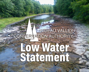
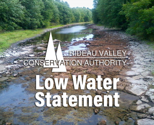
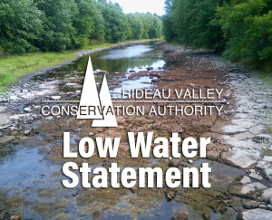
August 30, 2018 – This statement is to advise that the low water status in the Rideau River watershed remains at “Minor” Severity except for the Kemptville Creek sub-watershed which continues to be “Moderate” Severity.
Flow in Kemptville Creek has continued to be very low. The amount of rain measured in the Kemptville Creek sub-watershed for the same time period is well below the historical average at both Kemptville and at the Brockville Airport near the Creek headwaters The impact of the low flow is that aquatic creatures living in the Creek are confined to smaller and smaller pools that are getting warmer and becoming short of oxygen.
The average rainfall on the whole Rideau watershed for the last thirty days is below the threshold of 80% of normal for “Minor” Severity. Rainfall was relatively heavy in some areas of the lower reaches of the system on the 29th;18 millimetres at Ottawa Airport compared to 0.2 mm at Westport. Some rain is forecast to fall through next week but, if it follows the pattern to date, little impact will be seen. Lawns will be green but trees are suffering from the lack of persistent light rain over several days that gets water to the deeper roots.
The Rideau Canal reservoir lake levels are as little as a day (Wolfe Lake) to three weeks earlier than levels normally reached at this time of year and a week to three weeks below the target levels. However, there is sufficient depth that Parks Canada is able to state “Normal Draft. Normal Navigation” for the Rideau system on their infonet.
Water conservation is recommended for all residents of the Rideau River watershed. Municipalities may have invoked water restrictions and burn bans. Check your municipal website for applicable bylaws. Those who have permits for taking water from surface or groundwater sources are encouraged to reduce their actual taking as much as possible.
Conservation Authority staff continue to monitor conditions and communicate with water managers throughout the watershed. Updates to this message will be issued as conditions warrant.
Other relevant information sources are:
- Ministry of Environment and Climate Change: https://www.ontario.ca/page/managing-your-water-well-times-water-shortage
- Ontario’s Low Water Response program: https://www.ontario.ca/page/low-water-response-program.
- Parks Canada Infonet: https://www.pc.gc.ca/en/lhn-nhs/on/rideau/info/infonet/tirant-deau-draft
- RVCA website: www.rvca.ca
- Hourly and daily streamflows and water levels: https://www.rvca.ca/watershed-monitoring-reporting/reporting/streamflow-water-levels
Rideau Valley Conservation Authority is a partnership of municipalities within the Rideau Valley watershed created under the Conservation Authorities Act to deliver a range of programs in watershed management and natural resource conservation.
Communication Materials
RVCA logo and other communication materials for download
| Description | File Name |
|---|---|
| RVCA Logo High-Resolution JPG files | |
| English RVCA Colour Logo | |
| English RVCA Black and White Logo | |
| French RVCA Colour Logo | |
| French RVCA Black and White Logo | |
| Bilingual RVCA Colour Logo | |
| Bilingual RVCA Black and White Logo | |
| RVCA Logo Low-Resolution JPG files | |
| Colour Low-resolution file — large jpg file, XX kb | |
| Colour Low-resolution file — medium jpg file, XX kb | |
| Colour Low-resolution file — small jpg file, XX kb | |
| RVCA Logo Encapsulated Postscript Files (eps) | |
| colour file | |
| black and white file | |
| inverse file | |
| RVCA Logo Adobe Acrobat-Portable Document Files (pdf) | |
| colour file | |
| black and white file | |
| Powerpoint Template | |
| powerpoint slideshow 1 | RVCA-slideshow-1.ppt |
| powerpoint slideshow 2 | RVCA-slideshow-2.ppt |
| RVCA Letterhead Template | |
| RVCA letterhead Word file | RVCA-letterhead.docx |
Ash Tree Replacement Pilot Program
If you are a resident of the City of Ottawa with Ash trees that have been affected by the Emerald Ash Borer (EAB), you may be eligible for funding for the removal and replacement of your trees.
As part of a partnership with the City of Ottawa, South Nation Conservation is offering a new Ash Tree Replacement Pilot Program to assist landowners within the City of Ottawa affected by the EAB on private property. Landowners may be eligible to receive up to $500 in cost-share funding towards the removal and replacement of an infected Ash tree on their property, up to a maximum of $5,000 per landowner. Funding is limited to a first-come, first-serve basis and is available to all property owners within the entire City of Ottawa.
All work related to tree removal and replacement must be performed by a registered forestry professional.
Visit nation.on.ca/eab to learn more about the program and to access an application form.
Program Contact:
Karen Paquette
South Nation Conservation
1-877-984-2948 ext. 286
Hard Working Natural Waterfront Donated to RVCF
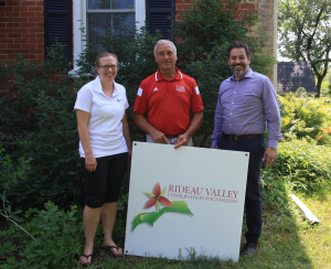
North Grenville, September 7, 2018 — “It just seemed like the logical choice,” said Wally Kaczkowski as he pondered his decision to donate land to the Rideau Valley Conservation Foundation (RVCF). “The donation benefited me and the community in many different ways.”
In early 2017, Mr. Kaczkowski started to reflect on his ownership of a 1.55 acre parcel nestled along the shore of the Rideau River just north of Kemptville. Too small to develop and with dwindling interest in the property from his sons, it just didn’t seem to make sense to keep it anymore.
“It is a nice chunk of shoreline and wetland,” said Mr. Kaczkowski, while admitting that where it may not have been the best development purchase, it still has a value to the community. The retired teacher and MacSkimming Outdoor educator appreciates that the property has significant natural features and turned to the Rideau Valley Conservation Foundation to see if they were interested in protecting the green space.
The RVCF has an active procurement plan and an established track record in receiving land donations. More and more families and individuals are considering giving their land to the Conservation Foundation. Some donors want to keep it undeveloped and in a natural state forever — others welcome the tax benefits of their donations. Regardless of the motivation, the RVCF reviews the environmental benefits of the property prior to acceptance. The RVCF is particularly interested in land that is ecologically sensitive or has unique water-related features (wetlands, shorelines and aquifer recharge areas). The Kaczkowski property fit the Foundation’s review process.
“Normally we don’t accept such small properties,” said Kristy Giles, Conservation Lands Planner. “But this property will support the growing neighbourhood of public properties in the nearby vicinity — making the area a much more productive and well-functioning natural zone along this stretch of the Rideau River.”
Natural shorelines and wetland areas are valuable areas. They help maintain clean water, they prevent soil erosion, reduce the impacts of flooding and provide wildlife with food and habitat. They are incredibly productive ecosystems — comparable to rainforests and coral reefs. The Kaczkowski property is the perfect blend of natural shoreline, wetland and trees that provides value habitat for many species including the endangered Henslow’s Sparrow and the rare Eastern Musk Turtle which have both been seen at the site.
“Staff were easy to approach and discuss options with. And what’s impressive is that all costs are covered, making it very appealing to donors like myself,” said Mr. Kaczkowski. The Conservation Foundation pays all of the costs associated with the transfer of title.
Although donated, gifted lands are not free. Each land donation could have a cost of up to $10,000 in terms of legal, surveying and appraisal fees plus the ongoing taxes, maintenance and fund in addition to the land itself. Some trust and conservation groups may only accept new lands if such fees are forthcoming.
“It cost me nothing — instead, the Foundation gave me a charitable tax receipt for the fair market value of my land and the satisfaction of providing a lasting gift to future generations of watershed residents,” said Mr. Kaczkowski.
“The RVCF has a fund to help offset the cost of accepting these lands on behalf of the public,” says Michael Poliwoda, Executive Director of the Rideau Valley Conservation Foundation. “These hidden costs of a donation are in large measure funded by the RVCF’s Environmental Land Fund made possible by annual support from Mattamy Homes. Obviously, it would be a shame to lose the opportunity to protect an important piece of the Rideau Valley — after all, no more wilderness is being made.”
The local community can help RVCF continue to accept important land donations by donating to the Steve Simmering Endowment Fund. This fund supports the perpetual costs of maintenance and ownership.
Mr. Kaczkowski’s waterfront is now one of 51 unique parcels owned by the Conservation Foundation and managed by the Conservation Authority. The sites, including the Boucher Property, Curtis Property and DePencier Property, are to be kept in a natural state in perpetuity and are located across the entire Rideau watershed.
RVCF is a member of the Canadian Land Trust Alliance and adhere to the Standards and Practices set out in the Land Trust documents. Guiding principles in our land donation program include integrity, perpetual responsibility, and excellence in public service and good governance.
Special thanks to Wally Kaczkowski for his community-minded gift. If you are interested in learning more about land donations here in Eastern Ontario’s Rideau watershed, contact Michael Poliwoda or visit the RVCF website at www.rvcf.ca.
Low Water Status Update in Rideau River Watershed (Sept. 14)
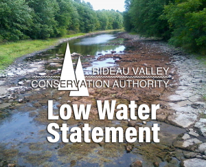
September 14, 2018 – This statement is to advise that the low water status in the Rideau River watershed is still at “Minor” Severity except for the Kemptville Creek sub-watershed which continues to be “Moderate” Severity.
The overall watershed 30 day rainfall is at 72% of normal for the time of year. The 30 day rain measured at Kemptville College is at 42%. Rainfall is slightly higher in the headwater areas of Kemptville Creek but most appears to have infiltrated into the ground, rather than into the Creek, with flows just 1.3% of normal. Aquatic species will be increasingly stressed as available pools shrink, temperatures rise and oxygen concentrations decline.
An obvious indicator of drought stress are trees with leaves changing colour earlier than usual.
The Rideau Canal reservoir lake levels are as little as 2 centimetres (Wolfe Lake) to 19 cm (Upper Rideau) below levels normally reached at this time of year. Navigation in the north flowing sector is not presently at risk. Further information is available on the Parks Canada Infonet (address below).
Water conservation is recommended for all residents of the Rideau River watershed. Burn bans may still be in effect in some municipalities. Check your municipal website for applicable bylaws. Those who have permits for taking water from surface or groundwater sources are encouraged to reduce their actual taking as much as possible.
Conservation Authority staff continue to monitor conditions and communicate with water managers throughout the watershed. Updates to this message will be issued as conditions warrant.
Other relevant information sources are:
Ministry of Environment and Climate Change: https://www.ontario.ca/page/managing-your-water-well-times-water-shortage
Ontario’s Low Water Response program: https://www.ontario.ca/page/low-water-response-program.
Parks Canada Infonet: https://www.pc.gc.ca/en/lhn-nhs/on/rideau/info/infonet/tirant-deau-draft
RVCA website: www.rvca.ca
Hourly and daily streamflows and water levels: https://www.rvca.ca/watershed-monitoring-reporting/reporting/streamflow-water-levels .
Low Water Status Continued in Rideau River Watershed
August 30, 2018 – This statement is to advise that the low water status in the Rideau River watershed remains at “Minor” Severity except for the Kemptville Creek sub-watershed which continues to be “Moderate” Severity.
Flow in Kemptville Creek has continued to be very low. The amount of rain measured in the Kemptville Creek sub-watershed for the same time period is well below the historical average at both Kemptville and at the Brockville Airport near the Creek headwaters The impact of the low flow is that aquatic creatures living in the Creek are confined to smaller and smaller pools that are getting warmer and becoming short of oxygen.
The average rainfall on the whole Rideau watershed for the last thirty days is below the threshold of 80% of normal for “Minor” Severity. Rainfall was relatively heavy in some areas of the lower reaches of the system on the 29th;18 millimetres at Ottawa Airport compared to 0.2 mm at Westport. Some rain is forecast to fall through next week but, if it follows the pattern to date, little impact will be seen. Lawns will be green but trees are suffering from the lack of persistent light rain over several days that gets water to the deeper roots.
The Rideau Canal reservoir lake levels are as little as a day (Wolfe Lake) to three weeks earlier than levels normally reached at this time of year and a week to three weeks below the target levels. However, there is sufficient depth that Parks Canada is able to state “Normal Draft. Normal Navigation” for the Rideau system on their infonet.
Water conservation is recommended for all residents of the Rideau River watershed. Municipalities may have invoked water restrictions and burn bans. Check your municipal website for applicable bylaws. Those who have permits for taking water from surface or groundwater sources are encouraged to reduce their actual taking as much as possible.
Conservation Authority staff continue to monitor conditions and communicate with water managers throughout the watershed. Updates to this message will be issued as conditions warrant.
Other relevant information sources are:
- Ministry of Environment and Climate Change: https://www.ontario.ca/page/managing-your-water-well-times-water-shortage
- Ontario’s Low Water Response program: https://www.ontario.ca/page/low-water-response-program.
- Parks Canada Infonet: https://www.pc.gc.ca/en/lhn-nhs/on/rideau/info/infonet/tirant-deau-draft
- RVCA website: www.rvca.ca
- Hourly and daily streamflows and water levels: https://www.rvca.ca/watershed-monitoring-reporting/reporting/streamflow-water-levels
Rideau Valley Conservation Authority is a partnership of municipalities within the Rideau Valley watershed created under the Conservation Authorities Act to deliver a range of programs in watershed management and natural resource conservation.
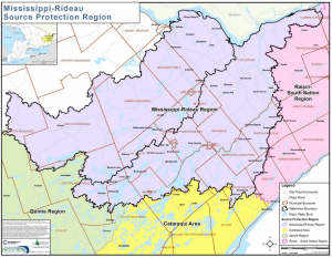
AUGUST 20, 2018, RIDEAU VALLEY AND MISSISSIPPI VALLEY WATERSHEDS – The Mississippi-Rideau Source Protection Committee wants your input on their Draft Amendment for the Rideau Valley Source Protection Area Assessment Report and Source Protection Plan (prepared under Ontario’s Clean Water Act).
The Draft Amendment for the Assessment Report identifies:
- A new wellhead protection area for the new municipal well system for the Western Development Lands in Richmond
- Revised wellhead protection areas for the existing municipal well systems in King’s Park Richmond and Munster
- Potential drinking water threats in the new and existing wellhead protection areas
The Draft Amendment for the Source Protection Plan does not include any policy changes but rather simple updates to reflect the addition of new or revised wellhead protection areas in Munster and Richmond, including updated maps and schedules.
There are several ways to view the Draft Amendment:
Visit the Mississippi-Rideau Source Protection Region’s website:
Visit either of the Conservation Authority Offices:
- Mississippi Valley Conservation Authority, 10970 Hwy. 7 Carleton Place from 8:00 a.m. to 4:00 p.m. weekdays
- Rideau Valley Conservation Authority, 3889 Rideau Valley Drive, Manotick from 8:30 a.m. to 4:30 p.m. weekdays
Contact Tessa Di Iorio at the City of Ottawa at 613-582-2424 ext. 17658 to schedule a viewing appointment at:
- North Gower Client Service Centre, 2155 Rogers Stevens Drive, North Gower
- Laurier Client Service Centre, 110 Laurier Avenue West, Ottawa
For more information or to provide comments, please contact: Brian Stratton, Project Manager
Mississippi-Rideau Source Protection Region
3889 Rideau Valley Drive, PO Box 599, Manotick, ON K4M 1A5
613-692-3571 or 1-800-267-3504 ext. 1141
All comments must be received no later than Friday, September 28, 2018.
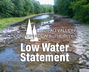
August 20, 2018 – This statement is to advise that the low water status in the Rideau River watershed generally remains at “Minor” Severity except for the Kemptville Creek sub-watershed which has risen to “Moderate” Severity.
Rainfall in eastern Ontario has been widely varied since late July. What rain that has fallen in the Kemptville Creek sub-watershed has had little effect on flows with much of it infiltrating into the soil and retained in wetlands. The Creek is down to intermittent pools in some sections. Beaver have been active, building dams that contribute to the ponding. At the same time, they are creating pools upstream of their dams they are causing or expanding dry sections downstream. The ponding on Kemptville Creek and other streams has left fish and other aquatic populations to cope with confined spaces, warmer water and declining oxygen concentrations.
Conditions in the rest of the Rideau watershed are closer to “Minor” Severity which has been in place for the last two weeks. Much less rain than was forecast fell on Thursday and Friday last week. Water levels continue to decline and all monitoring stations are showing levels below average. Rain is forecast for tomorrow but, with weather systems as erratic as they have been, it remains to be seen how significant an impact there will be.
The Rideau Canal reservoir lakes all continue to have levels below normal. Sufficient draft is still available for boats on the system but caution is advised. Other lakes have also had falling water levels and aquatic plants and algae are thriving on some due to the warm temperatures and shallower depths.
Longer range forecasts indicate warmer and dryer conditions than normal through the rest of the summer and into the fall. If that forecast comes to pass, flows and levels can be expected to fall well below normal.
Water conservation should be practiced by everyone within the Rideau River watershed. Various actions all contribute to the conservation of our water resources. Municipalities may have invoked water restrictions and burn bans so check your municipal website for applicable bylaws. Those who have permits for taking water from surface or groundwater sources are encouraged to reduce their actual taking as much as possible.
Conservation Authority staff continue to monitor conditions and communicate with water managers throughout the watershed. Updates to this message will be issued as conditions warrant.
Other relevant information sources are:
Ministry of Environment and Climate Change: https://www.ontario.ca/page/managing-your-water-well-times-water-shortage
Ontario’s Low Water Response program: https://www.ontario.ca/page/low-water-response-program.
RVCA website: www.rvca.ca
Hourly and daily streamflows and water levels: https://www.rvca.ca/watershed-monitoring-reporting/reporting/streamflow-water-levels .
Watershed Discovery Day
TAY WATERSHED — Discover and explore the Tay Watershed at the Friends of the Tay Watershed's 18th Annual Watershed Discovery Day. The event takes place on Saturday, August 18 from 8 a.m. to 1 p.m. at the Perth Farmers' Market.
For full details click here.
