Super User
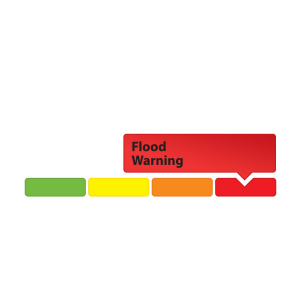
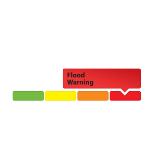
May 10, 2019 — Rideau Valley Conservation Authority (RVCA), in conjunction with the Mississippi Valley Conservation Authority (MVCA) and South Nation Conservation (SNC) is maintaining the FLOOD WARNING issued on April 19, 2019 for the areas under our jurisdiction along the Ottawa River.
The most recent analysis from the Ottawa River Regulation Committee (ORRC) indicate that water levels along the Ottawa River from Mattawa to Montreal are increasing due to recent precipitation and increased flow from the upper part of the watershed. Water levels are not expected to reach the levels observed last week over the forecasted period.
All flood-prone areas along the Ottawa River from Lac Coulonge down to the Montreal Archipelago are at risk as snowmelt continues along the upper Ottawa River. Levels are expected to remain high for the next two to three weeks. Risk is highly dependent on the amount of precipitation that is received. Residents are strongly urged to keep sandbags in place for now. Updates to all projections will be provided as they become available.
MVCA areas of concern:
Water levels in the Constance Bay area are expected to increase over the next 24 to 48 hours but are expected to be 5 to 10 cm lower than last week’s peak elevations.
RVCA areas of concern:
Water levels in the Britannia area (Grandview Road, Britannia Village, and the Belltown Community) are expected to increase over the next 24 to 48 hours but are expected to be 5 to 10 cm lower than last week’s peak elevations.
Water levels east of Cumberland Village (Boise Village, Morin Road, Leo Lane) are expected to increase over the next 24 to 48 hours but are not expected to exceed the peak levels observed last week.
SNC areas of concern:
Water level in Clarence-Rockland and Alfred-Plantagenet have risen 0.04m in the last 48 hours. Levels are expected to increase over the next 24 to 48 hours but are not expected to exceed the peak levels observed last week.
Residents in flood-prone areas are encouraged to closely follow evolving conditions and to take necessary measures. Residents are advised to stay away from watercourses where flows are high and where banks might be unstable. Parents are encouraged to explain dangers to children.
This FLOOD WARNING is in effect until Tuesday, May 14, 2019 at 5:00 PM.
RVCA and its Ottawa partners, MVCA and SNC monitor the water levels and weather forecasts with the Ministry of Natural Resources and Forestry as part of the Flood Forecasting and Warning Program. Updates are provided as conditions change.
The Ottawa River Regulation Planning Board will be reassessing forecast conditions and providing hydrological condition updates on its website daily at www.ottawariver.ca/forecast.php.
To view current flood warnings across Ontario, visit https://www.ontario.ca/law-and-safety/flood-forecasting-and-warning-program.”
- end -
"Rideau Valley Conservation Authority is a partnership of municipalities within the Rideau Valley watershed created under the Conservation Authorities Act to deliver a range of programs in watershed management and natural resource conservation."
RVCA Watershed Conditions Statements:
- Water Safety – High flows, unstable banks, melting ice or other factors that could be dangerous for recreational users such as anglers, canoeists, hikers, children, pets, etc. Flooding is not expected.
- Flood Outlook – Early notice of the potential for flooding based on weather forecasts, calling for heavy rain, snow melt, high winds or other conditions that could lead to high runoff, cause ice jams and/or lakeshore flooding or erosion.
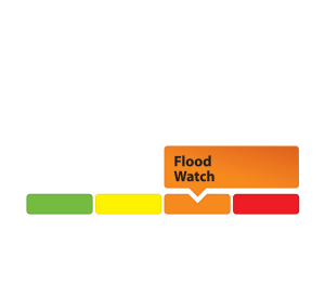
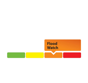
- Flood Watch – Flooding is possible in specific watercourses or municipalities. Municipalities, emergency services and individuals in flood-prone areas should prepare.
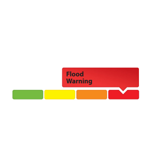
- Flood Warning – Flooding is imminent or already occurring in area watercourses.
May 7, 2019 — Rideau Valley Conservation Authority (RVCA), in conjunction with the Mississippi Valley Conservation Authority (MVCA) and South Nation Conservation (SNC) is maintaining the FLOOD WARNING issued on April 19, 2019 for the areas under our jurisdiction along the Ottawa River.
The current weather forecast indicates that significant rainfall amounts are possible from Thursday morning into Friday as a large low-pressure system moves into the area.
The most recent analysis from the Ottawa River Regulation Committee (ORRC) indicate that water levels along the Ottawa River from Chats Lake down to Lac Deschenes are stable and may increase as a result of the forecasted rainfall but should not exceed the initial peaks observed last week. From Pointe Gatineau down to the Grenville/Hawkesbury area water levels are still decreasing but may level off as a result of the forecasted rainfall.
All flood-prone areas along the Ottawa River from Lac Coulonge down to the Montreal Archipelago are at risk as snowmelt continues along the upper Ottawa River. Levels are expected to remain high for the next two to three weeks. Risk is highly dependent on the amount of precipitation that is received. Residents are strongly urged to keep sandbags in place for now. Updates to all projections will be provided as they become available.
MVCA areas of concern:
Water levels in the Constance Bay area are stable and are expected to remain that way over the next 48 hours. The forecasted rainfall on Thursday and Friday could cause levels to increase again.
RVCA areas of concern:
Water levels in the Britannia area (Grandview Road, Britannia Village, and the Belltown Community) are stable and are expected to remain that way over the next 48 hours. The forecasted rainfall on Thursday and Friday could cause levels to increase again.
Water levels east of Cumberland Village (Boise Village, Morin Road, Leo Lane) are still decreasing but may level off due to the forecasted rainfall on Thursday and Friday.
SNC areas of concern:
Water levels in Clarence-Rockland and Alfred-Plantagenet are still decreasing but may level off due to the forecasted rainfall on Thursday and Friday.
Residents in flood-prone areas are encouraged to closely follow evolving conditions and to take necessary measures. Residents are advised to stay away from watercourses where flows are high and where banks might be unstable. Parents are encouraged to explain dangers to children.
This FLOOD WARNING is in effect until Friday, May 10, 2019 at 5:00 PM.
RVCA and its Ottawa partners, MVCA and SNC monitor the water levels and weather forecasts with the Ministry of Natural Resources and Forestry as part of the Flood Forecasting and Warning Program. Updates are provided as conditions change.
The Ottawa River Regulation Planning Board will be reassessing forecast conditions and providing hydrological condition updates on its website daily at www.ottawariver.ca/forecast.php.
To view current flood warnings across Ontario, visit https://www.ontario.ca/law-and-safety/flood-forecasting-and-warning-program”
- end -
"Rideau Valley Conservation Authority is a partnership of municipalities within the Rideau Valley watershed created under the Conservation Authorities Act to deliver a range of programs in watershed management and natural resource conservation."
RVCA Watershed Conditions Statements:
- Water Safety – High flows, unstable banks, melting ice or other factors that could be dangerous for recreational users such as anglers, canoeists, hikers, children, pets, etc. Flooding is not expected.
- Flood Outlook – Early notice of the potential for flooding based on weather forecasts, calling for heavy rain, snow melt, high winds or other conditions that could lead to high runoff, cause ice jams and/or lakeshore flooding or erosion.
- Flood Watch – Flooding is possible in specific watercourses or municipalities. Municipalities, emergency services and individuals in flood-prone areas should prepare.
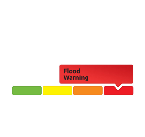
- Flood Warning – Flooding is imminent or already occurring in area watercourses.
May 7 , 2019 — Rideau Valley Conservation Authority (RVCA), in conjunction with the Mississippi Valley Conservation Authority (MVCA) and South Nation Conservation (SNC) is maintaining the FLOOD WARNING issued on April 19, 2019 for the areas under our jurisdiction along the Ottawa River.
The current weather forecast indicates that significant rainfall amounts are possible from Thursday morning into Friday as a large low-pressure system moves into the area.
The most recent analysis from the Ottawa River Regulation Committee (ORRC) indicate that water levels along the Ottawa River from Chats Lake down to Lac Deschenes are stable and may increase as a result of the forecasted rainfall but should not exceed the initial peaks observed last week. From Pointe Gatineau down to the Grenville/Hawkesbury area water levels are still decreasing but may level off as a result of the forecasted rainfall.
All flood-prone areas along the Ottawa River from Lac Coulonge down to the Montreal Archipelago are at risk as snowmelt continues along the upper Ottawa River. Levels are expected to remain high for the next two to three weeks. Risk is highly dependent on the amount of precipitation that is received. Residents are strongly urged to keep sandbags in place for now. Updates to all projections will be provided as they become available.
MVCA areas of concern:
Water levels in the Constance Bay area are stable and are expected to remain that way over the next 48 hours. The forecasted rainfall on Thursday and Friday could cause levels to increase again.
RVCA areas of concern:
Water levels in the Britannia area (Grandview Road, Britannia Village, and the Belltown Community) are stable and are expected to remain that way over the next 48 hours. The forecasted rainfall on Thursday and Friday could cause levels to increase again.
Water levels east of Cumberland Village (Boise Village, Morin Road, Leo Lane) are still decreasing but may level off due to the forecasted rainfall on Thursday and Friday.
SNC areas of concern:
Water levels in Clarence-Rockland and Alfred-Plantagenet are still decreasing but may level off due to the forecasted rainfall on Thursday and Friday.
Residents in flood-prone areas are encouraged to closely follow evolving conditions and to take necessary measures. Residents are advised to stay away from watercourses where flows are high and where banks might be unstable. Parents are encouraged to explain dangers to children.
This FLOOD WARNING is in effect until Friday, May 10, 2019 at 5:00 PM.
RVCA and its Ottawa partners, MVCA and SNC monitor the water levels and weather forecasts with the Ministry of Natural Resources and Forestry as part of the Flood Forecasting and Warning Program. Updates are provided as conditions change.
The Ottawa River Regulation Planning Board will be reassessing forecast conditions and providing hydrological condition updates on its website daily at www.ottawariver.ca/forecast.php.
To view current flood warnings across Ontario, visit https://www.ontario.ca/law-and-safety/flood-forecasting-and-warning-program”
- end -
"Rideau Valley Conservation Authority is a partnership of municipalities within the Rideau Valley watershed created under the Conservation Authorities Act to deliver a range of programs in watershed management and natural resource conservation."
RVCA Watershed Conditions Statements:
- Water Safety – High flows, unstable banks, melting ice or other factors that could be dangerous for recreational users such as anglers, canoeists, hikers, children, pets, etc. Flooding is not expected.
- Flood Outlook – Early notice of the potential for flooding based on weather forecasts, calling for heavy rain, snow melt, high winds or other conditions that could lead to high runoff, cause ice jams and/or lakeshore flooding or erosion.
- Flood Watch – Flooding is possible in specific watercourses or municipalities. Municipalities, emergency services and individuals in flood-prone areas should prepare.
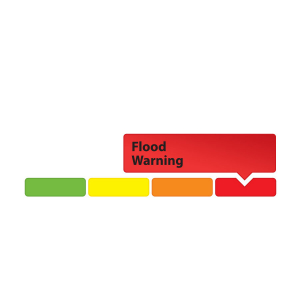
- Flood Warning – Flooding is imminent or already occurring in area watercourses.
May 7, 2019 – As thousands of Canadian students walked out of class to protest climate policies on May 3, a group of Nepean High School students were taking their protest back to basics.
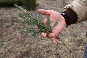
Shovels in hand, the 14-person crew braved wet weather to plant 500 trees at MacSkimming Outdoor Education Centre in Cumberland. Rideau Valley Conservation Authority (RVCA) provided the seedlings and taught the students how and where to plant them.
“I like that we’re taking real action, we’re out here actually planting trees,” said Emily Drummond, a Grade 9 environment club member. The club had planned to join the #FridaysForFuture climate strike at Parliament Hill, but decided they could have a more immediate impact reforesting an abandoned field.
Most of the students were in Grade 11 or 12 and part of the school’s environmental Specialist High Skills Major (SHSM) program. They take courses in habitat ecology, resource management and environmental science as part of their core curriculum. Most said they would pursue careers in an environmental field.
SHSM director and environment club leader Chris Drummond said he has worked with the RVCA before, planting endangered butternut seedlings in another part of the outdoor education centre and installing several turtle habitat sites.
The trees were paid for by the RVCA’s charitable arm, the Rideau Valley Conservation Foundation.
The RVCA manages the Rideau River watershed. It monitors flood risks and other hazards, regulates development around waterways and supports stewardship activities like tree planting and shoreline naturalization to make the watershed more resilient. It also maintains 11 conservation areas and 42 kilometres of public trails.
You can support the RVCA’s work through a charitable donation to the foundation (www.rvcf.ca), purchasing a tree for a special occasion or donating private land for preservation.
-end-
May 7, 2019 – Your mother gave you the gift of life, and now you can return the favour.
Thanks to the Rideau Valley Conservation Foundation’s special occasions tree planting program, you can skip the grocery store bouquet and plant an environmental legacy in your mom’s honour, instead.
The trees are planted across the Rideau Valley watershed, from Frontenac to Smiths Falls to downtown Ottawa, helping to fight erosion, manage floods and keep contaminants out of our rivers and lakes. Staff tend to the new trees, helping them grow into maturity so they can thrive for decades – much like your mother did for you.
A single tree costs $25, while a small grove of five is only $100. Ten trees costs $150 and a family grove of 25 trees costs $250 – just $10 a tree.
Online ordering makes it easy and fast. Under the RVCF’s Special Occasion Trees program, simply enter your donation amount and your information, and you’ll receive a charitable tax receipt to your inbox right away. You can even send your mom an e-card right from the foundation site.
The foundation is a registered charity that supports the work of the Rideau Valley Conservation Authority, which monitors more than 4,000 km2 of waterways across 18 municipalities in Eastern Ontario.
The authority is responsible for monitoring water quality, flood risks and other hazards to keep people, property and the environment safe. Planting trees is an important part of the authority’s efforts to promote biodiversity, protect our drinking water and reduce the risk of flooding.
The RVCF plants a combination of white cedar, white pine, red oak and sugar maple.
To order your Mother’s Day trees or make another donation, visit www.canadahelps.org.
-end-
May 6, 2019 —A FLOOD WATCH is being maintained for properties around Bobs Lake and Christie Lake.
Water levels on both lakes continue to decline slowly but both remain above average for this time of year. The current water level on Bobs Lake is above the "Full Supply" threshold at which flood damage can occur. The current water level on Christie Lake is such that some flood damage can also occur. The current forecast indicates between 20 mm and 35 mm of rain could fall later this week. This rainfall will likely increase water levels again on Bobs Lake and Christie Lake. Parks Canada staff are closely monitoring the water levels in these lakes. Operations at the Bolingbroke Dam will take place as required to balance the levels in Bobs Lake and Christie Lake.
Water levels are now near seasonal in the rest of the Rideau Valley Watershed.
Everyone needs to be cautious around lakes and streams with the fluctuating water levels. Children need to be educated about the hazards and kept away from all watercourses.
This watershed conditions statement is in effect until Monday May 13, 2019 at 5 PM and will be updated at that time unless the forecast or conditions change.
-end-
More Information:
Brian Stratton, RVCA Manager Engineering Services
Rideau Valley Conservation Authority
613-692-6804, 1-800-267-3504 ext. 1141
or cell 613-799-9423
Media Enquiries:
Diane Downey, RVCA Director of Communications and Outreach
Rideau Valley Conservation Authority
613-692-3571, 1-800-267-3504 ext. 1126
or cell 613-698-9453
"Rideau Valley Conservation Authority is a partnership of municipalities within the Rideau Valley watershed created under the Conservation Authorities Act to deliver a range of programs in watershed management and natural resource conservation."
RVCA Watershed Conditions Statements:
- Water Safety – High flows, unstable banks, melting ice or other factors that could be dangerous for recreational users such as anglers, canoeists, hikers, children, pets, etc. Flooding is not expected.
- Flood Outlook – Early notice of the potential for flooding based on weather forecasts, calling for heavy rain, snow melt, high winds or other conditions that could lead to high runoff, cause ice jams and/or lakeshore flooding or erosion.
- Flood Watch – Flooding is possible in specific watercourses or municipalities. Municipalities, emergency services and individuals in flood-prone areas should prepare.
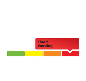
- Flood Warning – Flooding is imminent or already occurring in area watercourses.
May 3, 2019 — Rideau Valley Conservation Authority (RVCA), in conjunction with the Mississippi Valley Conservation Authority (MVCA) and South Nation Conservation (SNC) is maintaining the FLOOD WARNING issued on April 19, 2019 for the areas under our jurisdiction along the Ottawa River.
The most recent model outputs from the Ottawa River Regulation Committee (ORRC) indicate that water levels have peaked on Lac Coulonge and are expected to begin rising again over the next few days. Along the Ottawa River below Lac Coulonge, levels are expected to remain stable or slowly decline over the next few days in all locations.
All flood-prone areas along the Ottawa River from Lac Coulonge down to the Montreal Archipelago are at risk as snowmelt from the upper Ottawa River basin begins to move through the system.
Levels will remain high for at least the next week but are expected to decline slowly based on the current weather forecasts. Risk is highly dependent on the amount of precipitation received over the next two to three weeks. Residents are strongly urged to keep sandbags in place for at least the next two weeks.
MVCA areas of concern:
Water levels in the Constance Bay area have peaked and have begun to recede.
RVCA areas of concern:
Water levels in Britannia area (Grandview Road, Britannia Village, and the Belltown Community) and the area east of Cumberland Village (Boise Village, Morin Road, Leo Lane) have peaked and begun to recede.
SNC areas of concern:
Water levels in Clarence-Rockland and Alfred-Plantagenet have peaked on Wednesday, May 1, 2019 and have dropped over the last 48 hours.
Residents in flood-prone areas are encouraged to closely follow evolving conditions and to take necessary measures. Residents are advised to stay away from watercourses where flows are high and where banks might be unstable. Parents are encouraged to explain dangers to children.
This FLOOD WARNING is in effect until Tuesday, May 7, 2019 at 5:00 PM.
RVCA and its Ottawa partners, MVCA and SNC monitor the water levels and weather forecasts with the Ministry of Natural Resources and Forestry as part of the Flood Forecasting and Warning Program. Updates are provided as conditions change.
The Ottawa River Regulation Planning Board will be reassessing forecast conditions and providing hydrological condition updates on its website daily at www.ottawariver.ca/forecast.php.
To view current flood warnings across Ontario, visit https://www.ontario.ca/law-and-safety/flood-forecasting-and-warning-program.
- end -
"Rideau Valley Conservation Authority is a partnership of municipalities within the Rideau Valley watershed created under the Conservation Authorities Act to deliver a range of programs in watershed management and natural resource conservation."
RVCA Watershed Conditions Statements:
- Water Safety – High flows, unstable banks, melting ice or other factors that could be dangerous for recreational users such as anglers, canoeists, hikers, children, pets, etc. Flooding is not expected.
- Flood Outlook – Early notice of the potential for flooding based on weather forecasts, calling for heavy rain, snow melt, high winds or other conditions that could lead to high runoff, cause ice jams and/or lakeshore flooding or erosion.
- Flood Watch – Flooding is possible in specific watercourses or municipalities. Municipalities, emergency services and individuals in flood-prone areas should prepare.
- Flood Warning – Flooding is imminent or already occurring in area watercourses.

