Super User

(WCS – R06/2022)
April 1, 2022 – The Rideau Valley Conservation Authority is issuing a HIGH WATER SAFETY message for all areas. Water levels and flows are declining for most areas of the Rideau Valley Watershed, except for the reservoir lakes which are discussed below.
The short-term forecast indicates mostly above zero temperatures and limited precipitation, although there is a possible rain event coming later next week. The snow has melted across the lower watershed, but some snow remains in the upper watershed, near Perth.
Parks Canada staff who manage the water levels for the Rideau Canal are carefully watching the water levels in the upper watershed lakes. The water levels in the Upper Rideau and Big Rideau Lakes are high but are no longer increasing. The water levels in Bobs and Christie lakes continue to rise due to on-going snowmelt and will be managed depending on the rain amounts next week and inflow responses in both watersheds.
Extreme caution should be exercised by everyone when near local waterbodies. Parents should inform their children of the risks and provide appropriate supervision. Pets should be leashed near all bodies of water. Please contact your municipality if you see any ice jams that are causing localized flooding.
This watershed conditions statement is in effect until April 15, 2022 at 5 PM. No further updates will be issued unless the forecast or conditions change.
-end-
More Information:
Contact: Brian Stratton, RVCA Manager Engineering Services
Rideau Valley Conservation Authority
613-692-6804, 1-800-267-3504 ext. 1141
www.rvca.ca/watershed-conditions
Rideau Valley Conservation Authority is a partnership of municipalities within the Rideau Valley watershed created under the Conservation Authorities Act to deliver a range of programs in watershed management and natural resource conservation.
RVCA Watershed Conditions Statements:
- Water Safety – High flows, unstable banks, melting ice or other factors that could be dangerous for recreational users such as anglers, canoeists, hikers, children, pets, etc. Flooding is not expected.
- Flood Outlook – Early notice of the potential for flooding based on weather forecasts, calling for heavy rain, snow melt, high winds or other conditions that could lead to high runoff, cause ice jams and/or lakeshore flooding or erosion.
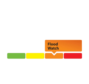
- Flood Watch – Flooding is possible in specific watercourses or municipalities. Municipalities, emergency services and individuals in flood prone areas should prepare.
- Flood Warning – Flooding is imminent or already occurring in specific watercourses or municipalities.

OTTAWA, March 30, 2022 – Public consultation on the draft hazard mapping study for Stevens Creek from Malakoff Road to the Rideau River will continue until April 29, 2022.
The Rideau Valley Conservation Authority (RVCA), in collaboration with the City of Ottawa, has completed a hazard mapping study for Stevens Creek from Malakoff Road to the Rideau River. Virtual public consultation began late November 2021. Affected landowners were notified by mail and staff have been responding to inquiries by telephone calls, e-mail, virtual meetings, small group in-person meetings and site visits. In some cases the draft mapping has been refined based on site-specific information.
With the recent easing of provincial COVID-19 restrictions, the RVCA is now able to host an in-person presentation and question and answer session to provide an additional opportunity for public consultation.
Thursday, April 21, 2022
Alfred Taylor Recreation Centre
2300 Community Way, North Gower
Doors Open at 6:00 p.m.
Presentation begins at 6:15 p.m.
Question & Answer period to follow
Anyone unable to attend can contact an RVCA Resource at 613-692-3571, toll-free at 1-800-267-3504 or by email at . Additional information is also available on our website at www.rvca.ca/stevens-creek.
The new mapping shows areas that are subject to natural hazards such as flooding and unstable slopes or have important natural features such as wetlands. The goal of this mapping is to help ensure sound land use planning, development and resource management decisions are made that protect people and property.
Once approved, the mapping will be used by the City of Ottawa when updating its Official Plan and Zoning Schedules and in the review of development applications under the Planning Act. RVCA will also use the mapping to guide the review of development applications submitted under the RVCA’s Development, Interference with Wetlands and Alterations to Shorelines and Watercourses Regulation.
This study is being done through a collaboration involving the City of Ottawa and the Rideau Valley, Mississippi Valley and South Nation Conservation Authorities. The City recognized a need to update its zoning schedules based on up-to-date hazard mapping and has provided contributions enabling the Conservation Authorities to move ahead with these studies sooner than would otherwise be possible. For a complete list on ongoing work, please visit www.rvca.ca.
-30-
Annual Report offers glimpse into RVCA’s record-setting 2021

MANOTICK, April 5, 2022 – With another challenging year behind us, it’s clear the Rideau Valley Conservation Authority not only survived 2021, but thrived.
The RVCA’s 2021 Annual Report is now available online. Despite continued disruption from the global pandemic, staff embarked on many special projects in 2021 that will continue into the coming year. This included:
- installing 11 new climate stations across the watershed to improve our flood and drought forecasting, particularly in the face of a changing climate
- completing draft hazard mapping studies for the Upper Jock River and Stevens Creek
- kicking off an ambitious Watershed Report process to deliver a comprehensive snapshot of environmental conditions in the Rideau Valley
- drafting updates to our planning and development policies to better align with provincial legislation and local needs
- developing 5.5 hectares of new pollinator meadow habitat in Barrhaven in partnership with Hydro Ottawa and the Canadian Wildlife Federation
On top of this, RVCA staff continued to deliver our regular programs and services at record levels. In 2021, the RVCA:
- welcomed 300,000 visitors to RVCA’s 11 conservation areas, up 50% over pre-pandemic numbers
- piloted a new virtual outdoor education program at Baxter Conservation Area, welcoming 1,612 students in partnership with the Ottawa Catholic School Board
- planted 230,100 trees throughout the watershed, with more than $356,000 fundraised
- Celebrated the 2 millionth tree planted through the City of Ottawa’s Green Acres program
- Completed 193 clean water projects and provided more than $478,000 in grants to rural farmers and landowners
- Naturalized 61 shoreline properties with 16,412 native trees and shrubs
- Distributed 1,440 free disease-tolerant butternut tree seedlings to landowners
- Dampled and surveyed dozens of streams, rivers and lakes for surface water quality, thanks in part to 13 community volunteers who filled lake sampling gaps created by COVID-19 limitations
- Issued 7 flood messages and 5 low water response messages
- Reviewed 1,874 Planning Act applications (site plan control, minor variances, severances, subdivision reviews and other development needs)
- Processed 1,376 septic system applications and inspections
- Processed a record 4,647 inquiries, applications, complaints and violations under the Conservation Authorities Act
The RVCA’s general manager Sommer Casgrain-Robertson also participated on the Province’s multi-stakeholder Conservation Authorities Working Group over the course of 2021 to provide input into new regulations under the Conservation Authorities Act.
“I am so proud of what the RVCA team has been able to accomplish under such challenging circumstances over the past two years,” said Casgrain-Robertson. “We have laid the groundwork for a healthy watershed, which in turn will support healthy communities, healthy economies and a healthy future. We look forward to a productive and exciting 2022.”
For your copy of the RVCA 2021 Annual Report, visit www.rvca.ca or call 613-692-3571 or 1-800-267-3504 for a hard copy.
-30-

(WCS – R06/2022)
March 25, 2022 – The Rideau Valley Conservation Authority is terminating the FLOOD WATCH for the Village of North Gower but a FLOOD OUTLOOK continues for all the low-lying areas around the smaller creeks and streams in the Rideau Valley Watershed, including any connected creeks or ditches.
The current short-term weather forecast indicates cooler, mostly below zero temperatures, for the next five days with limited precipitation. Although much of the snow has already melted, some snow remains in the watershed, especially in the upper watershed areas.
Parks Canada staff who manage the water levels for the Rideau Canal have indicated that the water levels in some of the upper watershed reservoir lakes are significantly increasing due to snowmelt and recent rainfall. More specifically, the water levels in the Upper Rideau and Big Rideau Lakes are increasing and measures are being taken to reduce the rate of increase. The releases from these lakes will be done to minimize downstream impacts. However, areas along the Rideau River between Smiths Falls and Merrickville should expect elevated water levels and flows for the next few days.
The current forecast along with Parks Canada operations indicate no significant flooding across the watershed at this time, although the areas between Smiths Falls and Merrickville will experience temporarily elevated water levels and flows.
Extreme caution should be exercised by everyone when near local waterbodies. Parents should inform their children of the risks and provide appropriate supervision. Pets should be leashed near all bodies of water. Please contact your municipality if you see any ice jams that are causing localized flooding.
Residents in flood prone or low-lying areas, historically susceptible to flooding, should continue to take the necessary precautions to protect their property, such as:
- • Ensuring sump pump is clear, in good working condition and has a backwater valve
- • Ensuring easy access to a portable backup generator and pump
- • Ensuring downspouts are clear and the outlet is at least 3 metres from the dwelling
- • Securing items that might float away as flows increase
- • Removing valuable items from basements or lower floors that could be subject to flooding
- • Keeping emergency phone numbers handy
- • Familiarizing yourself with your municipality’s Emergency Preparedness Plan
This watershed conditions statement is in effect until April 1, 2022, at 5 p.m. and will be updated at that time unless the forecast or conditions change.
-end-
More Information:
Contact: Brian Stratton, RVCA Manager Engineering Services
Rideau Valley Conservation Authority
613-692-6804, 1-800-267-3504 ext. 1141
Rideau Valley Conservation Authority is a partnership of municipalities within the Rideau Valley watershed created under the Conservation Authorities Act to deliver a range of programs in watershed management and natural resource conservation.
RVCA Watershed Conditions Statements:
- Water Safety – High flows, unstable banks, melting ice or other factors that could be dangerous for recreational users such as anglers, canoeists, hikers, children, pets, etc. Flooding is not expected.
- Flood Outlook – Early notice of the potential for flooding based on weather forecasts, calling for heavy rain, snow melt, high winds or other conditions that could lead to high runoff, cause ice jams and/or lakeshore flooding or erosion.
- Flood Watch – Flooding is possible in specific watercourses or municipalities. Municipalities, emergency services and individuals in flood prone areas should prepare.
- Flood Warning – Flooding is imminent or already occurring in specific watercourses or municipalities.

Continued Snowmelt and Forecasted Rain Will Keep Water Levels Elevated Across Rideau Valley Watershed
(WCS – R05/2022)
March 23, 2022 – The current short-term weather forecast indicates mostly above zero temperatures until Sunday and possibly 30 – 50 mm of rain from Thursday to Saturday. Although much of the snow has already melted, some snow remains in the watershed, especially in the upper watershed areas.
The forecasted rain and on-going snowmelt are expected to keep water levels elevated and cause some flooding in all low-lying areas, especially those identified below. Parks Canada staff who manage the water levels for the Rideau Canal have indicated that water levels in upper watershed lakes will continue to rise as the snowpack melts.
Some specific areas of concern are highlighted below:
A FLOOD WATCH continues for all the low-lying areas along Stevens Creek and Taylor Drain in the Village of North Gower.
A FLOOD OUTLOOK continues for all the low-lying areas around the smaller creeks and streams in the Rideau Valley Watershed, including any connected creeks or ditches.
Extreme caution should be exercised by everyone when near local waterbodies. Parents should inform their children of the risks and provide appropriate supervision. Pets should be leashed near all bodies of water. Please contact your municipality if you see any ice jams that are causing localized flooding.
Residents in flood prone or low-lying areas, historically susceptible to flooding, should continue to take the necessary precautions to protect their property, such as:
- • Ensuring sump pump is clear, in good working condition and has a backwater valve
- • Ensuring easy access to a portable backup generator and pump
- • Ensuring downspouts are clear and the outlet is at least 3 metres from the dwelling
- • Securing items that might float away as flows increase
- • Removing valuable items from basements or lower floors that could be subject to flooding
- • Keeping emergency phone numbers handy
- • Familiarizing yourself with your municipality’s Emergency Preparedness Plan
This watershed conditions statement is in effect until March 31, 2022, at 5 p.m. and will be updated at that time unless the forecast or conditions change.
-end-
More Information:
Contact: Brian Stratton, RVCA Manager Engineering Services
Rideau Valley Conservation Authority
613-692-6804, 1-800-267-3504 ext. 1141
Rideau Valley Conservation Authority is a partnership of municipalities within the Rideau Valley watershed created under the Conservation Authorities Act to deliver a range of programs in watershed management and natural resource conservation.
RVCA Watershed Conditions Statements:
- Water Safety – High flows, unstable banks, melting ice or other factors that could be dangerous for recreational users such as anglers, canoeists, hikers, children, pets, etc. Flooding is not expected.
- Flood Outlook – Early notice of the potential for flooding based on weather forecasts, calling for heavy rain, snow melt, high winds or other conditions that could lead to high runoff, cause ice jams and/or lakeshore flooding or erosion.
- Flood Watch – Flooding is possible in specific watercourses or municipalities. Municipalities, emergency services and individuals in flood prone areas should prepare.
- Flood Warning – Flooding is imminent or already occurring in specific watercourses or municipalities.
Warm Temperatures and Possible Rain Will Cause Increased Water Levels Across Rideau Valley Watershed

(WCS – R04/2022)
March 15, 2022 – The current short-term weather forecast indicates warm daytime temperatures this week, with Thursday’s temperature above 10 degrees Celsius, and night-time low temperatures near zero. The short-term forecast also indicates that a substantial rain event could occur on Sat. March 19.
Current conditions at several RVCA and Park Canada snow course sites indicate near normal amounts of snow for this time of year.
If the temperatures come as forecast in the coming days, significant snowmelt is expected across the Rideau Valley watershed. This will increase water levels and cause some flooding in all low-lying areas, especially those identified below. Forecasted rain later in the week may further increase water levels throughout the watershed. Parks Canada staff who manage the water levels for the Rideau Canal have indicated that the levels in lakes are expected to rise in the upper watershed lakes as the snowpack melts.
Some specific areas of concern are highlighted below:
A FLOOD WATCH is being issued for all the low-lying areas along Stevens Creek and Taylor Drain in the Village of North Gower.
A FLOOD OUTLOOK is being issued for all the low-lying areas around the smaller creeks and streams in the Rideau Valley Watershed, including any connected creeks or ditches.
Extreme caution should be exercised by everyone when near local waterbodies. Parents should inform their children of the risks and provide appropriate supervision. Pets should be leashed near all bodies of water.
Residents in flood-prone or low-lying areas that are historically susceptible to flooding should take the necessary precautions to protect their property, such as:
- Ensuring sump pump is clear, in good working condition and has a backwater valve
- Ensuring easy access to a portable backup generator and pump
- Ensuring downspouts are clear and the outlet is at least 3 metres from the dwelling
- Securing items that might float away as flows increase
- Removing valuable items from basements or lower floors that could be subject to flooding
- Keeping emergency phone numbers handy
- Familiarizing yourself with your municipality’s Emergency Preparedness Plan.
This watershed conditions statement is in effect until March 15, 2022, at 5 p.m. and will be updated at that time unless the forecast or conditions change first.
-end-
More Information:
Contact: Brian Stratton, RVCA Manager Engineering Services
Rideau Valley Conservation Authority
613-692-6804, 1-800-267-3504 ext. 1141
Rideau Valley Conservation Authority is a partnership of municipalities within the Rideau Valley watershed created under the Conservation Authorities Act to deliver a range of programs in watershed management and natural resource conservation.
RVCA Watershed Conditions Statements:
- Water Safety – High flows, unstable banks, melting ice or other factors that could be dangerous for recreational users such as anglers, canoeists, hikers, children, pets, etc. Flooding is not expected.
- Flood Outlook – Early notice of the potential for flooding based on weather forecasts, calling for heavy rain, snow melt, high winds or other conditions that could lead to high runoff, cause ice jams and/or lakeshore flooding or erosion.
- Flood Watch – Flooding is possible in specific watercourses or municipalities. Municipalities, emergency services and individuals in flood prone areas should prepare.
- Flood Warning – Flooding is imminent or already occurring in specific watercourses or municipalities.
Spring Flood Outlook: Current Conditions Favourable for Slow Snow Melt Across the Watershed

(WCS – R03/2022)
March 8, 2022 – The winter of 2021/22 is quickly coming to an end, and RVCA’s Flood Forecasting team is working closely with its municipal and agency partners to prepare for potential spring flooding.
To date, the spring flood outlook remains positive. December was generally mild with below average precipitation, while temperatures in January were well below normal. Precipitation in January was also below normal but a large storm mid-January left almost 50 cm of snow on the ground. In February, both the temperature and precipitation amounts were very close to normal. Early March conditions at several RVCA and Parks Canada snow course sites indicated near normal amounts of snow for this time of year. However, some snow was lost due to mild temperatures on Sunday, March 6. Water levels and flows across the watershed are now near normal for early March.
The current short-term weather forecast indicates daytime high temperatures near zero and night-time low temperatures below zero for the next five days. The forecast also indicates some mixed precipitation during this same time-period.
If the temperatures come as forecast over the next few days, limited snowmelt is expected across the Rideau Valley watershed and is unlikely to cause any significant flooding. Parks Canada staff who manage the water levels for the Rideau Canal have indicated that the levels in lakes are expected to rise in the upper watershed lakes as the snowpack begins to melt.
Beyond the short-term forecast discussed above, it is difficult to predict what’s in store for flooding conditions in the Rideau Valley Watershed, since flood conditions are a result of natural processes that vary from year to year based on snowmelt, temperature increases and precipitation events. It is important to be prepared for possible flood conditions for the next few weeks as the winter comes to an end.
City of Ottawa crews have begun the annual ice removal program on the Rideau River between Rideau Falls and Bronson Avenue. Crews will work to keep the ice from reforming until the spring freshet occurs (for more information call City of Ottawa’s information line at 311).
With rising water levels expected over the coming weeks, ice cover on lakes, ditches, local streams, and rivers will be unstable. Extreme caution should be exercised by everyone when near local waterbodies. Parents should inform their children of the risks and provide appropriate supervision. Keep pets leashed near waterbodies, as well.
Residents in flood-prone or low-lying areas that are historically susceptible to flooding should take the necessary precautions to protect their property, such as:
- Ensuring sump pump is clear, in good working condition and has a backwater valve
- Ensuring easy access to a portable backup generator and pump
- Ensuring downspouts are clear and the outlet is at least 3 metres from the dwelling
- Securing items that might float away as flows increase
- Removing valuable items from basements or lower floors that could be subject to flooding
- Keeping emergency phone numbers handy
- Familiarizing yourself with your municipality’s Emergency Preparedness Plan.
This watershed conditions statement is in effect until March 15, 2022, at 5 p.m. and will be updated at that time unless the forecast or conditions change first.
-end-
More Information:
Contact: Brian Stratton, RVCA Manager Engineering Services
Rideau Valley Conservation Authority
613-692-6804, 1-800-267-3504 ext. 1141
Rideau Valley Conservation Authority is a partnership of municipalities within the Rideau Valley watershed created under the Conservation Authorities Act to deliver a range of programs in watershed management and natural resource conservation.
RVCA Watershed Conditions Statements:
- Water Safety – High flows, unstable banks, melting ice or other factors that could be dangerous for recreational users such as anglers, canoeists, hikers, children, pets, etc. Flooding is not expected.
- Flood Outlook – Early notice of the potential for flooding based on weather forecasts, calling for heavy rain, snow melt, high winds or other conditions that could lead to high runoff, cause ice jams and/or lakeshore flooding or erosion.
- Flood Watch – Flooding is possible in specific watercourses or municipalities. Municipalities, emergency services and individuals in flood prone areas should prepare.
- Flood Warning – Flooding is imminent or already occurring in specific watercourses or municipalities.
Mild Temperatures and Rain on Sunday May Increase Water Levels and Flows and Cause Unstable Ice Across Watershed

(WCS – R02/2022)
March 4, 2022 – Environment Canada is forecasting temperatures above 10 degrees Celcius and rain on Sunday. This weather event will likely result in elevated water runoff to all waterways because of snow melt and rainfall.
Although no significant flooding is anticipated, water levels and flows are expected to increase in all waterways in the Rideau Valley Watershed. Depending on how much snow melts and rain falls, residents who are adjacent to the smaller creeks and streams are advised to keep a close watch on water levels and flows and should take the necessary precautions to protect their property, such as:
- Ensuring sump pump is clear, in good working condition and has a backwater valve
- Ensuring easy access to a portable backup generator and pump
With the expected temperature changes and increase in water levels and flows in the coming days, ice cover on lakes, ditches, local streams and rivers will be unstable. Extreme caution should be exercised by everyone when near local waterbodies. Parents should inform their children of the risks and provide appropriate supervision.
This watershed conditions statement is in effect until Tuesday March 8, 2022 at 5 PM or until an update has been issued.
-end-
More Information:
Contact: Brian Stratton, RVCA Manager Engineering Services
Rideau Valley Conservation Authority
613-692-6804, 1-800-267-3504 ext. 1141
Rideau Valley Conservation Authority is a partnership of municipalities within the Rideau Valley watershed created under the Conservation Authorities Act to deliver a range of programs in watershed management and natural resource conservation.
RVCA Watershed Conditions Statements:
- Water Safety – High flows, unstable banks, melting ice or other factors that could be dangerous for recreational users such as anglers, canoeists, hikers, children, pets, etc. Flooding is not expected.
- Flood Outlook – Early notice of the potential for flooding based on weather forecasts, calling for heavy rain, snow melt, high winds or other conditions that could lead to high runoff, cause ice jams and/or lakeshore flooding or erosion.
- Flood Watch – Flooding is possible in specific watercourses or municipalities. Municipalities, emergency services and individuals in flood prone areas should prepare.
- Flood Warning – Flooding is imminent or already occurring in specific watercourses or municipalities.
Don’t let huts or hockey nets go down with the ice

OTTAWA, March 1, 2022 – It’s officially March, and that means it's time to haul in your fishing huts, hockey nets and other gear before the ice is out.
Building materials, rink lights, benches and shovels, garbage and other waste can pollute our rivers and lakes, be toxic for fish and wildlife and create hazards for boaters and swimmers in the spring.
Under Ontario law, Eastern Ontario fishing huts must be removed by March 15. However, as the sun gets stronger and the weather begins to warm, it’s wise to remove them sooner rather than later. If you wait too long, you may find the ice too thin to access your belongings! It is an offence under the Public Lands Act to leave your ice hut out after ice break up, even if that occurs before the removal deadline.
So take some time this week to collect your belongings, dispose of your garbage and dismantle any structures you’ve built on the ice. Protect and respect the river that has kept you going all through the long winter months!
For complete fishing hut regulations visit www.ontario.ca/page/ice-fishing. To learn about water quality in your area and how to improve it, visit watersheds.rvca.ca.
-30-