Super User
Identifying hazard lands is an important responsibility for Ontario’s Conservation Authorities.
During the last five years, the Rideau Valley Conservation Authority (RVCA) has been conducting several hazard mapping studies on watercourses within the City of Ottawa and the RVCA area of jurisdiction. For some watercourses, old mapping will be updated; and for others, hazards maps will be created for the first time.
Studies look at identifying two main types of hazards along the watercourses: flood risk and slope stability risk.
Flood risk studies make use of contemporary methods in hydrologic and hydraulic analysis,all the available historical records of streamflow and/or water level, and the most up-to-date topographical data to produce estimates of the 1:100 year flood discharge and corresponding water surface elevations and flood lines for the watercourses under consideration. The resulting flood risk maps identify areas along the river that are vulnerable to flooding, and where new development is to be restricted or prohibited in accordance with Provincial Planning Policies.
These studies are being done through a collaboration involving the City of Ottawa and the Rideau Valley, Mississippi Valley and South Nation Conservation Authorities. The City recognized a need to update its zoning schedules based on up-to-date flood risk mapping, and has provided contributions enabling the Conservation Authorities to move ahead with these studies sooner than would otherwise be possible.
Slope stability studies make use of new, highly detailed topographic data to identify toe and top of slope. This information is used to create an allowance area that serve as a flag of potentially unstable slope areas.
When completed, the new flood risk mapping will be used by the City of Ottawa when updating its Official Plan and Zoning Schedules and in the review of development applications under the Planning Act. Conservation Authorities will use the same mapping flood risk mapping as well as slope stability risk in the administration and enforcement of regulations made under the Conservation Authorities Act.
Currently, the RVCA is focusing its efforts on the following streams:
- Flowing Creek (Flewellyn Road to Jock River)
- Hobbs Drain (Fallowfield Road to Jock River)
- Kings Creek (Brunton Side Road to Jock River)
- Nichols Creek (Montague Boundary Road to Jock River)
- Becketts Creek (Sarsfield Road to Ottawa River)
- Bilberry Creek (Innes Road to Ottawa River)
- Rideau River (Hogs Back to Kars)
- Rideau River (Kars to Burritts Rapids)
Historical records, news clippings, photographs and local anecdotal stories and memories of past flood events can be useful in confirming the reasonableness of the calculations and resulting floodplain mapping. Local residents with this kind of information are encouraged to share their information and knowledge with RVCA’s Ferdous Ahmed (1-800-267-3504 or 613-692-3571 ext. 1170 or ).
Those interested in learning more about the project or being included on our contact list are also encouraged to contact the RVCA.
Once the technical work for individual study areas is complete and hazard mapping has been prepared, a public information session will be held to collect public feedback. Any new information or comments will be taken into consideration in further refinement of the mapped hazard limits.
As part of the continuing commitment to support the community and improve its already environmentally friendly operations, Carleton Refrigeration, Heating and Air Conditioning Inc. will be planting 1,302 young, vigorous, native-Canadian trees in Ottawa. The company is the newest participant in Rideau Valley Conservation Foundation’s (RVCF) Carbon Neutral Program.
Carleton Refrigeration, Heating and Air Conditioning is working with RVCF to calculate the amount of carbon emissions they produce (in tonnes of carbon dioxide) and then convert that into the number of trees to be planted to offset (or absorb) the carbon the company produces in their day-to-day operations.
Each of Carleton Refrigeration, Heating and Air Conditioning’s trees is a little environmental cleaning station producing better air, cleaner water, more wildlife habitat, noise and wind buffers, increased forest cover. Research shows that lives are improved by trees, hospital recovery times are shortened and other common problems, such as stress and attention deficit disorder, become more manageable when we are in regular contact with trees and green spaces.
Carleton Refrigeration, Heating and Air Conditioning joins a number of distinguished local companies, and many community and family events around town taking a bite out of carbon emissions and creating cleaner air for the residents of this area.
Carleton Refrigeration, Heating and Air Conditioning Ltd. is a locally owned and operated family business since 1973. Their team of dedicated professionals pride themselves on their award-winning commitment to excellence in customer service. They sell and install quality furnace and air conditioning equipment produced by superior quality manufacturers, and backed up by some of the best warranty programs in the industry.
Rideau Valley Conservation Foundation is a registered environmental charity working to improve the lands and waters of the Rideau River right here at home in Eastern Ontario. They are proud to be associated with Carleton Refrigeration, Heating and Air Conditioning Inc.
Flood Warning Withdrawn for Lakes on Tay River
Water levels are finally receding on Christie and Bobs Lakes both of which have had high water since the two bouts of heavy rain three weeks ago.
Bobs Lake levels were high from the spring runoff in April. The rain recorded at Bolingbroke, about 90 millimetres over the four days from May 4 through 7, was similar to what fell over much of the eastern parts of Ontario. The increase of Bobs lake levels made it necessary for Parks Canada staff to release water through the Bolingbroke Dam. Christie Lake has been the unfortunate recipient of the excess water from Bobs Lake. Residents around Christie Lake are again able to access their properties to begin the cleanup process.
The Rideau Valley Conservation Authority will maintain a Flood Watch into next week with rain forecast for several days beginning on Sunday. Levels can be expected to increase slightly but are not expected to return to flood stage in the Rideau watershed nor on the Ottawa River. On the Rideau Canal, scheduled to open for navigation last weekend, all locks on the Rideau except Narrows and Newboro on Upper Rideau Lake remain closed as of this writing.
Note that, despite flows and levels tending toward normal or the time of year, conditions around rivers and lakes continue to be hazardous with water temperatures still cold and water levels relatively high. Everyone, especially children, are advised to stay away.
The public is encouraged to tag us or share photos of water conditions in their area at RVCA Facebook (RideauValleyConservationAuthority) and Twitter (@RideauValleyCA).
Conservation Authority staff will continue to monitor conditions and will issue updates as warranted.
For water level and flow information in the Rideau system as well as the Ottawa River, visit the RVCA Streamflows and Water Levels webpage at http://his.rvca.ca/rvcafwl/ .
For more information about conditions on the Ottawa River, check the webpage of the Ottawa River Regulation Planning Board at http://ottawariver.ca/river-levels-flows.php#river-levels-flows-7-days .
RVCA Watershed Conditions Statements:
- Water Safety – High flows, unstable banks, melting ice or other factors that could be dangerous for recreational users such as anglers, canoeists, hikers, children, pets, etc. Flooding is not expected.
- Flood Outlook – Early notice of the potential for flooding based on weather forecasts, calling for heavy rain, snow melt, high winds or other conditions that could lead to high runoff, cause ice jams and/or lakeshore flooding or erosion.
- Flood Watch – Flooding is possible in specific watercourses or municipalities. Municipalities, emergency services and individuals in flood prone areas should prepare.
- Flood Warning – Flooding is imminent or already occurring in area watercourses.
Flood Warning Extent Reduced
Water levels have continued to recede over the weekend and are not expected to be affected significantly by rain forecast for later this week. This has led to a reduction of the coverage of the Flood Warning.
The Flood Warning is now limited to the upper Tay River where outflow from Bobs Lake has continued but there has yet to be a significant drop of the water level. Several properties around Christie Lake are still flooded. Sections of the Christie Lake North Shore Road has been under water for several days.
Flow of the Tay through Perth is declining slowly at 1 to 2 centimetres (cm) per day as water passes through from Bobs Lake. Some flooding has occurred in Stewart Park and in and near Last Duel Park in Perth.
Not as much rain as was forecast fell over the weekend. Little to no increases in levels occurred in the Rideau watershed or in the areas the RVCA monitors on the Ottawa River - Lac Deschene, Petrie Island and Boise Village. These areas are no longer under Flood Warning status as levels decline by about 10 cm per day.
The water level on the Long Reach of the Rideau River has dropped below the flood level for the access road to Hilly Lane. Flood waters have fully receded at all the rest of the susceptible areas on the Long Reach.
Rideau Canal reservoir lakes, Big Rideau, Upper Rideau and Wolfe, have all been declining with Upper Rideau dropping below the Full Supply level today.
Conditions around rivers and lakes are still hazardous with water levels that are relatively high. Everyone, especially children, are advised to stay away.
The public is encouraged to tag us or share photos of water conditions in their area at RVCA Facebook (RideauValleyConservationAuthority) and Twitter (@RideauValleyCA).
Conservation Authority staff will continue to monitor conditions and will issue updates as warranted.
For water level and flow information in the Rideau system as well as the Ottawa River, visit the RVCA Streamflows and Water Levels webpage at http://his.rvca.ca/rvcafwl/.
For more information about conditions on the Ottawa River, also check the webpage of the Ottawa River Regulation Planning Board at http://ottawariver.ca/river-levels-flows.php#river-levels-flows-7-days.
RVCA Watershed Conditions Statements:
- Water Safety – High flows, unstable banks, melting ice or other factors that could be dangerous for recreational users such as anglers, canoeists, hikers, children, pets, etc. Flooding is not expected.
- Flood Outlook – Early notice of the potential for flooding based on weather forecasts, calling for heavy rain, snow melt, high winds or other conditions that could lead to high runoff, cause ice jams and/or lakeshore flooding or erosion.
- Flood Watch – Flooding is possible in specific watercourses or municipalities. Municipalities, emergency services and individuals in flood prone areas should prepare.
- Flood Warning – Flooding is imminent or already occurring in area watercourses.
What Should You Do If You Are At Risk Of Flooding
For residents in flood prone areas, the Rideau Valley Conservation Authority (RVCA) suggests the most effective method of reducing flood damages is to make a plan and be prepared to execute it if necessary.
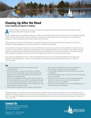
Cleaning Up After The Flood
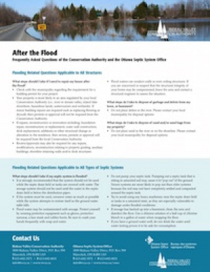
After the Flood
Weekend Rain Expected To Have Minor Impact
Water levels have declined through the week and are not expected to be affected significantly by rain forecast for the weekend.
With no rain through the week water levels have had time to decline. On the Ottawa, levels below Chaudiere Falls have gone down more than 50 centimetres (cm). The Long Reach on the Rideau has dropped 30 cm.
The Flood Warning will remain in effect through the weekend because of 20 or more millimetres of rain forecast for Saturday and Sunday. However, to have an impact, the rain would need to be from a widespread system with heavy rain at times. Indications are that the rain will come as showers spread over two days. Smaller streams can be expected to have increased flows and some ponding in still wet fields is likely.
Residents in the areas the RVCA monitors on the Ottawa River, Lac Deschene, Petrie Island and Boise Village, can expect to see a continuing decline in levels through the weekend.
Long Reach of the Rideau River will also continue to drop toward navigation level. Hilly Lane has less than 10 cm to go before the road is out of the water.
Big Rideau Lake levels have finally started to decline after Parks Canada staff reduced the inflow from Upper Rideau. Both Upper Rideau and Wolfe Lakes have been gradually dropping.
Water levels on Bobs Lake have remained high despite outflow through the Bolingbroke Dam. Christie Lake continues to have flood issues because the outlet of the lake is too narrow to pass the excess water quickly. Levels on Bobs Lake have been above Full Supply since the spring freshet in early April and relief became necessary.
Flows in the Tay through Perth are presently on a downward trend but the recession may be slow as water passes through from Bobs Lake. Some flooding has occurred in Stewart Park and in and near Last Duel Park in Perth.
Residents are advised to stay away from watercourses where flows are high and where banks might be unstable. Parents are encouraged to explain these dangers to their children.
Only if it is safe to do so, the public is encouraged to share photos of water conditions in their area via RVCA Facebook (@RideauValleyConservationAuthority) and Twitter (@RideauValleyCA).
Conservation Authority staff will continue to monitor conditions and will issue updates as warranted.
For water level and flow information in the Rideau system as well as the Ottawa River, visit the RVCA Streamflows and Water Levels webpage at http://his.rvca.ca/rvcafwl/.
For more information about conditions on the Ottawa River, also check the webpage of the Ottawa River Regulation Planning Board at http://ottawariver.ca/river-levels-flows.php#river-levels-flows-7-days.
RVCA Watershed Conditions Statements:
- Water Safety – High flows, unstable banks, melting ice or other factors that could be dangerous for recreational users such as anglers, canoeists, hikers, children, pets, etc. Flooding is not expected.
- Flood Outlook – Early notice of the potential for flooding based on weather forecasts, calling for heavy rain, snow melt, high winds or other conditions that could lead to high runoff, cause ice jams and/or lakeshore flooding or erosion.
- Flood Watch – Flooding is possible in specific watercourses or municipalities. Municipalities, emergency services and individuals in flood prone areas should prepare.
- Flood Warning – Flooding is imminent or already occurring in area watercourses.
Flood levels on both the Ottawa and Rideau River systems can be expected to decline through the week following peak flows on Monday.
No rain is in the forecast for today or tomorrow. During that time, water levels can be expected to decline slowly. However, the Flood Warning will remain in effect because of up to 40 millimetres of rain forecast to start on Thursday or Friday. The impact will depend on how much levels have subsided, how widespread the weather system is and how intensely the rain falls.
The areas the RVCA monitors on the Ottawa River, Lac Deschene, Petrie Island and Boise Village, all continue to be flooded.
Flood waters are also still present on the Long Reach of the Rideau River.
Big Rideau Lake levels continue to rise by 1 to 1.5 centimetres a day. Parks Canada staff will reduce the flow over the dam between Big and Upper Rideau in an effort to control that rise.
Bobs Lake levels remain high despite outflow through the Bolingbroke Dam that is causing high water levels on Christie Lake.
Flows in the Tay through Perth are presently on a downward trend but the recession may be prolonged by the outpouring from Bobs Lake.
Residents are advised to stay away from watercourses where flows are high and where banks might be unstable. Parents are encouraged to explain these dangers to their children.
Only if it is safe to do so, the public is encouraged to share photos of water conditions in their area via RVCA Facebook (@RideauValleyConservationAuthority) and Twitter (@RideauValleyCA).
Conservation Authority staff will continue to monitor conditions and will issue updates as warranted.
For water level and flow information in the Rideau system as well as the Ottawa River, visit the RVCA Streamflows and Water Levels webpage at http://his.rvca.ca/rvcafwl/.
For more information about conditions on the Ottawa River, also check the webpage of the Ottawa River Regulation Planning Board at http://ottawariver.ca/river-levels-flows.php#river-levels-flows-7-days.
RVCA Watershed Conditions Statements:
- Water Safety – High flows, unstable banks, melting ice or other factors that could be dangerous for recreational users such as anglers, canoeists, hikers, children, pets, etc. Flooding is not expected.
- Flood Outlook – Early notice of the potential for flooding based on weather forecasts, calling for heavy rain, snow melt, high winds or other conditions that could lead to high runoff, cause ice jams and/or lakeshore flooding or erosion.
- Flood Watch – Flooding is possible in specific watercourses or municipalities. Municipalities, emergency services and individuals in flood prone areas should prepare.
- Flood Warning – Flooding is imminent or already occurring in area watercourses.
Rideau River Levels Reaching Peak
Flood levels can be expected to decline through the afternoon today as peaks are being reached on the Rideau and tributaries.
Peak levels have been or are being reached in the lower Rideau watershed downstream of Smiths Falls as runoff from the heavy weekend rains passes through the system. The general indication is that levels are stabilizing and will decline over the afternoon.
The Long Reach of the Rideau has stabilized and can be expected to start to decline this afternoon. It will take a couple of days for the flood waters to fully recede from the roadways. Hilly Lane, for example, has over 30 centimetres of water to shed.
The Rideau Canal reservoir lake levels continue to be well above the “Full Supply Limit”. Upper Rideau Lake has begun to decline and Parks Canada staff will cut back the outflow to Big Rideau to help reduce levels there. Outflow continues to be passed through the Bolingbroke Dam in an effort to reduce flood levels on Bobs and Crow Lakes. The unfortunate recipient of that outflow is Christie Lake where flooding is also occurring. Flows in the Tay through Perth are presently on a downward trend but the recession may be prolonged by the outpouring from Bobs Lake.
Residents are advised to stay away from watercourses where flows are high and where banks might be unstable. Parents are encouraged to explain these dangers to their children.
Only if it is safe to do so, the public is encouraged to share photos of water conditions in their area via RVCA Facebook (@RideauValleyConservationAuthority) and Twitter (@RideauValleyCA).
Conservation Authority staff will continue to monitor conditions and will issue updates as warranted.
For water level and flow information in the Rideau system as well as the Ottawa River, visit the RVCA Streamflows and Water Levels webpage at http://his.rvca.ca/rvcafwl/.
For more information about conditions on the Ottawa River, also check the webpage of the Ottawa River Regulation Planning Board at http://ottawariver.ca/river-levels-flows.php#river-levels-flows-7-days.
RVCA Watershed Conditions Statements:
- Water Safety – High flows, unstable banks, melting ice or other factors that could be dangerous for recreational users such as anglers, canoeists, hikers, children, pets, etc. Flooding is not expected.
- Flood Outlook – Early notice of the potential for flooding based on weather forecasts, calling for heavy rain, snow melt, high winds or other conditions that could lead to high runoff, cause ice jams and/or lakeshore flooding or erosion.
- Flood Watch – Flooding is possible in specific watercourses or municipalities. Municipalities, emergency services and individuals in flood prone areas should prepare.
- Flood Warning – Flooding is imminent or already occurring in area watercourses.


