Super User
Rideau River Hazard Mapping Studies
Project Status: Complete
Hogs Back to Kars & Kars to Burritts Rapids
The Rideau Valley Conservation Authority (RVCA) has completed two hazard mapping studies for the Rideau River: Hogs Back to Kars and Kars to Burritts Rapids. These studies update existing mapping in some areas and new mapping in others.
These maps are typically known as “floodplain mapping” and they show areas that are prone to natural hazards such as flooding, erosion and natural environment features such as wetlands. Both Rideau River studies look at identifying two main types of hazards along these stretches of the watercourse: flooding and slope stability.
When completed, the mapping will be used by the City of Ottawa and the Municipality of North Grenville when updating their Official Plan and Zoning Schedules and in the review of development applications under the Planning Act. RVCA will also use the mapping to guide the review of development applications submitted under the Province’s Development, Interference with Wetlands and Alterations to Shorelines and Watercourses Regulation.
Members of the public are encouraged to attend our open house and/or provide comments on the mapping below. Conservation Authority staff welcome historical records of past flood events, news clippings, photographs and even anecdotal stories to help confirm the reasonableness of calculations and resulting hazard mapping. For those unable to attend the open house, comments can be sent to Ferdous Ahmed, RVCA Senior Water Resources Engineer at .
These mapping studies are being completed as part of the City of Ottawa Hazard Mapping Project.
These studies are being done through a collaboration — known as the City of Ottawa Hazard Mapping Project — involving the City of Ottawa and the Mississippi Valley, Rideau Valley and South Nation Conservation Authorities. The City recognized a need to update its zoning schedules based on up-to-date flood risk mapping and has provided contributions enabling the Conservation Authorities to move ahead with these studies sooner than would otherwise be possible. The RVCA is currently working on several studies in the Ottawa area.
Flooding has occurred in areas of the Rideau Watershed as a result of rains that were closer to monthly totals than daily amounts.
The community of North Gower has had floodwaters in some homes and in the streets near Stevens Creek. Low-lying areas along the Rideau and its tributaries have also been flooded but no residential flooding has been reported or is expected in those areas at this time.
A weather system moving into eastern Ontario Wednesday night may bring more rain in thunder storms. What impact these storms will have will depend on timing, intensity and size. The decline of today’s high waters can be expected to be slowed if not reversed. Forecasts do not yet indicate how much rain can be expected.
As has been the case each month since February, precipitation amounts for July have been well above normals throughout the region. On several occasions this year, daily rains have set new records including yesterday when all Meteorological Service of Canada climate stations had rainfall well above previous record totals for the day. The Ottawa Airport received 79 millimetres (mm) yesterday compared to the previous 30 year record of 59 mm in 1987. The Brockville Climate Station at the Brockville Airport had 102 mm compared to 77.4 in 2005. Normal for July at the Brockville area station is 88.1 mm. At the RVCA precipitation monitoring station at Portland on Big Rideau Lake 117 mm was recorded.
The impacts of the unusual amounts of rain are obvious in the region. Crops in farm fields are being damaged by standing water. Golf courses and playing fields have had to be closed. With high flows and levels on area streams and lakes, boaters need to be aware of submerged obstacles and careful when approaching partially submerged docks. Mooring boats and securing docks has become a problem with the higher waters.
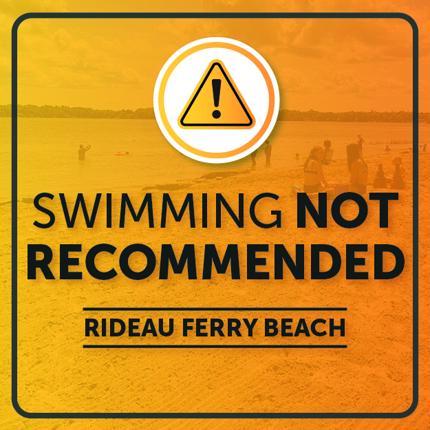
All residents need to be aware of the dangers around all waterbodies particularly children.
For water level and flow information in the Rideau system as well as the Ottawa River, visit the RVCA Streamflows and Water Levels webpage at http://his.rvca.ca/rvcafwl/ .
For more information about conditions on the Ottawa River, check the webpage of the Ottawa River Regulation Planning Board at http://ottawariver.ca/river-levels-flows.php#river-levels-flows-7-days .
Heavy Rains Forecast in Rideau River Watershed
Heavy rains forecast for Monday into Tuesday could cause rapid increases in water levels in small streams and raise rivers and lakes to above normal levels.
The Meteorological Service of Canada (MSC) has issued a Rainfall Warning that says “A slow moving upper disturbance over Lake Huron is expected to generate significant rainfall amounts over much of Eastern Ontario”. As much as 100 millimetres (mm) of rain is possible over a wide area.
A few days without rain provided some capacity for infiltration of the rain into the soil but that storage has been filled with water levels already on the rise from rainfall this morning. Levels will continue to increase throughout the day.
Flows in smaller streams could go over their banks with heavy localized rain in thunder storms. The rivers in the watershed are not expected to go to the onset of flooding but higher waters may affect navigation on lakes and rivers if normally visible hazards are submerged. Anyone boating on area lakes and rivers needs to be cautious and parents need to remind children of the risks of high levels in all waterbodies.
For water level and flow information in the Rideau system as well as the Ottawa River, visit the RVCA Streamflows and Water Levels webpage at http://his.rvca.ca/rvcafwl/ .
For more information about conditions on the Ottawa River, check the webpage of the Ottawa River Regulation Planning Board at http://ottawariver.ca/river-levels-flows.php#river-levels-flows-7-days.
Kindergarten Nature Program

Your Kindergarten class will be led through a series of age-appropriate, interactive activities suited to the season. Investigate what animals need to survive in different habitats through an outdoor scavenger hunt, get hands-on with animal pelts and skulls, and explore nature through fun play-based activities. Can be offered as a half-day or full-day program.
Above normal rain has received plenty of attention over recent weeks with close to a normal month worth of rain having fallen at several monitoring locations in the Rideau watershed in half the month of July. Most extreme is at the Ottawa Airport where 109 millimetres (mm) has fallen to date where 92 mm is the 30 year historical average. Normal precipitation on the watershed to mid-July is about 504 mm. This year, an average of 729 mm has been recorded.
After relatively high spring levels in April on Rideau watershed streams and lakes, rainfall has continued to keep levels above normal. The flow at the Rideau at Ottawa monitoring station reached about 160 cubic metres per second (cms) flow on July 3. The previous July highest recorded flow was 98 cms in 2008.
The Jock River has been unusually high compared to normal throughout the spring and early summer. The third peak of the year was also the highest on record for July, reaching 64 cms on July 3 as compared to 23 cms in July of 2009.
The snowmelt peak on Kemptville Creek of 56 cms on April 7 was below the highest recorded flow of 80 cms in 1972. The second peak on May 8, however, was about 45 cms, almost twice the previously recorded May high of 24 cms. Unlike what is ongoing on the Jock River, Kemptville Creek flows have not challenged previous records in July with relatively less rain falling in the headwater areas than in other locations in the watershed. Rainfall at the Brockville Airport climate station is at a surplus for the year to date of 52 mm with July rainfall
Similarly, recent July rains in the Tay River watershed have not been as heavy as in the Jock or Lower Rideau. The Rideau Canal reservoir lakes, Big Rideau, Upper Rideau, Wolfe and Bobs, are presently close to the respective targets. The outflow from Bobs Lake is still slightly above normal for the time of year. Fortunately, levels on Christie Lake are not being adversely affected unlike when close to 170 mm of rain was recorded at the monitoring station at Bobs Lake over the first week of May that did cause flooding issues on Christie Lake.
The impact of all the rain is obvious throughout the watershed with ponded water on many farm fields. Some golf courses and playing fields are unplayable. Residences and other buildings, some not close to a stream, are contending with saturated soils that are causing seepage through basement walls and floors.
Flows continue to be above normal throughout the watershed. July is typically a dry month, normal flow on the Jock River is about 1.7 cms but is well above that today at 30 cms. Rideau at Ottawa is about ten times normal for this date. Kemptville Creek is nine times normal. The Tay River flow in Perth is somewhat less at only twice normal. All flows will remain relatively high as long as the rain persists which is for the foreseeable future.
With the high flows in ditches and streams come slippery streambanks. Caution is needed and parents should advise their children of the danger.For water level and flow information in the Rideau system as well as the Ottawa River, visit the RVCA Streamflows and Water Levels webpage at http://his.rvca.ca/rvcafwl/ .
For more information about conditions on the Ottawa River, check the webpage of the Ottawa River Regulation Planning Board at http://ottawariver.ca/river-levels-flows.php#river-levels-flows-7-days .
RVCA Watershed Conditions Statements:
- Water Safety – High flows, unstable banks, melting ice or other factors that could be dangerous for recreational users such as anglers, canoeists, hikers, children, pets, etc. Flooding is not expected.
- Flood Outlook – Early notice of the potential for flooding based on weather forecasts, calling for heavy rain, snow melt, high winds or other conditions that could lead to high runoff, cause ice jams and/or lakeshore flooding or erosion.
- Flood Watch – Flooding is possible in specific watercourses or municipalities. Municipalities, emergency services and individuals in flood prone areas should prepare.
- Flood Warning – Flooding is imminent or already occurring in area watercourses.


Baxter Family Programs
Unfortunately, due to COVID-19, we will not be offering any family programs at Baxter in the summer of 2020. Please check back in the spring of 2021 for more information.