Super User
Local Conservation Authorities Support Recommendations in Ontario’s Independent Review of 2019 Flood Events
December 2, 2019 – Local Conservation Authorities are pleased with the findings of the independent review of the Spring 2019 flood. Retained by the Ontario Government, Special Advisor on Flooding Douglas NcNeil recognizes Ontario’s unique watershed-based Conservation Authority model and its success in minimizing flood risks and mitigating flood impacts.
Ottawa area Conservation Authorities (Mississippi, Rideau and South Nation) met with Mr. McNeil and other agencies in September to review the spring flood and discuss local experiences. Ideas were shared on how to improve protection of Ontario residents and their properties from flooding. The McNeil report contains 66 actions, and the three Conservation Authorities are pleased to see recommendations raised during those consultations in the report, including the need to:
- Update provincial guidance,
- Increase attention to floodplain mapping and the impacts of climate change,
- Conserve and restore green infrastructure like wetlands and forests that store water and reduce flooding, and
- Continue support for the role of Conservation Authorities in coordinating planning
and action.
Specifically, the report, available at ontario.ca/floodreport, encourages the Province to “consult with Conservation Authorities on their application of the natural hazards-based approach and the risk-based approach to managing flooding.”
Flood management is a shared responsibility among municipalities, emergency management officials, the Province, and Conservation Authorities. Authorities work closely with member municipalities to identify flood risk areas and to guide development activities outside of floodplains. The watershed-based approach has protected Ontarians for decades and has avoided millions in flood damages.
This approach has also built resilient communities that not only have flood control infrastructure but also important “green infrastructure” that reduces the impacts of climate change and flooding.
Local Conservation Authorities look forward to maintaining and improving flood management programs and are eager to assist the Province in implementing all of the recommendations outlined in the Flood Advisor’s report.
-End-
For more information:
Sally McIntyre, General Manager
Mississippi Valley Conservation Authority
613-253-0006 ext. 223
Sommer Casgrain-Robertson, General Manager
Rideau Valley Conservation Authority
613-692-3571 ext. 1214
Angela Coleman, General Manager
South Nation Conservation
613-984-2948
Stillwater Creek Stabilization Project
Stillwater Creek Slope Stabilization Project
RVCA was contracted by the City of Ottawa to design and implement remediation of an eroded bank of Stillwater Creek adjacent to Nautica Private and Carling Avenue and into the Ottawa River. Erosion of the slope is being caused by fluctuating flow and velocity in the creek and this project will help prevent potential slope failure.
 |
 |
|
| East Bank Erosion | East Bank Erosion |
The headwaters of Stillwater Creek begin in the National Capital Commission’s Stoney Swamp. Stoney Swamp is almost 2000 hectares in size, and is a mix of woodland, wetland and regenerating fields. From Stoney Swamp, Stillwater Creek runs through a heavily channelized and impacted area adjacent to Robertson Road. The creek turns into its natural morphology downstream of Robertson Road until the Highway 417 crossing. It then becomes channelized again, as it runs through Wesley Clover Park on Corkstown Road. The creek flows through another large wetland before Moodie Drive crossing, and from there runs parallel between Highway 417 and Corkstown Road until it turns north flowing through residential neighborhoods before emptying into the Ottawa River between the Nepean Sailing Club and Andrew Haydon Park.
The first phase to be completed is on the west bank of the creek in the treed area. The highlighted blue area is the East bank portion of the work to be completed as the second phase.
 |
| Map of the Work Area |
Further erosion of the bank of Stillwater Creek at Nautica Private could be detrimental to the properties on Nautica Private and to the safety of the residents.
Rock Toe Berm Construction
RVCA looked into multiple alternatives for the slope stabilization of the banks of Stillwater Creek. RVCA decided on the construction of a rock toe berm to stabilize the east bank of the creek. Once the design was complete, RVCA had it checked by a third-party local geotechnical engineering firm.
The rock toe berm has been designed to make a “key” at the base of the slope to be filled with large “rock protection” sized stones. The slope will then be backfilled at a 1.5:1 (h:v) slope and the large stones will extend above the creeks assumed 100-year flood elevation. The work is expected to protect the properties on Nautica Private from further property damage due to erosion.
Timing
The project took place from approximately December 2, 2019 – February 28, 2020.
Project Partners
City of Ottawa
Rideau Valley Conservation Authority
Information
Terry K. Davidson, P.Eng.
Director of Engineering & Regulations
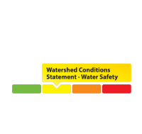
Current Watershed Conditions
-
Watershed Conditions Statement: Forecasted Precipitation to Increase Water Levels Across Rideau Valley Watershed
(WCS – R08/2024)
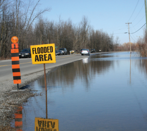
August 08, 2024 – The Rideau Valley Conservation Authority is issuing a WATER SAFETY message for the entire Rideau Valley Watershed.A low-pressure system associated with remnants of Tropical Storm Debby is expected to produce heavy rainfall throughout the region. Local estimates of 50 to 100 mm of rainfall are possible beginning Thursday evening and continuing into Friday. Despite above normal precipitation over the last month, stream flows have generally stabilized at normal seasonal levels.
Although riverine flooding is not anticipated at this time, all water levels and flows across the Rideau Valley Watershed are expected to increase. Depending on the location and rainfall intensity, localized flooding in low-lying areas, including ditches and stormwater features, may be possible. Flows on the Rideau River are not expected to increase significantly.
It is advised that residents adjacent to smaller tributaries and streams take precautionary measures to protect their property, including:
- Ensuring sump pumps are clear, in good working condition and have a backwater valve
- Ensuring easy access to a portable backup generator and pump
- Ensuring downspouts are clear and the outlet is at least 3 metres from the dwelling
- Securing items that might float away as flows increase
Until the water levels and flows recede, the RVCA advises the public to exercise extreme caution around ALL WATERBODIES and remind children about the dangers of playing near open water.
This watershed conditions statement is in effect until Friday, August 16, 2024 at 5 PM or until an update has been issued.
-end-
More Information:brian [DOT] stratton [AT] rvca [DOT] ca
Contact: Brian Stratton, RVCA Manager Engineering Services
Rideau Valley Conservation Authority
613-692-6804, 1-800-267-3504 ext. 1141
brian [DOT] stratton [AT] rvca [DOT] ca
www.rvca.ca/watershed-conditions"Rideau Valley Conservation Authority is a partnership of municipalities within the Rideau Valley watershed
created under the Conservation Authorities Act to deliver a range of programs in watershed management and
natural resource conservation."
RVCA Watershed Conditions Statements:
- Water Safety – High flows, unstable banks, melting ice or other factors that could be dangerous for recreational users such as anglers, canoeists, hikers, children, pets, etc. Flooding is not expected.
- Flood Outlook – Early notice of the potential for flooding based on weather forecasts, calling for heavy rain, snow melt, high winds or other conditions that could lead to high runoff, cause ice jams and/or lakeshore flooding or erosion.
- Flood Watch – Flooding is possible in specific watercourses or municipalities. Municipalities, emergency services and individuals in flood prone areas should prepare.
- Flood Warning – Flooding is imminent or already occurring in specific watercourses or municipalities.
Low Water Index
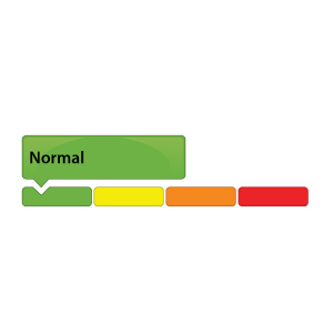
Our low water index has four stages:The RVCA issues water conditions statements to inform residents, municipalities and other stakeholders of changing water levels across the watershed.

A green gauge means conditions are normal. No low flow or drought conditions exist.

This category reflects concern.
80% to 60% of long-term average precipitation for 540 day and/or 90 day precipitation totals and/or 7-day average streamflows less than the 5 year return period low flow.

This category suggests a potentially serious problem is pending.
60% to 40% of long-term average precipitation for 540, 90 and/or 30 day precipitation totals and/or 7-day average streamflows less than the 10 year return period low flow.

This category indicates a failure of the water supply to meet demand.
Less than 40% of long-term average precipitation for 540, 90 and/or 30 day precipitation totals and/or 7-day average streamflows less than the 10 year return period low flow.
Click here for the RVCA's Watershed Conditions Statements.
Flood Index
Know the warning system
The RVCA issues water conditions statements to inform residents, municipalities and other stakeholders of changing water levels across the watershed.

A green gauge means conditions are normal.

A yellow Water Safety Statement means rivers could have high flows, unsafe banks, melting ice or other factors that could be dangerous. However, flooding is not expected.

A yellow Flood Outlook Statement is an early notice of the potential for flooding based on weather forecasts calling for heavy rain, snow melt, high wind or other conditions that could lead to high runoff, cause ice jams, lakeshore flooding or erosion.

An orange Flood Watch means flooding is possible in specific watercourses or municipalities. Municipalities, emergency services and individual landowners in flood-prone areas should prepare.

A red Flood Warning means flooding is imminent or already occurring in specific watercourses or municipalities.
Click here for the RVCA's Watershed Conditions Statements. Click here for RVCA real-time flows and water levels.
For water levels and flows on the Ottawa River visit the Ottawa River Regulation Planning Board
Before the Flood - Be Prepared
A flood is coming: What should you do?
If you live in a flood-prone area, the best thing you can do to keep your family and property safe is to make a plan and be prepared to follow it.
Each flood situation is unique, and your emergency plan should account for that – and be ready well in advance.
1. Know the warning system
The RVCA issues water conditions statements to inform residents, municipalities and other stakeholders of changing water levels across the watershed.
Click on a gauge for a larger image
GREEN: A green gauge means conditions are normal.
YELLOW: A yellow gauge can mean two things:
- A yellow Water Safety Statement means rivers could have high flows, unsafe banks, melting ice or other factors that could be dangerous. However, flooding is not expected.
- A yellow Flood Outlook Statement is an early notice of the potential for flooding based on weather forecasts calling for heavy rain, snow melt, high wind or other conditions that could lead to high runoff, cause ice jams, lakeshore flooding or erosion.
ORANGE: An orange Flood Watch means flooding is possible in specific watercourses or municipalities. Municipalities, emergency services and individual landowners in flood-prone areas should prepare.
RED: A red Flood Warning means flooding is imminent or already occurring in specific watercourses or municipalities.
2. Be prepared
- The first step to flood preparedness is knowing your risk level. Call an RVCA Resource Specialist to learn more about your property before flooding occurs.
- Subscribe to RVCA’s flood messages for regular updates and advanced warning of an impending flood. You can also stay informed through the RVCA website or our Facebook and Twitter pages.
- Learn about your municipality’s emergency plan: evacuation routes and locations for emergency shelters, as well as their sandbag program if they have one.
- Plan and practice an evacuation route with your family.
- Pack an emergency kit that can be accessed easily and carried quickly in case of evacuation; include any necessary medication, blankets, extra clothing and flashlights.
- Install a battery powered sump pump that can work in a blackout.
Learn more from Environment Canada's detailed flood preparation guide.
Frequently Asked Questions
Managing flood risks in the Rideau Valley
Conservation authorities have a broad mandate to protect their watersheds, which can include everything from tree planting to regulating development in the floodplain. Not surprisingly, many residents have questions about the role of conservation authorities in their lives, especially when it comes to floods.
Low Water Status Returned to “Normal” in Rideau River Watershed
October 30, 2019 —This statement is to advise that the “Minor Low Water” status in the Rideau Valley Watershed is returned to “Normal’ under the Ontario Low Water Response Program.
With several significant rainfall events occurring during the last two weeks, the average 90-day rainfall measured at climate stations in and around the Rideau Valley Watershed is well above 80 per cent of normal for this time of year, which is a key indicator for Minor Low Water status. In the past 30 days, average rainfall has been greater than 100 per cent of normal. Looking ahead, the seven-day weather forecasts suggests we’ll continue to experience more rain, including a large rainfall event tomorrow.
Water levels in some of the smaller rivers and streams across the watershed were well below normal prior the significant rainfall events noted above. These water levels have now begun to increase, and this trend is expected to continue based on the weather forecast.
Conservation Authority staff continue to monitor conditions and communicate with water managers throughout the watershed. Updates to this message will be issued as conditions warrant.
More resources:
Ministry of Environment and Climate Change: https://www.ontario.ca/page/managing-your-water-well-times-water-shortage
Ontario’s Low Water Response program: https://www.ontario.ca/page/low-water-response-program.
RVCA website: www.rvca.ca
Hourly and daily streamflows and water levels: https://www.rvca.ca/watershed-monitoring-reporting/reporting/streamflow-water-levels.
— end —
Hutton Creek Marsh getting makeover thanks to generous grant
October 22, 2019 – A provincially significant wetland will get a makeover this winter, thanks in part to a $55,000 grant from Wildlife Habitat Canada.
The Hutton Creek Marsh near Lombardy has become a monoculture: choked and overgrown with cattails, only 10 per cent of the marsh is now open water.
Crews will construct three 0.5 acre ponds and 500 metres of channels to help return the wetland to a healthier hemi-marsh state (50 per cent vegetation and 50 per cent open water).
This will provide new fish passages and areas for spawning and feeding, and will support critical life stages for amphibians, turtles and other wildlife. This healthier water-to-vegetation ratio is also ideal for waterfowl and would support the greatest biodiversity. Creating more open water will also restore local access for paddling, fishing and hunting.
Construction could begin as early as November. Crews will wait until the marsh has frozen to keep impacts to wildlife and water quality low.
This work is Phase 2 of a long-term project to bring the important wetland back to a more natural, productive state. In 2015, the nearby Motts Mills Dam was decommissioned and replaced with an earthen berm. In 2017, the Rideau Valley Conservation Authority (RVCA) lowered local water levels to help staff study the wetland and determine the best way to address the crowded cattails.
A dedicated group of local stakeholders made this project possible, including the RVCA, Ducks Unlimited Canada, Leeds and Grenville Stewardship Council and the United Counties of Leeds and Grenville (UCLG), which owns the property where the work will take place. Support of local residents has also been key to the project’s success.
The project is jointly funded by Wildlife Habitat Canada, Leeds and Grenville Stewardship Council, Ontario Federation of Anglers and Hunters Zone F, Ducks Unlimited Canada, UCLG, RVCA and the Rideau Valley Conservation Foundation.
The Wildlife Habitat Canada grant represents more than 40 per cent of the project’s total cost. The primary source of funding for the grant program is from the purchase of the Canadian Wildlife Habitat Conservation Stamp (Canadian Duck Stamp) by waterfowl hunters.
To learn more about how the Rideau Valley Conservation Foundation works to protect wetlands and waterways in the region, or to donate to the cause, visit www.rvcf.ca.
For more information about Motts Mills Conservation Area and the Hutton Marsh, visit https://www.rvca.ca/conservation-areas/no-fee-required/motts-mills-ca.
— end —