Super User
Support your backyard’s “secret superheroes” this summer

APRIL 25, 2019 - You probably know that bees and butterflies need our help – but do you know how easy it is?
Helping backyard pollinators can be as simple as planting a packet of native wildflower seeds in your backyard or on your balcony.
“That’s going to attract the pollinators, and once they pollinate the plants you’ll have more flowers,” said Amanda Lange, a resource technician with the Rideau Valley Conservation Authority (RVCA). “That in turn attracts more pollinators.”
Before you know it, you’ll have a backyard buzzing with activity and life.
Bees are the best-known pollinators, but they have lots of company. Native wildflowers – species that naturally occur in the region – attract flies, beetles, moths, butterflies and even some birds who all feed on the nectar of flowering plants, and in return help the plants reproduce. Without the right flowers to feed from, pollinators can quickly disappear. And without pollinators, the plants and crops that rely on them can also start to suffer.
“It’s a cycle. Everything’s connected,” Lange said.
Lange will represent the RVCA at the City of Ottawa’s Wildlife Speaker Series on April 26, which this spring will focus on the “secret superheroes” we rely on to pollinate not just our gardens but also important food crops and wild areas.
The event includes an hour-long vendor expo, where the RVCA and other environmental organizations will promote their stewardship and conservation programs. Afterward, two speakers will take the stage to discuss the important role pollinators play in our lives. Dr. Jessica Forrest, Associate Professor of Biology at the University of Ottawa, will discuss her research on the effects of climate change on pollination, the role of wild bees in crop pollination and the natural history of pollination. Dr. Jeff Skevington is a Research Scientist and the Head of Diptera (flies) at Agriculture and Agri-Food Canada’s Canadian National Collection of Insects in Ottawa. He will unofficially launch his new book, a ‘Field Guide to the Flower Flies (Hover Flies) of Northeastern North America’ at the event.
The free event runs from 6 to 9 p.m. at Ben Franklin Place at 101 Centrepoint Drive in Nepean.
How RVCA supports pollinators:
• Shoreline Naturalization Program replaces invasive species with native plants, and offers wildflower seeds and bee boxes for participants
• The “pollinator meadow” at Perth Wildlife Reserve Conservation Area buzzes with life every spring and summer
• City Stream Watch program in Ottawa removes invasive species to allow native plants to re-establish
• Wetland conservation projects involve planting native seed mixes that support pollinators.
For more information about RVCA’s programs and initiatives, visit www.rvca.ca. For more information about the city’s Wildlife Speaker Series visit tinyurl.com/wildlife-speaker-series.
-- end –
Wolfe Lake Scanlan Creek Fish Habitat Enhancement Project
Walleye spawn in the spring for one to two weeks, depending on water temperatures, and return to the same spawning site each year which means they have high site fidelity to their spawning areas. This project consisted of placing round river stone on the bed of Scanlan Creek to restore an impaired walleye spawning bed. This work will further enhance the productivity of the walleye that spawn in Scanlan Creek and return to Wolfe Lake. By restoring this spawning bed site to a functional riffle habitat we will improve the recruitment success of spawning walleye from Wolfe Lake.
Construction Phase
Two locations measuring five metres by 10 metres were determined to be in need of augmentation with appropriately-sized river stone. Staff and volunteers installed 100 tonnes of six-inch round river stone for walleye spawning on the bed of Scanlan Creek in the fall of 2019, when water levels were lower.
What are the anticipated outcomes?
- Create a greater awareness about the threats to the local walleye population and how simple costs effective measures can improve spawning success and recruitment.
- Engage with volunteers on Wolfe Lake and in the Westport area, building enthusiasm and environmental awareness while reinforcing a strong sense of community, particularly involving youth in the hands-on element of the project, providing them a valuable learning experience and opportunity to positively impact the world around them.
- Educate lake residents on how habitat enhancement efforts can improve the local walleye fishery on the lake.
- Promote the goodwill and partnerships formed through the enhancement project.
In order to implement this project a partnership was formed between the Wolfe Lake Association (WLA), the Westport Area Outdoor Association (WAOA), the Rideau Valley Conservation Authority (RVCA), Rideau Valley Conservation Foundation (RVCF), Camp IAWAH (Youth camp located on Wolfe Lake) and TD Friends of the Environment.

Information:

April 23, 2019 — The Rideau Valley Conservation Authority (RVCA), in conjunction with Mississippi Valley Conservation Authority (MVCA) and South Nation Conservation Authority (SNC) is maintaining our FLOOD WARNING issued on April 19, 2019 for the areas under our jurisdiction along the Ottawa River.
Significant rainfall has fallen over the Ottawa River basin since Thursday, April 18, 2019.
Warmer than forecasted temperatures were received Sunday and Monday. Additional rainfall of 15 to 50 mm is anticipated today and tomorrow in northern and central areas of the Ottawa River basin. Saturated soils, warm temperatures and precipitation received continues to increase snowmelt in the Ottawa River basin. Some snowpack remains in the western and northern areas of the basin.
All flood-prone areas along the Ottawa River from Lac Coulonge down to the Montreal Archipelago are at risk. Peak water levels across some areas of the Ottawa River are expected to be similar to those experienced in May 2017.
Levels will remain high for several days and will increase later this week due to forecasted precipitation and snowmelt runoff. Reservoirs throughout the basin are being used to store runoff and minimize flooding.
MVCA areas of concern:
Based on the most recent model outputs from the Ottawa River Regulation Committee (ORRC) and rainfall in the forecast, water levels in the Constance Bay area are projected to rise an additional 0.50 m to 0.60 m above the current elevation of 59.83 m over the next four days. Levels are currently forecast to be very close to those experienced at the height of the May 2017 flood. Updates to this projection will be provided as they become available.
RVCA areas of concern:
In Britannia (Grandview Road and the Belltown Community) water levels expected to increase an additional 0.50 m to 0.60 m above the current elevation of 59.83 m over the next four days. Levels are currently forecast to be very close to those experienced at the height of the May 2017 flood.
East of Cumberland Village (Boise Village, Morin Road, Leo Lane) water levels expected to increase an additional 0.40 m to 0.60 m above the current elevation over the next four days. Levels are currently forecast to be just below those experienced at the height of the May 2017 flood. Updates to this projection will be provided as they become available.
SNC areas of concern:
Water levels are expected to remain high along the Ottawa River for the next few days in Clarence-Rockland and Alfred-Plantagenet; current water elevation has peaked at 43.02m. Water levels are expected to increase rapidly later this week due to forecasted precipitation. Levels are expected to peak again on Monday, April 29, 2019 at 43.30m, slightly below peak levels observed during May 2017.
Due to the forecast uncertainty it is difficult to accurately predict how quickly water levels will rise and when river conditions may peak.
Residents in flood-prone areas are encouraged to closely follow evolving conditions and to take necessary measures. Residents are advised to stay away from watercourses where flows are high and where banks might be unstable. Parents are encouraged to explain dangers to children.
This FLOOD WARNING is in effect until Thursday, April 25, 2019.
The Rideau Valley Conservation Authority and its Ottawa partners, Mississippi Valley Conservation Authority and South Nation Conservation, monitor the water levels and weather forecasts with the Ministry of Natural Resources and Forestry as part of the Flood Forecasting and Warning Program. Updates are provided as conditions change.
The Ottawa River Regulation Planning Board will be reassessing forecast conditions and providing hydrological condition updates on its website daily at www.ottawariver.ca/forecast.php.
-end-
"Rideau Valley Conservation Authority is a partnership of municipalities within the Rideau Valley watershed created under the Conservation Authorities Act to deliver a range of programs in watershed management and natural resource conservation."
RVCA Watershed Conditions Statements:
- Water Safety – High flows, unstable banks, melting ice or other factors that could be dangerous for recreational users such as anglers, canoeists, hikers, children, pets, etc. Flooding is not expected.
- Flood Outlook – Early notice of the potential for flooding based on weather forecasts, calling for heavy rain, snow melt, high winds or other conditions that could lead to high runoff, cause ice jams and/or lakeshore flooding or erosion.
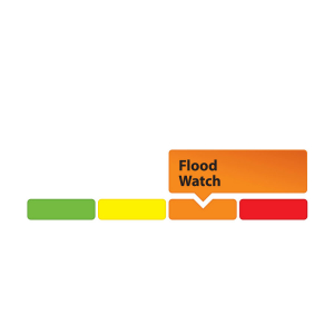
- Flood Watch – Flooding is possible in specific watercourses or municipalities. Municipalities, emergency services and individuals in flood-prone areas should prepare.
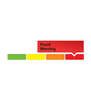
- Flood Warning – Flooding is imminent or already occurring in area watercourses.
April 23, 2019 — The Rideau Valley Conservation Authority (RVCA), in conjunction with Mississippi Valley Conservation Authority (MVCA) and South Nation Conservation Authority (SNC) is maintaining our FLOOD WARNING issued on April 19, 2019 for the areas under our jurisdiction along the Ottawa River.
Significant rainfall has fallen over the Ottawa River basin since Thursday, April 18, 2019.
Warmer than forecasted temperatures were received Sunday and Monday. Additional rainfall of 15 to 50 mm is anticipated today and tomorrow in northern and central areas of the Ottawa River basin. Saturated soils, warm temperatures and precipitation received continues to increase snowmelt in the Ottawa River basin. Some snowpack remains in the western and northern areas of the basin.
All flood-prone areas along the Ottawa River from Lac Coulonge down to the Montreal Archipelago are at risk. Peak water levels across some areas of the Ottawa River are expected to be similar to those experienced in May 2017.
Levels will remain high for several days and will increase later this week due to forecasted precipitation and snowmelt runoff. Reservoirs throughout the basin are being used to store runoff and minimize flooding.
MVCA areas of concern:
Based on the most recent model outputs from the Ottawa River Regulation Committee (ORRC) and rainfall in the forecast, water levels in the Constance Bay area are projected to rise an additional 0.50 m to 0.60 m above the current elevation of 59.83 m over the next four days. Levels are currently forecast to be very close to those experienced at the height of the May 2017 flood. Updates to this projection will be provided as they become available.
RVCA areas of concern:
In Britannia (Grandview Road and the Belltown Community) water levels expected to increase an additional 0.50 m to 0.60 m above the current elevation of 59.83 m over the next four days. Levels are currently forecast to be very close to those experienced at the height of the May 2017 flood.
East of Cumberland Village (Boise Village, Morin Road, Leo Lane) water levels expected to increase an additional 0.40 m to 0.60 m above the current elevation over the next four days. Levels are currently forecast to be just below those experienced at the height of the May 2017 flood. Updates to this projection will be provided as they become available.
SNC areas of concern:
Water levels are expected to remain high along the Ottawa River for the next few days in Clarence-Rockland and Alfred-Plantagenet; current water elevation has peaked at 43.02m. Water levels are expected to increase rapidly later this week due to forecasted precipitation. Levels are expected to peak again on Monday, April 29, 2019 at 43.30m, slightly below peak levels observed during May 2017.
Due to the forecast uncertainty it is difficult to accurately predict how quickly water levels will rise and when river conditions may peak.
Residents in flood-prone areas are encouraged to closely follow evolving conditions and to take necessary measures. Residents are advised to stay away from watercourses where flows are high and where banks might be unstable. Parents are encouraged to explain dangers to children.
This FLOOD WARNING is in effect until Thursday, April 25, 2019.
The Rideau Valley Conservation Authority and its Ottawa partners, Mississippi Valley Conservation Authority and South Nation Conservation, monitor the water levels and weather forecasts with the Ministry of Natural Resources and Forestry as part of the Flood Forecasting and Warning Program. Updates are provided as conditions change.
The Ottawa River Regulation Planning Board will be reassessing forecast conditions and providing hydrological condition updates on its website daily at www.ottawariver.ca/forecast.php.
"Rideau Valley Conservation Authority is a partnership of municipalities within the Rideau Valley watershed created under the Conservation Authorities Act to deliver a range of programs in watershed management and natural resource conservation."
RVCA Watershed Conditions Statements:
- Water Safety – High flows, unstable banks, melting ice or other factors that could be dangerous for recreational users such as anglers, canoeists, hikers, children, pets, etc. Flooding is not expected.
- Flood Outlook – Early notice of the potential for flooding based on weather forecasts, calling for heavy rain, snow melt, high winds or other conditions that could lead to high runoff, cause ice jams and/or lakeshore flooding or erosion.
- Flood Watch – Flooding is possible in specific watercourses or municipalities. Municipalities, emergency services and individuals in flood-prone areas should prepare.
- Flood Warning – Flooding is imminent or already occurring in area watercourses.
April 23, 2019 – Rainfall amounts close to 50 mm fell over much of the Rideau Valley Watershed between last Thursday through Saturday. This rain resulted in increased water levels and flows across the watershed over the Easter weekend. Conditions have now stabilized and water levels and flows are declining in all areas. The current forecast is calling for 10 to 20 mm of rain starting this evening and into Wednesday. The forecasted rain is not expected to significantly increase water levels or flows.
At this time, a FLOOD WATCH is being issued for properties around Bob’s Lake and Christie Lake, as these lakes are at capacity and although the water level increases are now almost stabilized, the water levels may still increase with the forecasted rain.
The FLOOD WARNING issued last week (April 17, 2019) for the following areas is now over:
- Properties around Bob’s Lake, Christie Lake and Tay River in the upper Rideau Valley Watershed.
- Properties around Wolfe Lake in the upper Rideau Valley Watershed.
- Properties around the smaller creeks and streams in the lower Rideau Valley Watershed, including the low-lying roads and waterfront properties adjacent to the Jock River (near Richmond) and Stevens Creek (near North Gower), and any connected creeks or ditches.
- Properties around the Long Reach (Burritts Rapids to Kars) of the Rideau River.
The FLOOD WATCH issued last week (April 17, 2019) for the following areas is now over:
- Properties around Big Rideau Lake
- Properties along the Rideau River from Smiths Falls through Burritts Rapids
- Streets and parkland along the Rideau River on Belmont Avenue, on Rideau River Drive at Belmont Avenue, Windsor Park and Brantwood Park
Extreme caution should be exercised by everyone when near local waterbodies. Parents should inform their children of the risks and provide appropriate supervision.
Residents in flood prone or low-lying areas, historically susceptible to flooding, should continue to take the necessary precautions to protect their property, such as:
- Ensuring sump pump is clear, in good working condition and has a backwater valve
- Ensuring easy access to a portable backup generator and pump
- Ensuring downspouts are clear and the outlet is at least 3 metres from the dwelling
- Securing items that might float away as flows increase
- Removing valuable items from basements or lower floors that could be subject to flooding
- Keeping emergency phone numbers handy
- Familiarizing yourself with your municipality’s Emergency Preparedness Plan
This watershed conditions statement is in effect until Monday April 29, 2019 and will be updated at that time unless the forecast or conditions change.
-end-
More Information:
Brian Stratton, RVCA Manager Engineering Services
Rideau Valley Conservation Authority
613-692-6804, 1-800-267-3504 ext. 1141
or cell 613-799-9423
Media Enquiries:
Diane Downey, RVCA Director of Communications and Outreach
Rideau Valley Conservation Authority
613-692-3571, 1-800-267-3504 ext. 1126
or cell 613-698-9453
"Rideau Valley Conservation Authority is a partnership of municipalities within the Rideau Valley watershed created under the Conservation Authorities Act to deliver a range of programs in watershed management and natural resource conservation."
RVCA Watershed Conditions Statements:
- Water Safety – High flows, unstable banks, melting ice or other factors that could be dangerous for recreational users such as anglers, canoeists, hikers, children, pets, etc. Flooding is not expected.
- Flood Outlook – Early notice of the potential for flooding based on weather forecasts, calling for heavy rain, snow melt, high winds or other conditions that could lead to high runoff, cause ice jams and/or lakeshore flooding or erosion.
- Flood Watch – Flooding is possible in specific watercourses or municipalities. Municipalities, emergency services and individuals in flood-prone areas should prepare.
- Flood Warning – Flooding is imminent or already occurring in area watercourses.

APRIL 21, 2019 OTTAWA RIVER FROM ARNPRIOR TO L'ORIGINAL — The Rideau Valley Conservation Authority (RVCA), in conjunction with the Mississippi Valley Conservation Authority (MVCA) and South Nation Conservation (SNC) is maintaining our FLOOD WARNING issued on April 19, 2019 for the areas under our jurisdiction along the Ottawa River.
The latest model run for the Ottawa River indicates that some areas of the Ottawa River are expected to peak today while others will be closer to the end of the week.
There is additional rain expected over the northern portion of the watershed that could impact levels and flows later in the week.
All flood-prone areas along the Ottawa River from Lac Coulonge down to the Montreal Archipelago are at risk.
MVCA areas of concern: Based on the most recent model outputs from the Ottawa River Regulation Committee (ORRC), water levels in the Constance Bay area are projected to rise an additional 0.40 m above the current elevation over the next seven days. Levels are currently forecast to be about 0.40 m below those experienced at the height of the May 2017 flood. Updates to this projection will be provided as they become available.
RVCA areas of concern: Water levels from Britannia to Cumberland are expected to increase an additional 0.40 m above the current elevation over the next seven days. Levels are currently forecast to be about 0.25 m below those experienced at the height of the May 2017 flood. Updates to this projection will be provided as they become available.
SNC areas of concern: Water levels are expected to continue to be elevated along the Ottawa River in Clarence-Rockland and Alfred-Plantagenet and are projected to peak today at 42.95 m. Areas previously affected by the May 2017 flood are at greatest risk.
Due to the forecast uncertainty it is difficult to accurately predict how quickly water levels will rise and when river conditions may peak.
Residents in flood-prone areas are encouraged to closely follow evolving conditions and to take necessary measures. Residents are advised to stay away from watercourses where flows are high and where banks might be unstable. Parents are encouraged to explain these dangers to their children.
This FLOOD WARNING is in effect until Monday, April 22, 2019.
RVCA and its Ottawa partners, MVCA and SNC monitor the water levels and weather forecasts with the Ministry of Natural Resources and Forestry as part of the Flood Forecasting and Warning Program. Updates are provided as conditions change.
The Ottawa River Regulation Planning Board will be reassessing forecast conditions and providing hydrological condition updates on its website daily at www.ottawariver.ca/forecast.php.
-end-
"Rideau Valley Conservation Authority is a partnership of municipalities within the Rideau Valley watershed created under the Conservation Authorities Act to deliver a range of programs in watershed management and natural resource conservation."
RVCA Watershed Conditions Statements:
- Water Safety – High flows, unstable banks, melting ice or other factors that could be dangerous for recreational users such as anglers, canoeists, hikers, children, pets, etc. Flooding is not expected.
- Flood Outlook – Early notice of the potential for flooding based on weather forecasts, calling for heavy rain, snow melt, high winds or other conditions that could lead to high runoff, cause ice jams and/or lakeshore flooding or erosion.
- Flood Watch – Flooding is possible in specific watercourses or municipalities. Municipalities, emergency services and individuals in flood-prone areas should prepare.
- Flood Warning – Flooding is imminent or already occurring in area watercourses.

APRIL 21, 2019, The Rideau Valley Conservation Authority (RVCA), in conjunction with the Mississippi Valley Conservation Authority (MVCA) and South Nation Conservation (SNC) is maintaining our FLOOD WARNING issued on April 19, 2019 for the areas under our jurisdiction along the Ottawa River.
The latest model run for the Ottawa River indicates that some areas of the Ottawa River are expected to peak today while others will be closer to the end of the week.
There is additional rain expected over the northern portion of the watershed that could impact levels and flows later in the week.
All flood-prone areas along the Ottawa River from Lac Coulonge down to the Montreal Archipelago are at risk.
MVCA areas of concern: Based on the most recent model outputs from the Ottawa River Regulation Committee (ORRC), water levels in the Constance Bay area are projected to rise an additional 0.40 m above the current elevation over the next seven days. Levels are currently forecast to be about 0.40 m below those experienced at the height of the May 2017 flood. Updates to this projection will be provided as they become available.
RVCA areas of concern: Water levels from Britannia to Cumberland are expected to increase an additional 0.40 m above the current elevation over the next seven days. Levels are currently forecast to be about 0.25 m below those experienced at the height of the May 2017 flood. Updates to this projection will be provided as they become available.
SNC areas of concern: Water levels are expected to continue to be elevated along the Ottawa River in Clarence-Rockland and Alfred-Plantagenet and are projected to peak today at 42.95 m. Areas previously affected by the May 2017 flood are at greatest risk.
Due to the forecast uncertainty it is difficult to accurately predict how quickly water levels will rise and when river conditions may peak.
Residents in flood-prone areas are encouraged to closely follow evolving conditions and to take necessary measures. Residents are advised to stay away from watercourses where flows are high and where banks might be unstable. Parents are encouraged to explain these dangers to their children.
This FLOOD WARNING is in effect until Monday, April 22, 2019.
RVCA and its Ottawa partners, MVCA and SNC monitor the water levels and weather forecasts with the Ministry of Natural Resources and Forestry as part of the Flood Forecasting and Warning Program. Updates are provided as conditions change.
The Ottawa River Regulation Planning Board will be reassessing forecast conditions and providing hydrological condition updates on its website daily at www.ottawariver.ca/forecast.php.
-end-
"Rideau Valley Conservation Authority is a partnership of municipalities within the Rideau Valley watershed created under the Conservation Authorities Act to deliver a range of programs in watershed management and natural resource conservation."
RVCA Watershed Conditions Statements:
- Water Safety – High flows, unstable banks, melting ice or other factors that could be dangerous for recreational users such as anglers, canoeists, hikers, children, pets, etc. Flooding is not expected.
- Flood Outlook – Early notice of the potential for flooding based on weather forecasts, calling for heavy rain, snow melt, high winds or other conditions that could lead to high runoff, cause ice jams and/or lakeshore flooding or erosion.
- Flood Watch – Flooding is possible in specific watercourses or municipalities. Municipalities, emergency services and individuals in flood-prone areas should prepare.
- Flood Warning – Flooding is imminent or already occurring in area watercourses.
Flood Warning -- Ottawa River - Arnprior to L'Original

APRIL 19, 2019 OTTAWA RIVER FROM ARNPRIOR TO L'ORIGINAL — The Rideau Valley Conservation Authority (RVCA), in conjunction with the Mississippi Valley Conservation Authority (MVCA) and South Nation Conservation Authorities (SNC) is issuing a FLOOD WARNING for the areas under our jurisdiction along the Ottawa River.
Significant rainfall (20 to 40 mm) has fallen over the Ottawa River basin since Thursday and an additional 20 to 35 mm of rain is expected by Saturday evening.
The current snowpack throughout much of the Ottawa River basin remains at twice its normal depth for this time of the year. Soils are saturated and warm temperatures and rain are contributing to some snow melt.
The Ottawa River Regulating Committee (ORRC) warns that levels and flows on the Ottawa River from Lac Coulonge down to the Montreal region have begun to rise extremely rapidly due to forecast rainfall and snowmelt runoff. Flooding is already occurring in low lying areas around Britannia and Thurso and is expected to continue to rise throughout the weekend.
Forecasted precipitation and warmer temperatures will melt a large portion of the remaining snowpack in the central areas of the basin. Rainfall and snowmelt will combine to produce very high runoff, causing levels to continue rise sharply on the Ottawa River throughout the weekend.
All flood-prone areas along the Ottawa River from Lac Coulonge down to the Montreal Archipelago are at risk.
MVCA areas of concern: Based on model outputs from the ORRC, water levels in the Constance Bay area are projected to rise .75 m above the current elevation over the next four days. Updates to this projection will be provided as they become available.
RVCA areas of concern: Water levels from Britannia to Cumberland are expected to continue to rise and are forecasted to peak in the next four days. Areas previously affected by the May 2017 flood are at greatest risk.
SNC areas of concern: Water levels are expected to continue to rise along the Ottawa River in Clarence-Rockland and Alfred-Plantagenet and are projected to rise 1.0 m above the current elevation over the next 4 days, by April 23. Areas previously affected by the May 2017 flood are at greatest risk.
Due to the forecast uncertainty it is difficult to accurately predict how quickly water levels will rise and when river conditions may peak.
Residents in flood-prone areas are encouraged to closely follow evolving conditions and to take necessary measures. Residents are advised to stay away from watercourses where flows are high and where banks might be unstable. Parents are encouraged to explain these dangers to their children.
This FLOOD WARNING is in effect until Sunday, April 21, 2019.
Rideau Valley Conservation Authority (RVCA) and its Ottawa partners, Mississippi Valley Conservation Authority and South Nation Conservation monitor the water levels and weather forecasts with the Ministry of Natural Resources and Forestry as part of the Flood Forecasting and Warning Program. Updates are provided as conditions change.
The Ottawa River Regulation Planning Board will be reassessing forecast conditions and providing hydrological condition updates on its website daily at www.ottawariver.ca/forecast.php.
-end-
"Rideau Valley Conservation Authority is a partnership of municipalities within the Rideau Valley watershed created under the Conservation Authorities Act to deliver a range of programs in watershed management and natural resource conservation."
RVCA Watershed Conditions Statements:
- Water Safety – High flows, unstable banks, melting ice or other factors that could be dangerous for recreational users such as anglers, canoeists, hikers, children, pets, etc. Flooding is not expected.
- Flood Outlook – Early notice of the potential for flooding based on weather forecasts, calling for heavy rain, snow melt, high winds or other conditions that could lead to high runoff, cause ice jams and/or lakeshore flooding or erosion.
- Flood Watch – Flooding is possible in specific watercourses or municipalities. Municipalities, emergency services and individuals in flood-prone areas should prepare.
- Flood Warning – Flooding is imminent or already occurring in area watercourses.
Flood Warning -- Ottawa River - Arnprior to L'Original

APRIL 19, 2019 OTTAWA RIVER FROM ARNPRIOR TO L'ORIGINAL —
The Rideau Valley Conservation Authority (RVCA), in conjunction with the Mississippi Valley Conservation Authority (MVCA) and South Nation Conservation Authorities (SNC) is issuing a FLOOD WARNING for the areas under our jurisdiction along the Ottawa River.
Significant rainfall (20 to 40 mm) has fallen over the Ottawa River basin since Thursday and an additional 20 to 35 mm of rain is expected by Saturday evening.
The current snowpack throughout much of the Ottawa River basin remains at twice its normal depth for this time of the year. Soils are saturated and warm temperatures and rain are contributing to some snow melt.
The Ottawa River Regulating Committee (ORRC) warns that levels and flows on the Ottawa River from Lac Coulonge down to the Montreal region have begun to rise extremely rapidly due to forecast rainfall and snowmelt runoff. Flooding is already occurring in low lying areas around Britannia and Thurso and is expected to continue to rise throughout the weekend.
Forecasted precipitation and warmer temperatures will melt a large portion of the remaining snowpack in the central areas of the basin. Rainfall and snowmelt will combine to produce very high runoff, causing levels to continue rise sharply on the Ottawa River throughout the weekend.
All flood-prone areas along the Ottawa River from Lac Coulonge down to the Montreal Archipelago are at risk.
MVCA areas of concern: Based on model outputs from the ORRC, water levels in the Constance Bay area are projected to rise .75 m above the current elevation over the next four days. Updates to this projection will be provided as they become available.
RVCA areas of concern: Water levels from Britannia to Cumberland are expected to continue to rise and are forecasted to peak in the next four days. Areas previously affected by the May 2017 flood are at greatest risk.
SNC areas of concern: Water levels are expected to continue to rise along the Ottawa River in Clarence-Rockland and Alfred-Plantagenet and are projected to rise 1.0 m above the current elevation over the next 4 days, by April 23. Areas previously affected by the May 2017 flood are at greatest risk.
Due to the forecast uncertainty it is difficult to accurately predict how quickly water levels will rise and when river conditions may peak.
Residents in flood-prone areas are encouraged to closely follow evolving conditions and to take necessary measures. Residents are advised to stay away from watercourses where flows are high and where banks might be unstable. Parents are encouraged to explain these dangers to their children.
This FLOOD WARNING is in effect until Sunday, April 21, 2019.
Rideau Valley Conservation Authority (RVCA) and its Ottawa partners, Mississippi Valley Conservation Authority and South Nation Conservation monitor the water levels and weather forecasts with the Ministry of Natural Resources and Forestry as part of the Flood Forecasting and Warning Program. Updates are provided as conditions change.
The Ottawa River Regulation Planning Board will be reassessing forecast conditions and providing hydrological condition updates on its website daily at www.ottawariver.ca/forecast.php.
-end-
"Rideau Valley Conservation Authority is a partnership of municipalities within the Rideau Valley watershed created under the Conservation Authorities Act to deliver a range of programs in watershed management and natural resource conservation."
RVCA Watershed Conditions Statements:
- Water Safety – High flows, unstable banks, melting ice or other factors that could be dangerous for recreational users such as anglers, canoeists, hikers, children, pets, etc. Flooding is not expected.
- Flood Outlook – Early notice of the potential for flooding based on weather forecasts, calling for heavy rain, snow melt, high winds or other conditions that could lead to high runoff, cause ice jams and/or lakeshore flooding or erosion.
- Flood Watch – Flooding is possible in specific watercourses or municipalities. Municipalities, emergency services and individuals in flood-prone areas should prepare.
- Flood Warning – Flooding is imminent or already occurring in area watercourses.