Super User
Conservation Authorities seek public input on updated development policies and wetland mapping in Eastern Ontario
EASTERN ONTARIO, June 7, 2024 – South Nation Conservation (SNC), Rideau Valley Conservation Authority (RVCA) and the Raisin Region Conservation Authority (RRCA) are welcoming public input on updated development policies and wetland mapping used in Conservation Authority permitting.
On April 1, 2024, the Government of Ontario replaced individual Conservation Authority Regulations under Section 28 of the Conservation Authorities Act, with Ontario Regulation 41/24: Prohibited Activities, Exemptions and Permits. This update requires Conservation Authorities to regulate development activities within 30 metres of all wetlands, as defined by the new regulation.
Conservation Authority staff have completed draft updates to policies, procedures and mapping in response to these provincial changes. Watershed residents are invited to schedule individual meetings (in-person or virtual) or attend an upcoming public open house to learn more about proposed development policy updates and wetland mapping.
|
Civitan Club of Perth |
R.J. Kennedy Community Centre |
|
RVCA Administrative Office |
SNC Administrative Office |
Wetlands provide significant ecosystem services and benefits including flood attenuation,
erosion protection, groundwater recharge, filtration of drinking water supplies, wildlife refuge,
and forest cover, as well as recreational, educational, and research opportunities. Wetlands are
also usually associated with unstable, organic soils and not always suited to development.
The Conservation Authority partners have regulated development activities within Provincially Significant Wetlands and certain Locally Significant Wetlands since 2006. With the new provincial regulation, most wetlands will now be regulated, however, the buffer around them where a development permit is required has been reduced from 120 metres to 30 metres.
“We recognize the important role of wetlands for the environment and our communities,” said SNC Managing Director, John Mesman. “We will work closely with property owners looking to develop their properties to help confirm wetland boundaries to ensure that future development is sustainable and protects the integrity of wetland habitat.”
“Many of the wetlands in our region connect to major waterways and are found within our Natural Heritage Systems,” said RRCA General Manager Alison McDonald. “These areas provide important natural cover, wildlife habitat, and mitigate the impacts of climate change, including flooding and drought.”
“Having updated policies and wetland mapping that reflects the new legislation will also streamline approvals and standardize approaches,” said RVCA General Manager Sommer Casgrain-Robertson. “Policies and mapping are used by staff, municipalities, and property owners to ensure that development is undertaken in a way that protects people and their property from natural hazards while also protecting wetlands and watercourses.
Policy information, draft maps and meeting request links are available online:
- SNC: nation.on.ca/consultations
- RVCA: rvca.ca/regulations-planning
- RRCA: rrca.on.ca/permits
Conservation Authorities work on behalf of their member municipalities to help manage, conserve and restore natural resources and guide sustainable development activities through permitting.
Through acquiring ecologically significant property, managing conservation lands, permitting sustainable development, and providing technical advice and cost-share funding for habitat improvement projects, there are a variety of ways to help improve wetlands and biodiversity within the region. Residents interested in learning more about land donations and project funding are encouraged to contact their local Conservation Authority.
FOR MORE INFORMATION:
South Nation Conservation
Erin Thorne, Communications Specialist,
1-877-984-2948 | .
Rideau Valley Conservation Authority
Diane Downey, Director, Communications and Outreach,
1-800-257-3504, ext.1126 | .
Raisin Region Conservation Authority
Lisa Van De Ligt, Team Lead, Communications and Stewardship,
613-938-3611 ext. 223 | .
- end -
Les offices de protection de la nature sollicitent l'avis du public sur la mise à jour des politiques de développement et de la cartographie des zones humides dans l'Est de l'Ontario
EST DE L'ONTARIO, le 7 juin 2024 : La Conservation de la Nation Sud (CNS), l'Office de protection de la nature de la vallée Rideau (RVCA) et l'Office de protection de la nature de la région Raisin (RRCA) accueillent les commentaires du public sur la mise à jour des politiques de développement et de la cartographie des zones humides dans l'Est de l'Ontario. Les politiques de développement et la cartographie des zones humides sont utilisées dans les permis délivrés par les offices de protection de la nature.
Le 1er avril 2024, le gouvernement de l'Ontario a remplacé les différents règlements des offices de protection de la nature en vertu de l'article 28 de la Loi sur les offices de protection de la nature par le Règlement de l'Ontario 41/24 : Activités interdites, exemptions et permis. Cette mise à jour exige que les offices de protection de la nature réglementent les activités d'aménagement dans un rayon de 30 mètres de toutes les terres humides, tel que défini par le nouveau règlement.
Le personnel de l'Office de protection de la nature a terminé l'ébauche de mises à jour des politiques, des procédures et de la cartographie en réponse à ces changements provinciaux. Les résidents du bassin versant sont invités à planifier des réunions individuelles (en personne ou virtuellement) ou à assister à une prochaine journée portes ouvertes pour en savoir plus sur les mises à jour proposées des politiques de développement et de la cartographie des zones humides.
|
Club Civitan de Perth |
Centre communautaire RJ Kennedy |
|
Bureau administratif de RVCA |
Bureau administratif de la CNS |
Les zones humides fournissent d'importants services et avantages écosystémiques, notamment l'atténuation des inondations, la protection contre l'érosion, la recharge des eaux souterraines, la filtration des réserves d'eau potable, les refuges fauniques, et le couvert forestier, ainsi que des opportunités de loisirs, d'éducation et de recherche. Les zones humides sont également généralement associées à des sols organiques instables et pas toujours adaptés au développement.
Les partenaires de l'Office de protection de la nature réglementent les activités de développement dans les zones humides d'importance provinciale et dans certaines zones humides d'importance locale depuis 2006. Avec la nouvelle réglementation provinciale, la plupart des zones humides seront désormais réglementées, cependant, la zone tampon autour d'elles où un permis d'aménagement est requis a été réduite de 120 mètres à 30 mètres.
« Nous reconnaissons le rôle important des zones humides pour l'environnement et nos communautés », a déclaré John Mesman, directeur, Terres protégées, de la CNS. « Nous travaillerons en étroite collaboration avec les propriétaires fonciers qui cherchent à développer leurs propriétés pour aider à confirmer les limites des zones humides afin de garantir que le développement futur soit durable et protège l'intégrité. d’habitats de zones humides.
« De nombreuses zones humides de notre région sont reliées aux principaux cours d'eau et se trouvent au sein de nos systèmes de patrimoine naturel », a déclaré la directrice générale de la RRCA, Alison McDonald. « Ces zones fournissent une couverture naturelle importante, un habitat faunique et atténuent les impacts du changement climatique, notamment les inondations et la sécheresse. »
« La mise à jour des politiques et de la cartographie des zones humides qui reflètent la nouvelle législation rationalisera également les approbations et normalisera les approches », a déclaré Sommer Casgrain-Robertson, directrice générale de RVCA. « Les politiques et la cartographie sont utilisées par le personnel, les municipalités et les propriétaires fonciers pour garantir que le développement est entrepris de manière à protéger les personnes et leurs propriétés contre les risques naturels, tout en protégeant les zones humides et les cours d'eau.
Des informations politiques, des projets de cartes et des liens de demande de réunion sont disponibles en ligne :
- CNS : nation.on.ca/fr/développement/consultations-publiques
- RVCA : rvca.ca/regulations-planning
- RRCA : rrca.on.ca/permits
Les offices de protection de la nature travaillent au nom de leurs municipalités membres pour aider à gérer, conserver et restaurer les ressources naturelles et guider les activités de développement durable au moyen de permis.
En acquérant des propriétés d'importance écologique, en gérant des terres protégées, en permettant le développement durable et en fournissant des conseils techniques et un financement à frais partagés pour des projets d'amélioration de l'habitat, il existe diverses façons d'aider à améliorer les zones humides et la biodiversité dans la région. Les résidents souhaitant en savoir plus sur les dons de terres et le financement de projets sont encouragés à contacter leur office de protection de la nature local.
POUR PLUS D'INFORMATIONS :
Conservation de la Nation Sud
Erin Thorne, spécialiste des communications
1-877-984-2948 |
Office de protection de la nature de la vallée Rideau
Diane Downey, directrice des communications et de la sensibilisation
1-800-257-3504, poste 200. 1126 |
Office de protection de la nature de la région Raisin
Lisa Van De Ligt, chef d'équipe, Communications et intendance
613-938-3611 ext. 223 |
- fin -
Public Consultation
The RVCA holds public consultation periods for numerous watershed projects. Any active public consultation periods will be posted below.
RIDEAU VALLEY, June 3, 2024 – In many ways, 2023 was the Year of the Bridge for the Rideau Valley Conservation Authority.
In its recently released annual report, it’s clear that 2023 was an extremely busy and productive year for all departments as they built bridges both real and figurative across the watershed.
In the most literal sense, staff completed the construction of two much-needed accessible pedestrian bridges at Baxter Conservation Area and Chapman Mills Conservation Areas, which will benefit the community for decades to come.
But staff also spent time connecting with valued partners, expanding their knowledge of the watershed and ensuring the RVCA’s services remain relevant, valuable and accessible to everyone who calls the Rideau Valley home.
Throughout 2023, RVCA staff:
- Welcomed more than 8,100 students to outdoor education programs at Baxter and Foley Mountain conservation areas;
- Planted 214,030 trees in partnership with private landowners, with $484,000 in external grant support;
- Funded 211 clean water projects on rural and farm properties, providing $642,935 in landowner grants;
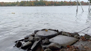
- Naturalized 1,719 metres of shoreline with more than 9,300 native plants, including more than 1,000 planted at Last Duel Park in Perth;
- Sampled 39 lakes and 119 stream sites for surface water quality;
- Surveyed 361 stream sections to assess aquatic habitat conditions;
- Completed a once-in-a-decade Watershed Conditions Report to bridge the gap between data collection and scientific analysis;
- Began data collection for new flood mapping on several upper watershed lakes and initiated the development of a new hydrologic model of the watershed;
- Accepted 199 hectares of conservation land donations from local landowners;
- Processed 319 Section 28 permit applications (with 98% approved or on hold), issuing decisions for all but 2 within provincial timelines;
- Reviewed 1,952 planning applications, providing natural hazard comments to municipalities;
- Processed 944 septic permit applications (usually within half the provincial timeline) and re-inspected 651 septic systems around lakes.
“I am so proud of our staff as they continue to provide quality conservation services to our watershed municipalities, residents and partners,” said RVCA General Manager Sommer Casgrain-Robertson. “We are committed to bringing value and expertise to all of our partners, and 2023 was a great example of that.”
To read the full report online visitwww.rvca.ca or contact the front desk at 613-692-3571 to request a hard copy.
RVCA is one of Ontario’s 36 Conservation Authorities responsible for furthering the conservation, restoration, development and management of natural resources in the watershed. Through the provincial Conservation Authorities Act, the RVCA is responsible for protecting people and property from natural hazards like flooding and erosion and managing natural resources within the Rideau Valley.
Learn more at www.rvca.ca.
-30-
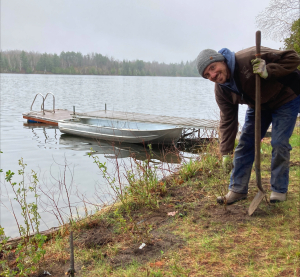
RIDEAU VALLEY, May 28, 2024 – With this year’s spring planting behind us, now’s the time to secure your spot for the 2025 season. Whether you want to plant trees on your idle or marginal land or plant shrubs to naturalize your shoreline, RVCA is now booking site visits to get the process started.
The Rideau Valley Conservation Authority (RVCA) offers generous grants to help landowners protect and enhance the watershed’s natural resources: tree planting is subsidized to between $0.15 and $0.40 per tree, while shoreline naturalization costs may be covered up to 90%.
Tree planting and shoreline naturalization projects support a thriving watershed by slowing down and filtering stormwater runoff, reducing erosion, mitigating floods and storing carbon to reduce the impacts of climate change. And there are benefits for the landowners, too: depending on the project, they may see reduced property maintenance, increased privacy, lower heating and cooling costs, fewer nuisance geese and increased property value.
“It’s really a win-win for everyone,” said RVCA Forestry Manager Ian Cochrane. “These projects become a legacy that landowners can gift to the next generation in the form of a clean environment, thriving biodiversity and a beautiful natural place to visit.”
The RVCA plants more than 200,000 native trees across the Mississippi and Rideau Valley watersheds every year, and approximately 10,000 native shoreline trees, shrubs and flowers around Rideau Valley lakes and rivers.
Site visits ensure eligibility and will allow staff to craft a custom planting plan to suit your needs. Once your project is booked, staff will order the plants and work towards the 2025 spring planting season. Staff will also return for several years to ensure the survival of your project and refill where necessary.
To book a tree planting site visit contact Ian Cochrane at . To book a shoreline naturalization site visit contact Meaghan McDonald at .
Tree Planting Eligibility:
Our large-scale tree planting program is available to all landowners in the Rideau Valley and Mississippi Valley watersheds, provided they meet minimum planting requirements. Outside the City of Ottawa, landowners must have at least 1.25 acres of suitable land and must order at least 1,000 trees. Within the City of Ottawa’s portion of the MVCA and RVCA watersheds, tree planting minimums have been lowered to 500 trees for 2025. This means Ottawa properties with 0.62 acres (0.25 hectares) of suitable land or more may now be eligible to participate.
Shoreline Naturalization Eligibility:
All lake- and river-front landowners within the Rideau Valley watershed are eligible for subsidized shoreline naturalization along the “ribbon of life” where land meets water. Staff work with landowners to create a custom plan that preserves their water access and views while adding a natural buffer along the shore. Landowners can choose to do the planting themselves or have RVCA staff assist.
Learn more about our stewardship programs at www.rvca.ca/stewardship-grants.
-30-
Public Consultation - Wetland Mapping Update
Consultation Paused on Updated Wetland Mapping
Please be advised that the RVCA, SNC and RRCA are pausing consultation on updated wetland mapping. We appreciate the feedback and comments we have received to-date and support direction we received from the Ministry of Natural Resources giving us time to work on a local approach.
Over the coming months, the conservation authorities will work with ministry staff, municipalities and stakeholders to develop this local approach. Please note that this means that open houses and one-on-one meetings with property owners will be paused and rescheduled at a later date.
- CANCELLED – Open House on June 26 (RVCA Administrative Office, Manotick)
- CANCELLED – Open House on June 27 (SNC Administrative Office, Finch)
If you have any questions, please contact RVCA staff at 613-692-3571 or 1-800-267-3504 or by email at .
Background:
On April 1, 2024, the Government of Ontario replaced individual Conservation Authority Regulations under Section 28 of the Conservation Authorities Act, with Ontario Regulation 41/24: Prohibited Activities, Exemptions and Permits. The goal of this legislative change was to streamline approvals and establish a standardized approach to the regulation of natural hazards, wetlands, watercourses and shorelines across Ontario.
The RVCA has updated its development policies to comply with the new regulation and be more user-friendly by:
- Improving transparency of the permit process.
- Consolidating all applicable policies into one document.
- Maintaining a consistent standard for review and thresholds for approvals.
- Enhancing the functionality of the document as a reference tool and technical guide.
- Increasing responsiveness of the document by annual updating to address emerging trends, legislative changes, and innovations in natural hazard protection.
The RVCA’s Draft Development Activity Policies and Procedures: Policies and Procedures for Development Activity permit applications made under Section 28.1 of the Conservation Authorities Act is now available for public consultation.
Summary of Changes
Summary of changes:
Below is a summary table highlighting where new policies have been added, existing policies have been modified, and where policies have been removed. This list is not exhaustive but captures substantive changes.
|
Topic |
Existing Policies |
New Policies |
Effect |
|
Watercourse Setbacks |
Requires 30 metres from any watercourse |
Removed |
Policies are focused on natural hazard mandate. |
|
Pollution and Conservation of Land |
Required pollution and/or conservation of land to be considered as part of permit review. |
Removed |
Pollution and conservation of land were removed from the Act. |
|
Ecological Function |
Was a policy consideration. |
Removed |
Policies are focused on natural hazard mandate. |
|
Additions to Existing Dwellings |
Allows 20% up to 20m2, or 50% up to 50m2 subject to site and design criteria. |
Allows 20m2 or 50m2 based on safe access availability. |
Simplifies standard, slightly more permissive, particularly for existing small dwellings. |
|
Roofline Overhangs |
Allows 10% overhang, typically only allowed for eavestroughs and doorway awnings. |
Allows up to cumulative total of 20m2. |
Will allow for small unenclosed covered decks or carports. |
|
Safe Access |
Allows maximum 0.3 m depth. |
Allows safe access based on depth and velocity. |
More permissive. Expected to provide more flexibility within the upper watershed. |
|
Areas of Reduced Flood Risk |
Allowed for increased development within specific built-up areas within the City of Ottawa where flood protection works were present |
Changed name to Area Specific Flooding Hazard Policies and consolidated with other sections. Removed Kingsview Park as applicable area in line with City of Ottawa changes. |
Policies ultimately are more aligned with direction related to natural hazards. Removed language contingent on municipal planning. |
|
Placement of Fill |
Allowed for minor placement of fill and balanced cut and fill |
Limits minor placement of fill to 15 m3. Refines balanced cut and fill policies by establishing technical guidelines. Expands fill placement to support private sewage systems and floodproofing |
Policies generally more permissive, however, improves clarity related to current implementation. |
|
Meander Belts |
No previous policies |
New Erosion Hazard Policies for Meander Belts for Unconfined Valley Systems. |
Modernizes policies to include natural hazard type included in Act |
|
Dynamic Beaches |
No previous policies |
Added policies that will properly apply based on the type of regulated hazards for Petrie Island. |
Modernizes policies to include natural hazard type included in Act |
|
Shoreline Protection |
Policies were specific to riverfront shorelines |
Policies expanded to clarify current implementation, specifically related to beaches, hardscaping. Language expanded to include lake shorelines. |
Policies generally the same with how permits have been conducted |
|
Sensitive Marine Clay |
No previous policies |
Added policies to require hazard to be assessed. |
Policies generally promote protecting hazard, will be subject to technical guidance under development. |
|
Bedrock Hazards |
No previous polices |
Added policies related to bedrock hazards, specifically karst formations |
Modernizes policies to include natural hazard type included in Act |
|
Watercourse interference |
Was based primarily Hydrotechnical analysis |
Policies expanded to include agricultural enclosures, and design requirements for crossings, channelization, realignment, dredging |
Slightly more permissive, and provides additional clarity on activity specific requirements |
|
Boat Houses, Boat Ports and Docks |
Not permitted on river systems |
Allows boat houses with restrictions to limit potential risks. |
More permissive, aligns with municipal and federal partners. |
|
Swimming Pools |
All pools directed 30 meters back from watercourses Limited location in floodplains |
Above ground pools shall be restricted from floodplains and erosion hazards. In-ground pools allowed subject to appropriate design. Setbacks removed. |
Policies generally more permissive and focuses on natural hazard. |
|
Wetlands |
Only Provincially Significant Wetlands (PSWs) and those in municipal Official Plans / zoning regulated Allowed development between 30 and 120 metres Further limited within 30 meters. |
Public Consultation
We encourage everyone to review RVCA’s updated development policies during the consultation period ending July 10. We also invite you to connect with RVCA staff to learn more about the policies and what it may mean for you and your property. You can do so by:
- Viewing draft policies
For more details, contact us:
MISSISSIPPI-RIDEAU, May 16, 2024 – Just in time for cottage season, the Mississippi-Rideau Source Protection Region (MRSPR) has released a series of short educational videos about keeping your drinking water safe when drawing directly from a lake or river.
Drinking surface water is not uncommon on waterfront properties, but comes with unique risks, including increased potential for harmful algal blooms, pathogens and chemical contaminants to impact drinking water safety.
The MRSPR’s new four-part video series addresses these issues, discussing the pros and cons of available at-home water treatment options and even taking viewers on a tour of an Otter Lake resident’s water treatment setup.
“Drinking water safety is paramount for lake residents, but it can be difficult to find reliable information to ensure you’re taking the right actions to keep your family safe,” said Mississippi-Rideau Source Protection Program Manager Marika Livingston. “We hope these videos can shed some light on the risks and offer easy solutions to help residents manage them.”
A recent study of private drinking water supplies on seven major lakes in the Upper and Middle Rideau Valley watershed found that approximately 1,000 residential properties draw water directly from their lake. About one third of these properties reported they are drinking that surface water.
The study recommended more public education for users of private surface water and groundwater systems, with a focus on the rising issue of harmful algae blooms on lakes and how to choose an appropriate private water treatment system for your property to ensure safe drinking water. This may include a combination of filters, chemical disinfectants, UV light disinfection, water softening or reverse osmosis. Each system comes with its own benefits and limitations, including the little-known fact that UV light disinfection is not effective for removing the toxic bacteria present during a harmful algal bloom (sometimes called a blue-green algae bloom).
The video series can be found here: https://youtube.com/playlist?list=PLUaIqdqjZV3ejIskX-heBA8dcfFPAht3v&si=hlhq4OHZ8y_F1SUK
More information about drinking water protection in general – including how residents can help keep contaminants out of their drinking water sources – can be found at www.mrsourcewater.ca.
-30-
More to explore:
The MRSPR, in partnership with local conservation authorities and neighbouring source protection regions, helps produce the Drinking Water Wise webinar series focused on informing residents about drinking water issues. Find recordings of past webinars and sign up on the mailing list to hear about upcoming dates here: https://www.quinteconservation.ca/en/watershed-management/drinking-water-wise-webinars.aspx.
Become a citizen scientist with City Stream Watch!

OTTAWA, May 13, 2024 – If you’re fascinated by the natural world, love spending time outside or simply want an excuse to splash around in your local creek, now’s your chance.
The RVCA’s City Stream Watch program will host a volunteer orientation day on May 25 for anyone interested in helping with its stream assessments, which carefully survey the full length of four Ottawa creeks each summer. This year’s candidates are Graham Creek near Bayshore Mall, Brassils Creek near Burritts Rapids, McEwan Creek in Greenboro and Greens Creek in Beacon Hill.
Survey volunteers can sign up for their preferred shifts on weekday mornings, afternoons or evenings, as well as Saturdays, with survey work beginning in June. Volunteers will help staff sample water chemistry for the presence of metals, nutrients and contaminants, and also record water temperature.
They’ll also help survey the stream's morphology, habitat and shoreline conditions, and note the presence of any native or invasive species.
“Urban creeks are especially vulnerable to pollution and invasive species thanks to their proximity to roads and developments, which can send a lot of contaminated runoff into our water,” said RVCA’s Acting City Stream Watch co-ordinator Eric Guitard. “By surveying these streams we can track the impacts and direct our resources toward areas that need some attention.”
This could include targeted invasive species removals, shoreline restoration or even recommendations for better stormwater management on nearby public properties.
Volunteers are the backbone of the program, which is administered by Ottawa’s three conservation authorities in the Rideau Valley, Mississippi Valley and South Nation watersheds with support from several community and non-profit organizations.
No experience is necessary, as the RVCA will host a volunteer orientation training day between 10 a.m. and 12 noon on Saturday, May 25 at the mouth of Sawmill Creek off of Riverside Drive for interested recruits. Training will also be provided on the job.
“It’s an incredible way to get involved,” said Guitard. “You make a meaningful difference to your local environment while spending the day learning outdoors. It doesn’t get much better than that.”
Volunteers are also needed for regular public clean-ups and invasive species removals, which usually take place on Saturday mornings across the city between now and October.
To join the volunteer mailing list or register for the orientation day, email . Visit https://www.rvca.ca/volunteer/city-stream-watch to learn more.
-30-