
Super User
RVCA to update Ottawa flood, hazard maps
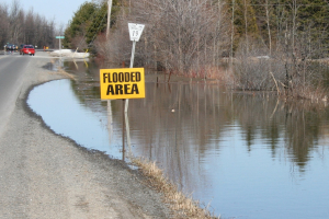
June 3, 2019 — More of the Rideau Valley watershed will be mapped for flood risks and other hazards thanks to a new agreement between the City of Ottawa and the Rideau Valley Conservation Authority (RVCA).
Over the next three years, the RVCA will update existing hazard mapping reports and map new areas along four waterways inside the City’s boundaries: Mud Creek in Manotick, Stevens Creek in North Gower, Mosquito Creek in Riverside South and Monahan Drain in Kanata South.
Previously known as “floodplain mapping” or “regulations mapping,” these studies show areas that are prone to natural hazards such as flooding, erosion and unstable slopes. They will also map natural features such as wetlands.
“Current mapping in these areas is outdated or non-existent, making it difficult to ensure public safety, protect property and make sound planning decisions,” said Ferdous Ahmed, RVCA Senior Water Resources Engineer.
The City has provided funding and high-quality topographical information for the projects, allowing the conservation authority to move ahead with studies sooner than otherwise possible. The agreement builds on a previous collaboration that mapped 11 areas between 2012 and 2019.
Ottawa is beginning an Official Plan review this year, and these maps will help determine development boundaries and zoning overlays. They’ll also help the conservation authorities and municipality review development applications under the provincial Planning Act.
The RVCA is one of three conservation authorities collaborating with the City on new hazard reports. Mississippi Valley Conservation Authority and South Nation Conservation will complete similar projects in their watersheds under the new agreement.
Hazard mapping is the cornerstone of keeping people and property safe from floods, erosion and unstable slopes. The studies will use contemporary methods of hydrologic and hydraulic analysis, historical records of stream flow and/or water levels, and the most up-to-date topographical data to produce updated estimates of the 1:100 year flood line and erosion and steep slope zones.
Historical records of past flood events, news clippings, photographs, and even anecdotal stories and memories can help confirm the reasonableness of calculations and resulting hazard mapping. Local residents with this kind of information are encouraged to share their knowledge with RVCA’s Ferdous Ahmed, (613-692-3571, 1-800-267-3504 ext. 1170 or ).
Once the technical work is completed and the maps have been prepared, open houses will be held in nearby communities to collect public feedback. Any new information or comments will be taken into consideration to further refine the maps.
For more information about the project visit www.rvca.ca/ottawa-mapping-project.
-end-

MAY 31, 2019 — Rideau Valley Conservation Authority (RVCA), in conjunction with the Mississippi Valley Conservation Authority (MVCA) and South Nation Conservation (SNC) is TERMINATING the FLOOD WARNING issued on April 19, 2019 for the areas under our jurisdiction along the Ottawa River.
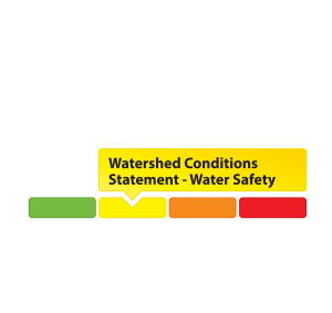
A Watershed Conditions – High Water Safety message is in effect as all areas are still well above normal for this time of year and conditions are expected to remain that was for at least the next two weeks.
The most recent analysis from the Ottawa River Regulation Committee (ORRC) indicate that water levels along the lower Ottawa River from Chats Lake to the Grenville/Hawkesbury area are declining steadily and that trend is expected to continue.
Residents are advised to stay away from watercourses where flows are high and where banks might be unstable. Parents are encouraged to explain dangers to children.
The Watershed Conditions – High Water Safety message will remain in effect until Friday, June 7, 2019 at 5:00 PM. No further updates will be issued unless forecasted levels or conditions change.
RVCA and its Ottawa partners, MVCA and SNC monitor the water levels and weather forecasts with the Ministry of Natural Resources and Forestry as part of the Flood Forecasting and Warning Program.
The Ottawa River Regulation Planning Board will be reassessing forecast conditions and providing hydrological condition updates on its website daily at www.ottawariver.ca/forecast.php.
To view current flood warnings across Ontario, visit https://www.ontario.ca/law-and-safety/flood-forecasting-and-warning-program”
-end-
"Rideau Valley Conservation Authority is a partnership of municipalities within the Rideau Valley watershed created under the Conservation Authorities Act to deliver a range of programs in watershed management and natural resource conservation."
RVCA Watershed Conditions Statements:
- Water Safety – High flows, unstable banks, melting ice or other factors that could be dangerous for recreational users such as anglers, canoeists, hikers, children, pets, etc. Flooding is not expected.
- Flood Outlook – Early notice of the potential for flooding based on weather forecasts, calling for heavy rain, snow melt, high winds or other conditions that could lead to high runoff, cause ice jams and/or lakeshore flooding or erosion.
- Flood Watch – Flooding is possible in specific watercourses or municipalities. Municipalities, emergency services and individuals in flood-prone areas should prepare.
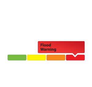
- Flood Warning – Flooding is imminent or already occurring in area watercourses.
MAY 31, 2019 — Rideau Valley Conservation Authority (RVCA), in conjunction with the Mississippi Valley Conservation Authority (MVCA) and South Nation Conservation (SNC) is TERMINATING the FLOOD WARNING issued on April 19, 2019 for the areas under our jurisdiction along the Ottawa River.
A Watershed Conditions – High Water Safety message is in effect as all areas are still well above normal for this time of year and conditions are expected to remain that was for at least the next two weeks.
The most recent analysis from the Ottawa River Regulation Committee (ORRC) indicate that water levels along the lower Ottawa River from Chats Lake to the Grenville/Hawkesbury area are declining steadily and that trend is expected to continue.
Residents are advised to stay away from watercourses where flows are high and where banks might be unstable. Parents are encouraged to explain dangers to children.
The Watershed Conditions – High Water Safety message will remain in effect until Friday, June 7, 2019 at 5:00 PM. No further updates will be issued unless forecasted levels or conditions change.
RVCA and its Ottawa partners, MVCA and SNC monitor the water levels and weather forecasts with the Ministry of Natural Resources and Forestry as part of the Flood Forecasting and Warning Program.
The Ottawa River Regulation Planning Board will be reassessing forecast conditions and providing hydrological condition updates on its website daily at www.ottawariver.ca/forecast.php.
To view current flood warnings across Ontario, visit https://www.ontario.ca/law-and-safety/flood-forecasting-and-warning-program”
-end-
"Rideau Valley Conservation Authority is a partnership of municipalities within the Rideau Valley watershed created under the Conservation Authorities Act to deliver a range of programs in watershed management and natural resource conservation."
RVCA Watershed Conditions Statements:
- Water Safety – High flows, unstable banks, melting ice or other factors that could be dangerous for recreational users such as anglers, canoeists, hikers, children, pets, etc. Flooding is not expected.
- Flood Outlook – Early notice of the potential for flooding based on weather forecasts, calling for heavy rain, snow melt, high winds or other conditions that could lead to high runoff, cause ice jams and/or lakeshore flooding or erosion.
- Flood Watch – Flooding is possible in specific watercourses or municipalities. Municipalities, emergency services and individuals in flood-prone areas should prepare.
- Flood Warning – Flooding is imminent or already occurring in area watercourses.

MAY 28, 2019 — Rideau Valley Conservation Authority (RVCA), in conjunction with the Mississippi Valley Conservation Authority (MVCA) and South Nation Conservation (SNC) is maintaining the FLOOD WARNING issued on April 19, 2019 for the areas under our jurisdiction along the Ottawa River.
Water conditions along the lower Ottawa River from Arnprior to Gatineau have been slowly declining but will remain well above normal conditions for this time of year. Levels from Gatineau to Hawkesbury are expected to remain stable and should resume declining on Wednesday. No additional increase in water levels is expected for this area.
Residents are strongly urged to keep sandbags in place for now. Updates to all projections will be provided as they become available.
Residents are advised to stay away from watercourses where flows are high and where banks might be unstable. Parents are encouraged to explain dangers to children.
This FLOOD WARNING is in effect until Tuesday, June 4, 2019 at 5:00 PM.
RVCA and its Ottawa partners, MVCA and SNC monitor the water levels and weather forecasts with the Ministry of Natural Resources and Forestry as part of the Flood Forecasting and Warning Program. Updates are provided as conditions change.
RVCA and its Ottawa partners, MVCA and SNC monitor the water levels and weather forecasts with the Ministry of Natural Resources and Forestry as part of the Flood Forecasting and Warning Program. Updates are provided as conditions change.
The Ottawa River Regulation Planning Board will be reassessing forecast conditions and providing hydrological condition updates on its website daily at www.ottawariver.ca/forecast.php.
To view current flood warnings across Ontario, visit https://www.ontario.ca/law-and-safety/flood-forecasting-and-warning-program”
-end-
"Rideau Valley Conservation Authority is a partnership of municipalities within the Rideau Valley watershed created under the Conservation Authorities Act to deliver a range of programs in watershed management and natural resource conservation."
RVCA Watershed Conditions Statements:
- Water Safety – High flows, unstable banks, melting ice or other factors that could be dangerous for recreational users such as anglers, canoeists, hikers, children, pets, etc. Flooding is not expected.
- Flood Outlook – Early notice of the potential for flooding based on weather forecasts, calling for heavy rain, snow melt, high winds or other conditions that could lead to high runoff, cause ice jams and/or lakeshore flooding or erosion.
- Flood Watch – Flooding is possible in specific watercourses or municipalities. Municipalities, emergency services and individuals in flood-prone areas should prepare.
- Flood Warning – Flooding is imminent or already occurring in area watercourses.

May 28, 2019 – The Rideau Valley Conservation Authority (RVCA) is terminating the Flood Watch that was previously in effect and issuing a High Water Safety message for properties around Bobs Lake and Christie Lake.
The water levels on Bobs and Christie Lakes continue to decline slowly but both lakes are still above average for this time of year. This water levels are expected to gradually drop down to seasonal levels with no significant rainfall and somewhat seasonal temperatures in the forecast for the next week. Parks Canada staff are closely monitoring the water levels in these lakes. Operations at the Bolingbroke Dam will take place as required to balance the levels in Bobs Lake and Christie Lake.
Water levels continue to be at seasonal values in the rest of the Rideau Valley Watershed.
Everyone needs to be cautious around lakes and streams with the fluctuating water levels. Children need to be educated about the hazards and kept away from all watercourses.
This watershed conditions statement is in effect until Tuesday June 4, 2019 at 5 PM and will be updated at that time unless the forecast or conditions change.
-end-
"Rideau Valley Conservation Authority is a partnership of municipalities within the Rideau Valley watershed created under the Conservation Authorities Act to deliver a range of programs in watershed management and natural resource conservation."
RVCA Watershed Conditions Statements:
- Water Safety – High flows, unstable banks, melting ice or other factors that could be dangerous for recreational users such as anglers, canoeists, hikers, children, pets, etc. Flooding is not expected.
- Flood Outlook – Early notice of the potential for flooding based on weather forecasts, calling for heavy rain, snow melt, high winds or other conditions that could lead to high runoff, cause ice jams and/or lakeshore flooding or erosion.
- Flood Watch – Flooding is possible in specific watercourses or municipalities. Municipalities, emergency services and individuals in flood-prone areas should prepare.
- Flood Warning – Flooding is imminent or already occurring in area watercourses.
May 23, 2019 – Looking for ways to green your backyard? Need inspiration from your most dedicated neighbours? Want the scoop on river-friendly development trends? The Rideau Valley Conservation Authority invites you to subscribe to its new blog, The River Reed.
From green waterfront living to cute critters to special features, we’ve got life in the Rideau Valley watershed covered!
The blog will focus on the people, projects and policies making our watershed a healthy, liveable place for all – people and wildlife included.
Subscribers will get tips for green waterfront living, learn about landowners making a difference, and access information about the best designs and approaches to make your development a welcoming and watershed-friendly place to thrive.
Our latest post, “Waterfront Living: Which Side Are You On?” features an interactive graphic showcasing the easy changes that can be made to make your waterfront property a haven for people and animals.
Other recent posts cover the recent floods, high school tree planters and how you can help pollinators thrive this season.
Follow along at www.rvca.ca/blog as we take you into the depths of watershed life! Click on the envelope to subscribe.
-end-

MAY 22, 2019 - Rideau Valley Conservation Authority (RVCA), in conjunction with the Mississippi Valley Conservation Authority (MVCA) and South Nation Conservation (SNC) is maintaining the FLOOD WARNING issued on April 19, 2019 for the areas under our jurisdiction along the Ottawa River.
The most recent analysis from the Ottawa River Regulation Committee (ORRC) indicate that water levels along the lower Ottawa River from Chats Lake to the Grenville/ Hawkesbury area will continue to decline over the coming weeks, albeit slowly.
All flood-prone areas along the Ottawa River from Lac Coulonge down to the Montreal Archipelago are at risk as spring runoff continues along the upper Ottawa River. Levels are expected to remain high for the next few weeks. Risk is highly dependent on the amount of precipitation that is received. Residents are strongly urged to keep sandbags in place for now. Updates to all projections will be provided as they become available.
Residents in flood-prone areas are encouraged to closely follow evolving conditions and to take necessary measures. Residents are advised to stay away from watercourses where flows are high and where banks might be unstable. Parents are encouraged to explain dangers to children.
This FLOOD WARNING is in effect until Tuesday, May 28, 2019 at 5:00 PM.
RVCA and its Ottawa partners, MVCA and SNC monitor the water levels and weather forecasts with the Ministry of Natural Resources and Forestry as part of the Flood Forecasting and Warning Program. Updates are provided as conditions change.
The Ottawa River Regulation Planning Board will be reassessing forecast conditions and providing hydrological condition updates on its website daily at www.ottawariver.ca/forecast.php.
To view current flood warnings across Ontario, visit https://www.ontario.ca/law-and-safety/flood-forecasting-and-warning-program”
-end-
"Rideau Valley Conservation Authority is a partnership of municipalities within the Rideau Valley watershed created under the Conservation Authorities Act to deliver a range of programs in watershed management and natural resource conservation."
RVCA Watershed Conditions Statements:
- Water Safety – High flows, unstable banks, melting ice or other factors that could be dangerous for recreational users such as anglers, canoeists, hikers, children, pets, etc. Flooding is not expected.
- Flood Outlook – Early notice of the potential for flooding based on weather forecasts, calling for heavy rain, snow melt, high winds or other conditions that could lead to high runoff, cause ice jams and/or lakeshore flooding or erosion.
- Flood Watch – Flooding is possible in specific watercourses or municipalities. Municipalities, emergency services and individuals in flood-prone areas should prepare.
- Flood Warning – Flooding is imminent or already occurring in area watercourses.