monitoring_1.jpeg
rvca-slide_01.jpg
rvca-slide_02.jpg
rvca-slide_03.jpg
rvca-slide_04.jpg
rvca-slide_05.jpg
rvca-slide_06.jpg
rvca-slide_07.jpg
rvca-slide_08.jpg
rvca-slide_09.jpg
rvca-slide_10.jpg
rvca-slide_11.jpg
rvca-slide_12.jpg
August 15, 2019 — As the warm, dry weather continues, conditions in the Rideau Valley Watershed now meet the threshold for Minor Low Water status under the Ontario Low Water Response Program. Watershed residents and businesses are encouraged to conserve water during dry conditions. After a cool and wet spring with very significant flooding in some areas, July and August have been mostly warm and dry across the Rideau Valley watershed, with some localized rainfall in early August. The average 90-day rainfall measured at climate stations in and around the watershed is just shy of 80 per cent of normal…
Aug. 14, 2019 – Did you know? Your beautiful backyard garden could be harbouring dangerous enemy invaders: sneaky, ruthless agents of destruction, ready to launch a coup at any opportunity. We’re talking, of course, about invasive species. They can be hard to spot – sometimes distracting you with their gorgeous blooms or glittery shells – but a workshop this weekend can help you identify these interlopers and keep them under control. From 9 a.m. to 12 p.m. on Saturday, Aug. 17, Rideau Valley staff will lead a free, public workshop at the conservation authority’s headquarters in Manotick. Participants can get up…

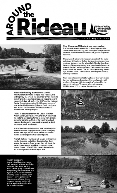
ATR - July August 2019

August 7, 2019  —You know what they say: "If you build it, they will come." But that old adage isn't just for haunted baseball fields – it also applies to wetland projects right in the heart of Ottawa's greenbelt. Last fall, staff at the RVCA and the National Capital Commission created 10,000 square metres of new wetland habitat along Stillwater Creek, just south of the new DND headquarters off Moodie Drive and Highway 417. Thanks to observations from the Ottawa-Carleton Wildlife Centre, which is located nearby, staff at the NCC and RVCA discovered the wetland had been suffering annually from extreme low water conditions. Most of the year the wetland was completely dry, dominated by long, reedy…
July 29, 2019 – Custom-built smartphone apps are changing the way staff at Rideau Valley Conservation Authority get their work done – and saving time, money and headaches in the process. This spring, the RVCA launched its latest app, this one for classifying shorelines – something no other conservation group is doing digitally. Gone are the bulky clipboards and windswept papers of previous surveys. And vanquished are the days of tedious data entry after a long season on the water. These days, with the tap of an app staff can quickly analyze a shoreline, take a photo and input all the relevant data into a digital database, all from the…

Mud Creek Flood Risk Mapping Study, July 2019

July 23, 2019

Mud Creek Hazard Mapping Study

Super User

Project Status: Complete

The Rideau Valley Conservation Authority (RVCA) has completed a hazard mapping study for Mud Creek from 3rd Line Road North to the Rideau River.

These maps have been traditionally known as “floodplain mapping” or “regulation mapping” and they show areas that are prone to natural hazards such as flooding, erosion and natural environment features such as wetlands. 

When completed, the mapping will be used by the City of Ottawa when updating their Official Plan and Zoning Schedules and in the review of development applications under the Planning Act. RVCA will also use the mapping to guide the review of development applications submitted under the Development, Interference with Wetlands and Alterations to Shorelines and Watercourses Regulation.

Members of the public are encouraged to attend the upcoming open house (details below) and/or provide comments on the draft mapping (see below). Conservation Authority staff welcome historical records of past flood events, slope failure, erosion, news clippings, photographs and even anecdotal stories to help confirm the reasonableness of calculations and resulting hazard mapping For those unable to attend the open house, comments can be sent to Ferdous Ahmed, RVCA Senior Water Resources Engineer at .

These mapping studies are being completed as part of the City of Ottawa Hazard Mapping Project.

These studies are being done through a collaboration — known as the City of Ottawa Hazard Mapping Project — involving the City of Ottawa and the Mississippi Valley, Rideau Valley and South Nation Conservation Authorities. The City recognized a need to update its zoning schedules based on up-to-date flood risk mapping and has provided contributions enabling the Conservation Authorities to move ahead with these studies sooner than would otherwise be possible. The RVCA is currently working on several studies in the Ottawa area.


July 19, 2019 – It’s a great time to be outdoors, but be aware: certain pests and poisonous plants are getting in on the action, too. As you hit the trails, remember to stay on the path and dress appropriately to protect against ticks, poison ivy, wild parsnip and other hazards. Ticks: Black-legged ticks are on the rise in Eastern Ontario and can carry Lyme disease, which is passed to humans through tick bites. Left untreated, Lyme can cause chronic neurological and physical problems including memory loss, mobility issues and heart conditions. But don’t let that keep you inside! Reasonable…
June 24, 2019 – Ah, summer: a time for relaxing with friends, soaking up the sun and, of course, hitting the beach. But sometimes beach days are more hassle than relaxle: fighting traffic, circling for parking and dodging rogue frisbees while you defend your tiny square of sand from the hordes of other beachgoers. Some fun! But there’s a solution: instead of wasting 30 minutes parking, spend it heading to Baxter Conservation Area in Osgoode, Rideau Ferry Yacht Club Conservation Area near Smiths Falls or Foley Mountain Conservation Area in Westport for a beautiful beach day away from the crowds.…
Page 30 of 82

Contact Us

Address:
Rideau Valley Conservation Authority
3889 Rideau Valley Drive
Manotick, Ontario K4M 1A5

Phone:
613-692-3571, 1-800-267-3504

Email:

Hours:

Regular Hours: Monday to Friday, 8:30 a.m. to 4:30 p.m.

Member of: conservation ontario