Super User
Low Water Index
Our low water index has four stages:The RVCA issues water conditions statements to inform residents, municipalities and other stakeholders of changing water levels across the watershed.

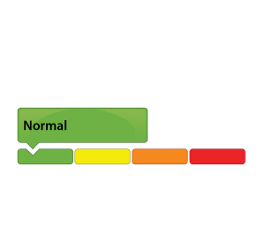
A green gauge means conditions are normal. No low flow or drought conditions exist.

This category reflects concern.
80% to 60% of long-term average precipitation for 540 day and/or 90 day precipitation totals and/or 7-day average streamflows less than the 5 year return period low flow.

This category suggests a potentially serious problem is pending.
60% to 40% of long-term average precipitation for 540, 90 and/or 30 day precipitation totals and/or 7-day average streamflows less than the 10 year return period low flow.

This category indicates a failure of the water supply to meet demand.
Less than 40% of long-term average precipitation for 540, 90 and/or 30 day precipitation totals and/or 7-day average streamflows less than the 10 year return period low flow.
Click here for the RVCA's Watershed Conditions Statements.
Flood Index
Know the warning system
The RVCA issues water conditions statements to inform residents, municipalities and other stakeholders of changing water levels across the watershed.

A green gauge means conditions are normal.

A yellow Water Safety Statement means rivers could have high flows, unsafe banks, melting ice or other factors that could be dangerous. However, flooding is not expected.

A yellow Flood Outlook Statement is an early notice of the potential for flooding based on weather forecasts calling for heavy rain, snow melt, high wind or other conditions that could lead to high runoff, cause ice jams, lakeshore flooding or erosion.

An orange Flood Watch means flooding is possible in specific watercourses or municipalities. Municipalities, emergency services and individual landowners in flood-prone areas should prepare.

A red Flood Warning means flooding is imminent or already occurring in specific watercourses or municipalities.
Click here for the RVCA's Watershed Conditions Statements. Click here for RVCA real-time flows and water levels.
For water levels and flows on the Ottawa River visit the Ottawa River Regulation Planning Board
Before the Flood - Be Prepared
A flood is coming: What should you do?
If you live in a flood-prone area, the best thing you can do to keep your family and property safe is to make a plan and be prepared to follow it.
Each flood situation is unique, and your emergency plan should account for that – and be ready well in advance.
1. Know the warning system
The RVCA issues water conditions statements to inform residents, municipalities and other stakeholders of changing water levels across the watershed.
Click on a gauge for a larger image
GREEN: A green gauge means conditions are normal.
YELLOW: A yellow gauge can mean two things:
- A yellow Water Safety Statement means rivers could have high flows, unsafe banks, melting ice or other factors that could be dangerous. However, flooding is not expected.
- A yellow Flood Outlook Statement is an early notice of the potential for flooding based on weather forecasts calling for heavy rain, snow melt, high wind or other conditions that could lead to high runoff, cause ice jams, lakeshore flooding or erosion.
ORANGE: An orange Flood Watch means flooding is possible in specific watercourses or municipalities. Municipalities, emergency services and individual landowners in flood-prone areas should prepare.
RED: A red Flood Warning means flooding is imminent or already occurring in specific watercourses or municipalities.
2. Be prepared
- The first step to flood preparedness is knowing your risk level. Call an RVCA Resource Specialist to learn more about your property before flooding occurs.
- Subscribe to RVCA’s flood messages for regular updates and advanced warning of an impending flood. You can also stay informed through the RVCA website or our Facebook and Twitter pages.
- Learn about your municipality’s emergency plan: evacuation routes and locations for emergency shelters, as well as their sandbag program if they have one.
- Plan and practice an evacuation route with your family.
- Pack an emergency kit that can be accessed easily and carried quickly in case of evacuation; include any necessary medication, blankets, extra clothing and flashlights.
- Install a battery powered sump pump that can work in a blackout.
Learn more from Environment Canada's detailed flood preparation guide.
Frequently Asked Questions
Managing flood risks in the Rideau Valley
Conservation authorities have a broad mandate to protect their watersheds, which can include everything from tree planting to regulating development in the floodplain. Not surprisingly, many residents have questions about the role of conservation authorities in their lives, especially when it comes to floods.
Low Water Status Returned to “Normal” in Rideau River Watershed
October 30, 2019 —This statement is to advise that the “Minor Low Water” status in the Rideau Valley Watershed is returned to “Normal’ under the Ontario Low Water Response Program.
With several significant rainfall events occurring during the last two weeks, the average 90-day rainfall measured at climate stations in and around the Rideau Valley Watershed is well above 80 per cent of normal for this time of year, which is a key indicator for Minor Low Water status. In the past 30 days, average rainfall has been greater than 100 per cent of normal. Looking ahead, the seven-day weather forecasts suggests we’ll continue to experience more rain, including a large rainfall event tomorrow.
Water levels in some of the smaller rivers and streams across the watershed were well below normal prior the significant rainfall events noted above. These water levels have now begun to increase, and this trend is expected to continue based on the weather forecast.
Conservation Authority staff continue to monitor conditions and communicate with water managers throughout the watershed. Updates to this message will be issued as conditions warrant.
More resources:
Ministry of Environment and Climate Change: https://www.ontario.ca/page/managing-your-water-well-times-water-shortage
Ontario’s Low Water Response program: https://www.ontario.ca/page/low-water-response-program.
RVCA website: www.rvca.ca
Hourly and daily streamflows and water levels: https://www.rvca.ca/watershed-monitoring-reporting/reporting/streamflow-water-levels.
— end —
Hutton Creek Marsh getting makeover thanks to generous grant
October 22, 2019 – A provincially significant wetland will get a makeover this winter, thanks in part to a $55,000 grant from Wildlife Habitat Canada.
The Hutton Creek Marsh near Lombardy has become a monoculture: choked and overgrown with cattails, only 10 per cent of the marsh is now open water.
Crews will construct three 0.5 acre ponds and 500 metres of channels to help return the wetland to a healthier hemi-marsh state (50 per cent vegetation and 50 per cent open water).
This will provide new fish passages and areas for spawning and feeding, and will support critical life stages for amphibians, turtles and other wildlife. This healthier water-to-vegetation ratio is also ideal for waterfowl and would support the greatest biodiversity. Creating more open water will also restore local access for paddling, fishing and hunting.
Construction could begin as early as November. Crews will wait until the marsh has frozen to keep impacts to wildlife and water quality low.
This work is Phase 2 of a long-term project to bring the important wetland back to a more natural, productive state. In 2015, the nearby Motts Mills Dam was decommissioned and replaced with an earthen berm. In 2017, the Rideau Valley Conservation Authority (RVCA) lowered local water levels to help staff study the wetland and determine the best way to address the crowded cattails.
A dedicated group of local stakeholders made this project possible, including the RVCA, Ducks Unlimited Canada, Leeds and Grenville Stewardship Council and the United Counties of Leeds and Grenville (UCLG), which owns the property where the work will take place. Support of local residents has also been key to the project’s success.
The project is jointly funded by Wildlife Habitat Canada, Leeds and Grenville Stewardship Council, Ontario Federation of Anglers and Hunters Zone F, Ducks Unlimited Canada, UCLG, RVCA and the Rideau Valley Conservation Foundation.
The Wildlife Habitat Canada grant represents more than 40 per cent of the project’s total cost. The primary source of funding for the grant program is from the purchase of the Canadian Wildlife Habitat Conservation Stamp (Canadian Duck Stamp) by waterfowl hunters.
To learn more about how the Rideau Valley Conservation Foundation works to protect wetlands and waterways in the region, or to donate to the cause, visit www.rvcf.ca.
For more information about Motts Mills Conservation Area and the Hutton Marsh, visit https://www.rvca.ca/conservation-areas/no-fee-required/motts-mills-ca.
— end —
Have your say on the future of Foley Mountain!
Oct. 10, 2019 – We’re updating Foley Mountain Conservation Area’s management plan, and we want your input on the future of Westport’s favourite outdoor oasis.
The updated plan will guide the next 10 years of resource management, habitat enhancement, programming, infrastructure upgrades and other developments at Foley Mountain to best meet the needs and desires of visitors, donors, nearby businesses and other stakeholders.
“We welcome public input, especially from our regular visitors and supporters who spend a lot of time in the park,” said Rebecca Whitman, site supervisor at Foley Mountain. “This is your chance to tell us what you love about Foley, and what you’d like to see improved.”
Foley Mountain Conservation Area is one of 11 conservation areas owned and operated by the Rideau Valley Conservation Authority. Located in Westport, ON overlooking the Upper Rideau Waterway, Foley is famous for its Spy Rock lookout, 10 kilometres of scenic hiking trails and hands-on outdoor education programs. The 337-hectare (833-acre) site is also known for its abundance of wildlife, including the threatened black rat snake which thrives on Foley’s granite ridge that forms part of the UNESCO-designated Frontenac Arch biosphere.
Once completed, the new management plan will provide clear goals and objectives for the site and offer strategies and recommendations to enhance the site for public use and enjoyment over the next decade.
Take our 10-minute survey here: https://www.surveymonkey.com/r/FoleyMountain.
Leave your email address to be entered in a draw for an annual pass to all RVCA conservation areas, worth $50!
For more information about Foley Mountain, visit www.rvca.ca/conservation-areas/fee-required/foley-mountain-ca.
— end —
Oct. 7, 2019 – Several changes are in the works for drinking water protection zones and chemical storage rules in the Mississippi-Rideau Source Protection Region.
Under Ontario’s Clean Water Act, municipal drinking water sources such as lakes, rivers and wells are protected from contamination through a combination of intake and wellhead protection zones, rules for chemical use and other threats, and risk management plans for landowners whose activities pose a risk to drinking water supplies.
The changes:
There are two proposed amendments to the Mississippi-Rideau Source Protection Plan and Assessment Report under Section 34 of the Clean Water Act.
1. North Grenville municipal well:
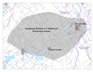
In 2015, a new municipal well was constructed in Kemptville in the Municipality of North Grenville. The proposed amendment will bring the well under the same Clean Water Act protections as the region’s 13 other municipal systems, as required by law. The amendment will include revised Wellhead Protection Area (WHPA) mapping for North Grenville and the Village of Merrickville-Wolford (groundwater flow to the Merrickville-Wolford system is affected by pumping at the new well in Kemptville.)
The updated maps could affect landowners if they engage in certain activities that pose potentially significant drinking water threats. In these cases, risk management staff will work with the owners to manage the threats through custom risk management plans.
2. Chemical policy revision:
The Source Protection Committee also wants to tweak its rules regarding Dense Non-Aqueous Phase Liquids (DNAPLs) – industrial chemicals that are denser than water. If spilled, they tend to sink into the ground and even in small amounts can contaminate the deepest groundwater sources.
Currently, any businesses established after Jan. 1, 2015 which store or handle DNAPLs are banned in areas where they could pose a significant drinking water threat, specifically in Intake Protection Zone-1 and Wellhead Protection Areas A, B and C. For some municipalities, the affected area can be quite large.
When developing risk management policies for DNAPLs, the committee expected to find these chemicals only in large quantities (i.e. industrial drums) at dry cleaning or manufacturing facilities. But after completing detailed background research and site visits, the committee realized DNAPL chemicals can also be found in small quantities, particularly in auto repair shops (i.e. chlorinated brake cleaner in aerosol cans).
With such large prohibition zones in some parts of the region, the restrictions could create unnecessary barriers for small business development in the future. The committee has proposed an amendment to make life a bit easier for small businesses in these zones, while still ensuring drinking water is protected.
Under the new policy, storage and handling of any amount of DNAPLs within areas of the highest vulnerability (score of 10) will remain prohibited. But the storage and handling of DNAPLs in quantities of less than 25 liters within WHPA B and C (scores 4 to 8) will now be permitted, if accompanied by a risk management plan. Storing or using large quantities of DNAPLs (more than 25 liters) within WHPA B and C will be banned.
Retail stores selling unopened containers are exempt from these rules, except for areas with the highest vulnerability.
How to view the amendments:
The proposed amendments are available on the Mississippi-Rideau Source Protection Region website at www.mrsourcewater.ca/en/public-consultation.
They can also be viewed in person at:
- Mississippi Valley Conservation Authority, 10970 Hwy. 7 Carleton Place, ON (8 am – 4 pm)
- Rideau Valley Conservation Authority, 3889 Rideau Valley Drive, Manotick, ON (8:30 am – 4:30 pm)
Residents and business owners are invited to provide written comments before Nov. 7, 2019.
For more information or to provide comments, please contact:
Marika Livingston
Project Manager
Mississippi-Rideau Source Protection Region
613-692-3571, ext. 1148.
— end —
ATR - September-October 2019
Conservation 2020: Fundraising campaign to protect local natural areas
Sept 30, 2019 – They say hindsight is 20/20 – and future generations may not like what they see if we don’t act now to protect and conserve our natural areas.
That’s why the Rideau Valley Conservation Foundation is excited to launch Conservation 2020: a major campaign to raise $125,000 toward keeping our natural areas in public hands forever.
The Foundation is a proud steward of more than 1,259 hectares of healthy, protected ecosystems throughout the Rideau River watershed. These are crucial habitats — forests, wetlands and shorelines — that work hard to reduce our risk of floods, clean our water, stop erosion and store vast amounts of carbon to keep our communities healthy and resilient in the face of climate change.
They are the lifeblood of our region, supporting vast, interconnected ecosystems that are increasingly fragmented or lost entirely to development and human activity.
Some properties are entirely untouched, left to their own devices to provide important green infrastructure functions for our communities. Others are public, close-to-home oases providing an antidote to the daily grind and stresses of daily life.
But they all cost money to maintain: whether it’s for property taxes, insurance or trail maintenance, the Foundation requires a steady stream of income to protect these green spaces in perpetuity.
Donations to the Conservation 2020 campaign will be invested in the Steve Simmering Conservation Land Endowment Fund, which marks its 10-year anniversary next year.
The fund was established in 2010 in memory of Steve Simmering, an active outdoorsman and vice chairman of the Foundation. The endowment has slowly been growing to provide a small stream of income to support our vibrant and vital outdoor spaces.
But more is needed to keep our natural areas secure forever.
“Today, the need to protect our conservation lands is increasingly important,” said Foundation chairman Jason Kelly. “Our 2020 campaign will look to grow this endowment fund, ensuring our local natural areas are protected and held safely in public hands.”
The Foundation, which turns 50 next year, is seeking investments large and small. Whether your family has $100 to spare or you lead a large corporation looking to make a lasting, local impact, your contribution will go directly toward conserving green space in your community for future generations.
Donors of large investments (between $10,000 and $25,000+ over five years) will be recognized in our media outreach and on the Foundation’s donor board. They’ll also receive some fun extras for the office, like complementary annual passes to our conservation areas, free facility rentals and even a staff retreat.
To invest in the region’s natural lands, contact Foundation executive director Diane Downey at 613-692-3571 ext. 1126 or .
For more information about how the endowment works, visit https://www.rvcf.ca/ways-to-give/steve-simmering-conservation-lands-endowment-fund.
— end —


