Super User
June 14, 2019 - Everyone wants a nice, quiet spot where they can get away from it all, without driving hundreds of kilometres into the woods. That will become a reality this summer at Chapman Mills Conservation Area with the installation of a new, accessible public dock.
Thanks to a generous donation to the Rideau Valley Conservation Foundation (RVCF) from Cabela’s Canada Outdoor Fund, the installation will replace the conservation area’s old dock in a more accessible location, creating a better place to catch a fish, launch a canoe or just dip your toes in the mighty Rideau River.
The Rideau Valley Conservation Authority (RVCA) owns and manages the conservation area off Winding Way and Prince of Wales drives. Conservation Lands technician Megan Dunster said the property’s current dock and water access set-up is damaging the fragile shoreline as anglers and paddlers find more convenient ways into the water.
The new dock will protect the shoreline and intends to meet accessibility standards for slope and width.
Dunster said there’s a shortage of public fishing spots in the city of Ottawa, particularly along the Rideau River. The new dock will allow the thousands of families who live in south Ottawa to take part in the sport – some for the very first time.
“I firmly believe the more that people can experience the outdoors, the more they will care about maintaining a healthy environment for themselves and for future generations,” said Dunster. “This connection is essential to the RVCA’s goals for a healthy, sustainable watershed.”
The dock project will include interpretive signs about fishing in the Rideau River.
Cabela’s Canada Outdoor Fund provided more than $4,800 for the project through a partnership with the RVCF, a registered charity which supports the RVCA’s conservation and watershed management goals.
For more information or to support the foundation, visit www.rvcf.ca.
-end-
Shoreline program now booking to protect against floods
June 10, 2019 – Planting trees and shrubs along your shoreline can protect your property from flood damage – and the Rideau Valley Conservation Authority is now booking site visits to help get the job done.
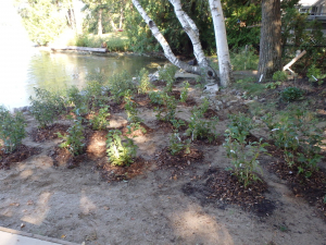
The RVCA’s Shoreline Naturalization Program offers landowners low-cost technical guidance, project management and all the native trees and shrubs you need to build a robust natural buffer along your waterfront.
These strategically-placed plants have hearty roots that hold soil in place so it doesn’t wash away during periods of high water, or in high-wake areas. There’s no need for expensive rock “rip rap” or other high-tech engineering – Mother Nature already knows what to do.
A three-metre natural buffer also discourages geese, reduces runoff and provides crucial wildlife habitat.
This spring, RVCA staff installed a total of 11,500 native plants on 63 private properties across the watershed. They also worked with a number of community groups to naturalize public shorelines.
Staff are now booking site visits for the 2020 spring planting season, and this year waterfront residents in the Tay Valley subwatershed can participate completely free of charge.
How does it work?
RVCA staff will visit your property between June and October to discuss your vision and assess planting potential. Then they’ll develop a unique plan for your property, including recommendations for the best native species for your property’s growing conditions. They’ll also discuss how you’d like to maintain your water access, seating areas and view.
From there, you can choose which subsidized plants you’d like based on your custom planting plan and the RVCA’s available species list, and staff will order them for you. In spring 2020, staff will deliver your plants and, if you choose, even do the planting for you!
Why naturalize?
Ninety per cent of all river life depends on a healthy shoreline to survive. But this “ribbon of life” also plays a crucial role in filtering out pollutants, reducing erosion and easing flood risks. By adding a natural buffer between your home and the water, you are protecting the health of our drinking water, ecosystems and shores.
For more information, visit https://www.rvca.ca/stewardship-grants/shoreline-naturalization/shoreline-naturalization-program. To book a site visit contact Meaghan McDonald.
-end-
JUNE 6, 2019 – A new batch of butternut seedlings have been sent into the world to help pull the endangered tree back from the brink – but this spring’s lot may have been the last.
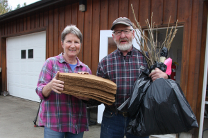
Landowners flocked to the Rideau Valley Conservation Authority’s specialized cold storage facility on Dilworth Road this spring to pick up their baby butternut trees, carefully grown at the Ferguson Forestry Centre from resilient seeds harvested across Eastern Ontario.
Butternut trees in Canada and the US have been decimated by the butternut canker, an incurable fungal disease scientists believe originated in Asia.
Since 2005, the RVCA has planted a total of 29,000 new butternuts across Eastern Ontario, partnering with landowners and other groups willing to plant the fragile trees on their properties.
But that could end now that proposed changes to the provincial Endangered Species Act have been signed into law.
The new rules, included in the Province of Ontario’s Bill 108: More Homes, More Choice Act, will allow developers to pay into a province-wide conservation fund instead of supporting localized, targeted efforts to save or replace the threatened species they disrupt. It’s unclear how the provincial pool of money would be doled out: money paid for local butternut destruction may no longer fund local butternut recovery.
That could leave the RVCA’s program without the critical funding it needs to collect resilient seeds to nurture new seedlings for reforestation. And it’s been a hugely successful model, if only because landowners have been so eager to plant the disappearing trees.
“I haven’t had a butternut on my property for more than 60 years,” said Mountain resident Fred Baker, who participated in the program for the first time this spring. He picked up 20 seedlings on May 10. “It’s a good, natural food for animals and wildlife, beautiful wood to work with, great saw logs if you can get them to that size. They’re beautiful to sit under.”
But even so, progress is achingly slow: of the 2,000 free seedlings handed out this spring, only about 30 per cent will live to age five, according to program manager Rosemary Fleguel.
“It’s a slow, steady drip to get butternuts back onto the landscape,” she said. “It’s still 30 per cent more than what was there, and they’re from genetically superior parent trees. What we don’t know is how many of these seedlings will be able to fend off the canker disease into maturity to produce seeds of their own.”
Fleguel estimates that 50 to 60 per cent of the population in eastern Ontario has died or is no longer reproducing since she started monitoring the trees in 1992.
“I’d say about 50 per cent still exist as viable trees, but every year a certain percentage fall off the edge,” she said. “The urgency to find these tolerant trees cannot be overstated.”
Model for the future
Fleguel’s job is largely focused on searching out healthy, pure butternuts that show signs of resisting or tolerating the canker disease.
She collects their leaves for DNA testing to ensure they are pure butternut and then collects their seeds to produce vigorous seedlings destined to replace the dead and dying butternut populations in the region. The RVCA recovery program also partners with the Forest Gene Conservation Association (FGCA) and assists in the cloning of these tolerant trees to save their genetic material. The clones are planted in five archives across southern Ontario and produce seeds for new, tolerant seedlings.
All of this takes place at a special greenhouse at the Ferguson Forestry Centre, where professional forestry technicians care for the grafts and tend them for years after they’ve been planted into the archives.
Fleguel said this is the program’s real success story.
Archiving material from disease-tolerant trees is a safeguard against extinction, she said, for two reasons. First, the saved genetic material will increase researchers’ full understanding of the disease and the butternut species so they can develop new and novel ways to save the species. For instance, DNA markers could more accurately identify tolerant trees, which would streamline the cloning process and capture many more trees for archiving.
“Seed collection can then increase 100-fold, because we’ll know for sure which trees have the DNA to reject the disease,” Fleguel said.
The genetic research has yet to catch up; butternut isn’t highly valued the way oak or maple is, so very few research dollars are funnelled into its salvation.
But the model for butternut can be applied to other endangered trees in the future.
“The template we’re developing can be transferred to other struggling tree species in the queue, like beech or ash,” Fleguel said. “If we are successful, people will be looking at this program in 50 years and saying ‘Wow, we really did something special here.’” The children and grandchildren of this year’s landowner participants might enjoy some quiet reflection under the shade of one of those trees in 50 years, or collect nuts from them in 30 years.
Fleguel called proposed changes to the Endangered Species Act “extremely short sighted,” noting residents and developers are just starting to see environmental protections as necessary and the norm – just as it took time for seatbelt laws to become the norm in the 1970s.
“To take it away now, we’re undoing a lot of progress at a time when biodiversity needs to be championed, not abandoned,” Fleguel said.
For more information, to report a butternut tree on your property or to order seedlings, visit https://www.rvca.ca/stewardship-grants/butternut-recovery.
-end-
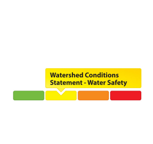
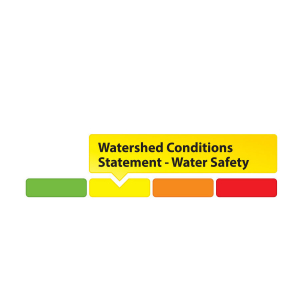
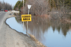
June 4, 2019 – The Rideau Valley Conservation Authority (RVCA) is maintaining a High Water Safety message for properties around Bobs Lake and Christie Lake.
The water levels on Bobs and Christie Lakes continue to decline slowly but both lakes are still above average for this time of year. This water levels are expected to gradually drop down to seasonal levels soon. Parks Canada staff are closely monitoring the water levels in these lakes. Operations at the Bolingbroke Dam will take place as required to balance the levels in Bobs Lake and Christie Lake.
Water levels continue to be at seasonal values in the rest of the Rideau Valley Watershed.
Everyone needs to be cautious around lakes and streams with the fluctuating water levels. Children need to be educated about the hazards and kept away from all watercourses.
This watershed conditions statement is in effect until Tuesday June 11, 2019 at 5 PM. No further updates will be issued unless the forecast or conditions change.
-end-
RVCA to update Ottawa flood, hazard maps
June 3, 2019 — More of the Rideau Valley watershed will be mapped for flood risks and other hazards thanks to a new agreement between the City of Ottawa and the Rideau Valley Conservation Authority (RVCA).
Over the next three years, the RVCA will update existing hazard mapping reports and map new areas along four waterways inside the City’s boundaries: Mud Creek in Manotick, Stevens Creek in North Gower, Mosquito Creek in Riverside South and Monahan Drain in Kanata South.
Previously known as “floodplain mapping” or “regulations mapping,” these studies show areas that are prone to natural hazards such as flooding, erosion and unstable slopes. They will also map natural features such as wetlands.
“Current mapping in these areas is outdated or non-existent, making it difficult to ensure public safety, protect property and make sound planning decisions,” said Ferdous Ahmed, RVCA Senior Water Resources Engineer.
The City has provided funding and high-quality topographical information for the projects, allowing the conservation authority to move ahead with studies sooner than otherwise possible. The agreement builds on a previous collaboration that mapped 11 areas between 2012 and 2019.
Ottawa is beginning an Official Plan review this year, and these maps will help determine development boundaries and zoning overlays. They’ll also help the conservation authorities and municipality review development applications under the provincial Planning Act.
The RVCA is one of three conservation authorities collaborating with the City on new hazard reports. Mississippi Valley Conservation Authority and South Nation Conservation will complete similar projects in their watersheds under the new agreement.
Hazard mapping is the cornerstone of keeping people and property safe from floods, erosion and unstable slopes. The studies will use contemporary methods of hydrologic and hydraulic analysis, historical records of stream flow and/or water levels, and the most up-to-date topographical data to produce updated estimates of the 1:100 year flood line and erosion and steep slope zones.
Historical records of past flood events, news clippings, photographs, and even anecdotal stories and memories can help confirm the reasonableness of calculations and resulting hazard mapping. Local residents with this kind of information are encouraged to share their knowledge with RVCA’s Ferdous Ahmed, (613-692-3571, 1-800-267-3504 ext. 1170 or ).
Once the technical work is completed and the maps have been prepared, open houses will be held in nearby communities to collect public feedback. Any new information or comments will be taken into consideration to further refine the maps.
For more information about the project visit www.rvca.ca/ottawa-mapping-project.
-end-
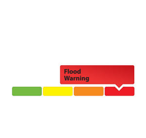
MAY 31, 2019 — Rideau Valley Conservation Authority (RVCA), in conjunction with the Mississippi Valley Conservation Authority (MVCA) and South Nation Conservation (SNC) is TERMINATING the FLOOD WARNING issued on April 19, 2019 for the areas under our jurisdiction along the Ottawa River.
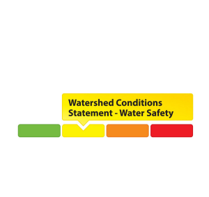
A Watershed Conditions – High Water Safety message is in effect as all areas are still well above normal for this time of year and conditions are expected to remain that was for at least the next two weeks.
The most recent analysis from the Ottawa River Regulation Committee (ORRC) indicate that water levels along the lower Ottawa River from Chats Lake to the Grenville/Hawkesbury area are declining steadily and that trend is expected to continue.
Residents are advised to stay away from watercourses where flows are high and where banks might be unstable. Parents are encouraged to explain dangers to children.
The Watershed Conditions – High Water Safety message will remain in effect until Friday, June 7, 2019 at 5:00 PM. No further updates will be issued unless forecasted levels or conditions change.
RVCA and its Ottawa partners, MVCA and SNC monitor the water levels and weather forecasts with the Ministry of Natural Resources and Forestry as part of the Flood Forecasting and Warning Program.
The Ottawa River Regulation Planning Board will be reassessing forecast conditions and providing hydrological condition updates on its website daily at www.ottawariver.ca/forecast.php.
To view current flood warnings across Ontario, visit https://www.ontario.ca/law-and-safety/flood-forecasting-and-warning-program”
-end-
"Rideau Valley Conservation Authority is a partnership of municipalities within the Rideau Valley watershed created under the Conservation Authorities Act to deliver a range of programs in watershed management and natural resource conservation."
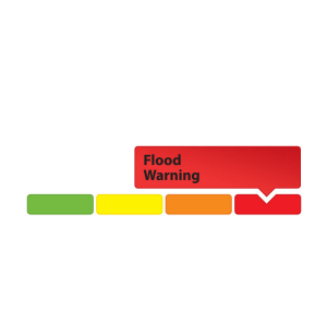
RVCA Watershed Conditions Statements:
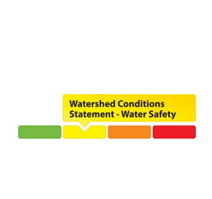
- Water Safety – High flows, unstable banks, melting ice or other factors that could be dangerous for recreational users such as anglers, canoeists, hikers, children, pets, etc. Flooding is not expected.
- Flood Outlook – Early notice of the potential for flooding based on weather forecasts, calling for heavy rain, snow melt, high winds or other conditions that could lead to high runoff, cause ice jams and/or lakeshore flooding or erosion.
- Flood Watch – Flooding is possible in specific watercourses or municipalities. Municipalities, emergency services and individuals in flood-prone areas should prepare.
- Flood Warning – Flooding is imminent or already occurring in area watercourses.
MAY 28, 2019 — Rideau Valley Conservation Authority (RVCA), in conjunction with the Mississippi Valley Conservation Authority (MVCA) and South Nation Conservation (SNC) is maintaining the FLOOD WARNING issued on April 19, 2019 for the areas under our jurisdiction along the Ottawa River.
Water conditions along the lower Ottawa River from Arnprior to Gatineau have been slowly declining but will remain well above normal conditions for this time of year. Levels from Gatineau to Hawkesbury are expected to remain stable and should resume declining on Wednesday. No additional increase in water levels is expected for this area.
Residents are strongly urged to keep sandbags in place for now. Updates to all projections will be provided as they become available.
Residents are advised to stay away from watercourses where flows are high and where banks might be unstable. Parents are encouraged to explain dangers to children.
This FLOOD WARNING is in effect until Tuesday, June 4, 2019 at 5:00 PM.
RVCA and its Ottawa partners, MVCA and SNC monitor the water levels and weather forecasts with the Ministry of Natural Resources and Forestry as part of the Flood Forecasting and Warning Program. Updates are provided as conditions change.
RVCA and its Ottawa partners, MVCA and SNC monitor the water levels and weather forecasts with the Ministry of Natural Resources and Forestry as part of the Flood Forecasting and Warning Program. Updates are provided as conditions change.
The Ottawa River Regulation Planning Board will be reassessing forecast conditions and providing hydrological condition updates on its website daily at www.ottawariver.ca/forecast.php.
To view current flood warnings across Ontario, visit https://www.ontario.ca/law-and-safety/flood-forecasting-and-warning-program”
-end-
"Rideau Valley Conservation Authority is a partnership of municipalities within the Rideau Valley watershed created under the Conservation Authorities Act to deliver a range of programs in watershed management and natural resource conservation."
RVCA Watershed Conditions Statements:
- Water Safety – High flows, unstable banks, melting ice or other factors that could be dangerous for recreational users such as anglers, canoeists, hikers, children, pets, etc. Flooding is not expected.
- Flood Outlook – Early notice of the potential for flooding based on weather forecasts, calling for heavy rain, snow melt, high winds or other conditions that could lead to high runoff, cause ice jams and/or lakeshore flooding or erosion.
- Flood Watch – Flooding is possible in specific watercourses or municipalities. Municipalities, emergency services and individuals in flood-prone areas should prepare.
- Flood Warning – Flooding is imminent or already occurring in area watercourses.


